Arroyo del Rey Watershed - Timeline
Based on original research by F. Watson & others.
Originally extracted from a Frog Pond timeline, but will be updated separately over time.
See also Work Memorial Park Timeline.
- 1862. Probable commencement of cattle grazing at Frog Pond after patent granted for Rancho Noche Buena.
- 1924. Historical map suggests that the earthen fill separating the western and eastern portions of the Frog Pond area was not yet emplaced. North-South Road did not yet extend south to Canyon Del Rey Boulevard (probably because of the steep terrain at Frog Pond), but instead turned east at South Boundary Road.
- 1929. Historical map suggests earthen fill between western and eastern Frog Pond areas not yet emplaced.
- 1933. Historical map suggests North-South Road may have been extended south to Canyon Del Rey Boulevard by this date. So, our best estimate of the date of emplacement of the earthen fill is sometime between 1929 and 1933.
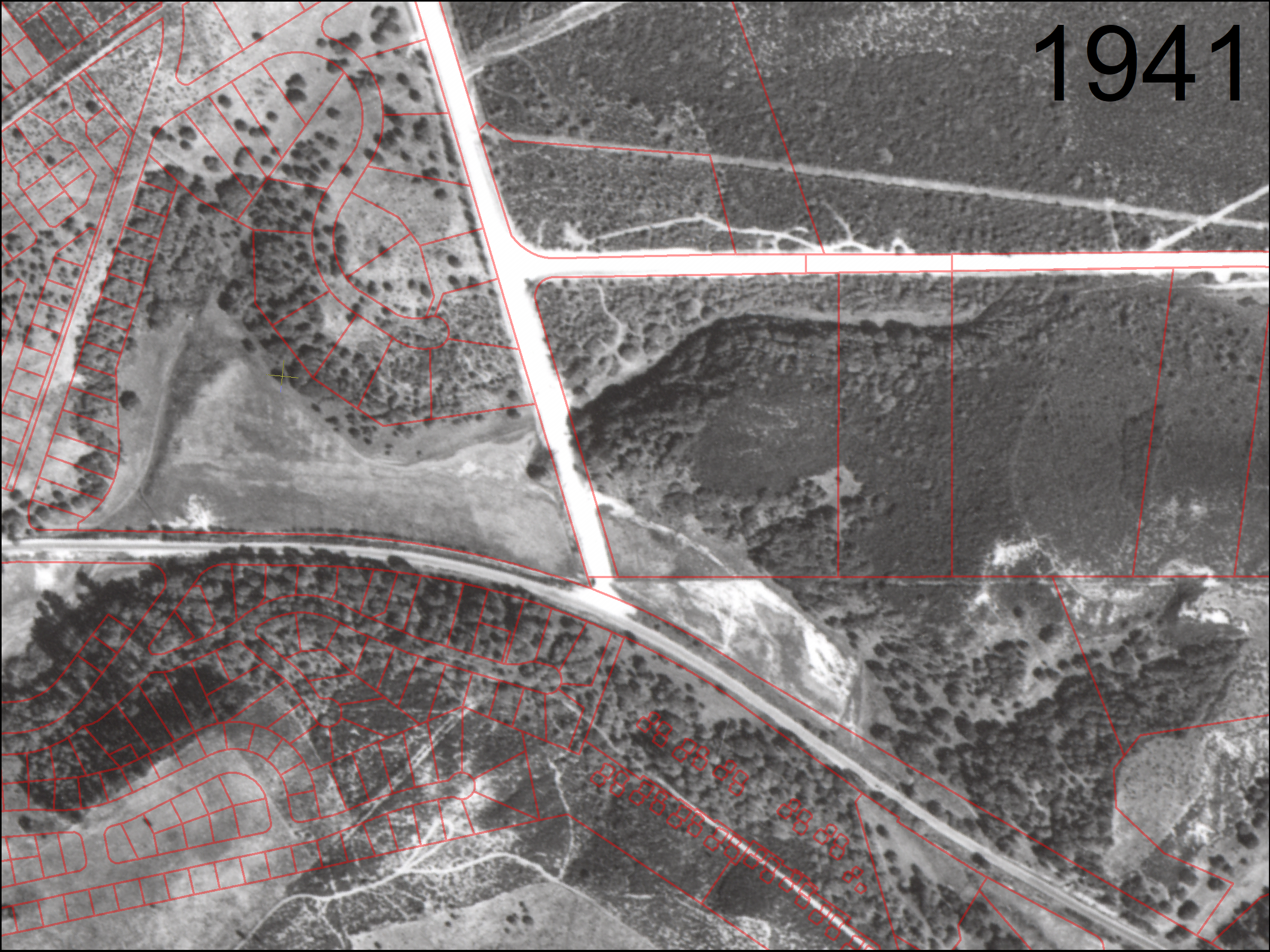
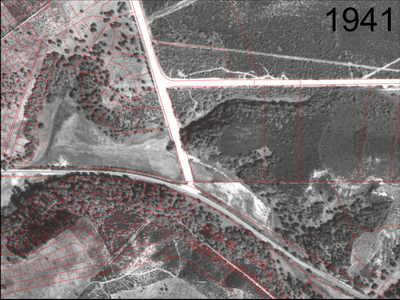
- In 1941, the flood plain now known as Frog Pond was grassy and generally devoid of trees. The upland areas were oak woodland and grassland. The grove of coast redwoods may have been recently planted. The eastern portions supported maritime chaparral.
Frog Pond in 1941 (click to enlarge):
Since 1941, the grassy lowland has since been replaced by dense willow forest. The upland oak woodland is largely intact, but heavily invaded in places by non-native iceplant and ivy. Non-native acacia trees tower above the willows in several areas.
Since 1941, in the eastern parcel, the balance between maritime chaparral and oak woodland has shifted. Some areas of maritime chaparral have transitioned to oak woodland.
In 1941, North-South Road had recently been constructed across the flood plain on a causeway of earthen fill.
In 1941, Arroyo Del Rey had already been ditched to run directly adjacent to Canyon Del Rey Boulevard, and apparently diked to reduce flooding. The previous course of the creek is barely discernable as a few meanders visible in the grassy floodplain. Prior to grazing, it may not have been a creek, so much as an arangement of swales in an otherwise diffuse marshy area.
- 1953, Dec 28. Work Memorial Park - Deed from Work family to City
"... for Park, School and other municipal purposes. Part of the property may be used for Church Purposes in the discretion of the City Council."
Property was previously a melon farm and pig ranch (Monterey County Weekly, 16-May-2013).
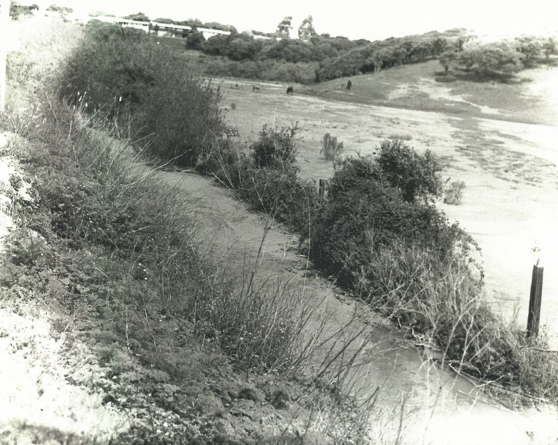
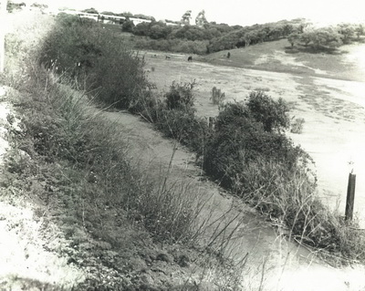
- In 1969, the flood plain at Frog Pond was still grassy and grazed by cattle. Fence posts demarcate the parcel boundary. The posts are still in place (December 2019) and the boundary is now between CalTrans (south) and MPRPD (north). Houses are visible along Carlton Drive, constructed sometime between 1941 and 1969.
April 14, 1969 - lookwing northwest from Canyon Del Rey Boulevard
(click to enlarge):
- 1971. Aerial imagery indicates minimal evidence of recent grazing at Frog Pond, and four or five small willow (?) trees in the western corner of the flood plain portion of the western parcel.
- 1977, June. "Monterey County
Master Drainage Plan -
Canyon Del Rey Watershed
Drainage and Erosion", 76 page report. Describes channels and culverts near "Frog Pond". Recommends that a mitigation measure "should":
"Design the Del Rey Oaks "Frog Pond" as a sediment catch basin for large floods. This would require permanent dedication of this area for wetland, design of spillway at the highway 218 crossing, and provision of access to
remove accumulated sediment. It is estimated that the 10-acre area will have a maximum of about 100 acre-feet of storage and a trap efficiency of about 85% (Bnme 1953)."
(100 acre-feet over 10 acres is equivalent to 10 feet of depth)
- After 1977. Grazing ceased at Frog Pond. Grassland transitioned to willow forest. Trails, boardwalk, and interpretive markers installed.
- 1978. Aerial imagery indicates patchy cover of willow trees cover about 60% of the flood plain portion of the western parcel at Frog Pond.
- 1980, October 8. Formation of Canyon del Rey Watershed Joint Powers Agency to "coordinate the development and maintenance of the Canyon Del Rey Watershed so as to preserve and improve the water quality of Laguna Grande and Roberts Lakes for the use and benefit of the citizens of the region". Members: MPRPD, Monterey County, Cities of Seaside, Monterey, and Del Rey Oaks.
- 1987. Aerial imagery indicates willow trees covering most of the western parcel of Frog Pond, with two small grassy patches east of the pond.
- 1988. Letter from Northern Salinas Valley Mosquito Abatement District (NSVMAD) to MPRPD expressing concern about mosquito problem at Frog Pond. Pond report to have transitioned from grassland to thickets of willow and bulrush.
- 1994, Sept. Draft (?) "Frog Pond Wetland Preserve Management Plan" document produced by MPRPD. It appears likely that this plan was never approved.
- 1994, Sept. 13. Letter from MPRPD to NSVMAD discusses remediation of stagnant water problem at Frog Pond through burning of slashed vegetation and possible re-routing of water from Arroyo Del Rey.
- 1995? Approximate date of weir installation and berming at Frog Pond (referred to in 1994 MPRPD document) (manifested as the DG trail on the southern side?)
- 1998, April 6. MPRPD Master Plan.
- 2002, Feb. "Draft Interim Plan Habitat Protection and Enhancement - Frog Pond Wetland Preserve" prepared by Balance Hydrologics & Zander Associates. Detailed investigation of the potential for sedimentation to adversely impact the natural function of the western parcel.
- 2003, Aug. 25. Letter from NSVMAD to MPRPD proposed construction of two 10-ft vehicle access roads through middle of western parcel of Frog Pond.
- 2003 Sep. 22. Letter from MPRPD to NSVMAD indicates MPRPD intends to collaborate on the "access clearing" at Frog Pond requested a few weeks earlier. Also reports that MPRPD hopes to have a long-range management plan approved by Spring 2004. This perhaps implies that the 1994 "Management Plan" was never approved?
- 2008, Nov. 25. "Frog Pond Wetlands Enhancement Plan - Scope of Work" by MPRPD. Includes the "17 acre" western parcel, and the "20 acre" eastern additions.
- 2012, April 27. Work Memorial Park. Article in Monterey Herald. Site abandonned as a golf driving range by former lesee. Future uses contemplated include: horse stables, seasonal recreational vehicle lot for visitors attending events at Laguna Seca Recreation Area, church day-care, Safeway employee parking, senior housing trailer park, or recreation center with a sports bar, driving range, bocce ball courts and sand volleyball courts.
Environmental consultant hired (presumably Denise Duffy & Associates).
- 2013. Anderson R. Frog Pond Wetland Preserve: Possibility of Colonization and Occupancy by California Red-legged Frogs. Interim report prepared for the Monterey Peninsula Regional Park District. University of California, Davis.
Not yet obtained.
- 2013, May 16. Work Memorial Park. Article in Monterey County Weekly. Site abandonned as a golf driving range by former lesee and now being considered for various uses such as "a rec center with a volleyball court adjacent to existing tennis courts; a sports bar; an RV park to house Laguna Seca visitors; additional Safeway parking; <...> an indoor-outdoor bocce court <or> a stable that would lead to horse trails hooking up with the proposed Monterey Downs development across Fort Ord".
- 2014, April. "Canyon del Rey Master
Drainage Plan - Draft" prepared by Balance Hydrologics for MPWMD. Describes hydrology & hydraulics of the watersheds above Frog Pond, and of the Arroyo del Rey channel and culverts adjacent to Frog Pond.
- 2014, Oct 20. Work Memorial Park. "Draft Initial Study Negative Declaration for the Tope’s Sustainable Garden Center. Prepared for the City of Del Rey Oaks" by Denise Duffy & Associates.
- 2015, Jan 20. Lease Agreement for portions of Work Memorial Park, between City of Del Rey Oaks and Del Rey Oaks Garden Center.
- 2015, Feb 2. Frog Pond Wetland Preserve Enhancement and Erosion Control Plan. CSUMB report for MPRPD by Geisler, Smith, & Watson.
- 2015, March 11. Del Rey Oaks Garden Center under construction. Article in Monterey Herald.
- 2015, circa. Haul road constructed across Work Memorial Park.
- 2015, May 15. CSUMB ENVS 560 graduate student research projects & associated reports. Henson, Smith, Watson. Preliminary Flood Inundation Map and Conceptual Stream Restoration Plan for Work Memorial Park, Del Rey Oaks, CA. Not for posting. Available on request.
- 2015, Nov 15. CSUMB graduate class project for City of DRO: "Stormwater mapping and land use analysis, City of Del Rey Oaks, California". Includes some information on stormwater draining to Frog Pond (Fig. 3).
- 2018 Mar 13. City of Del Rey Oaks council received two development proposals for the "17-acre site" along Hwy 218 east of GJMB just upstream of Frog Pond. (Proposals rejected by council a year later on April 23 2019)
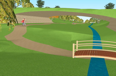
- 2018, May 17. Feasibility study of a regional trail underpass beneath General Jim Moore Boulevard in Del Rey Oaks, California. CSUMB class report. Conlen, Eichorn, Inglis, Watson. Demonstrates that there is enough vertical clearance to fit an underpass beneath GJMB. Visualizes what it would look like, using simulations based on site-specific topographic survey.
- 2019, January-March. CSUMB ENVS 560 graduate student research projects & associated reports. Watson, Kwan-Davis, Wandke, & Kortman. "Model-based prediction of runoff and stream discharge in an urban watershed – Arroyo del Rey, Monterey County, California". Not for posting. Available on request.
- 2019, April 23. City of Del Rey Oaks city council rejected the two development proposals they received a year ago on March 13 2018 for the "17-acre site" along Hwy 218 east of GJMB just upstream of Frog Pond.
- 2019, May 3. Work Memorial Park. Topographic Survey by L&S Engineering and Surveying, Inc., for City of Del Rey Oaks.
- 2020 January-March. CSUMB ENVS 560 graduate student research projects & associated reports. Solis, Bogdan, & Watson. "Model-based prediction of runoff related to increased development – Canyon del Rey Watershed, Monterey County, California". Not for posting. Potentially available on request.