A history of Hilltop Park
Compiled by Fred Watson, PhD
Copyright (C) F. Watson. Last updated: 18 May 2020.
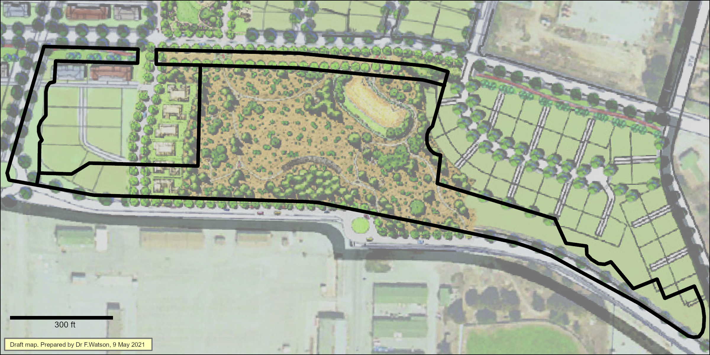
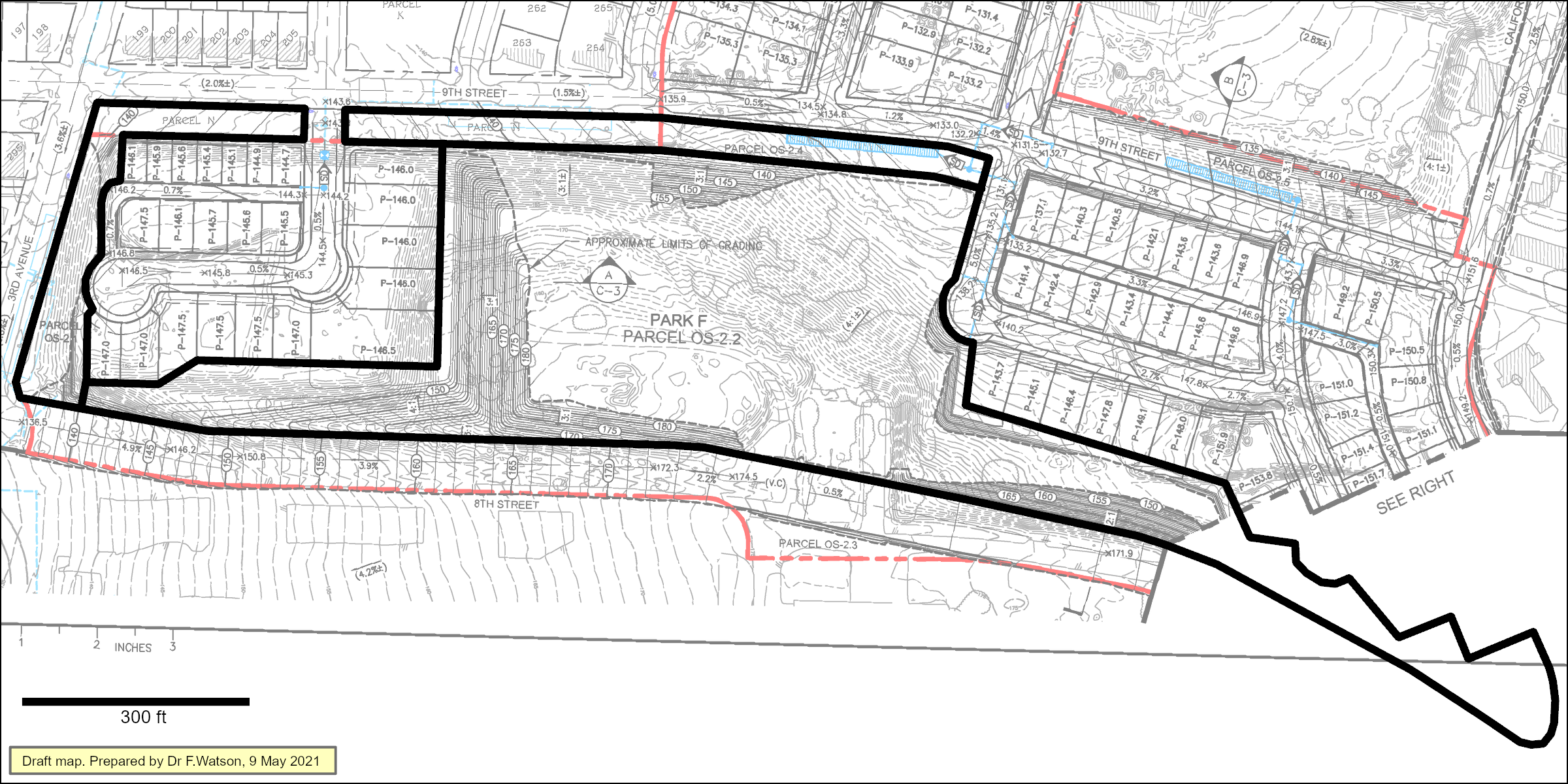
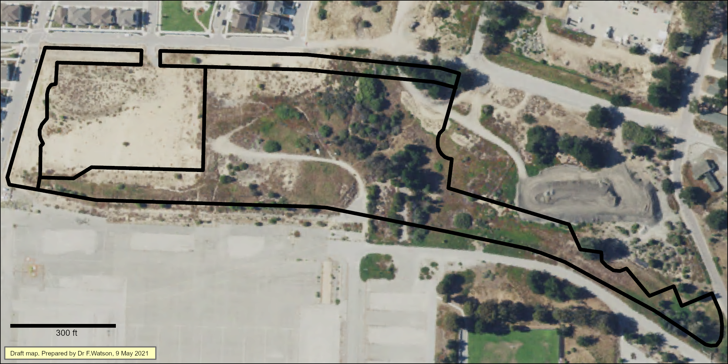
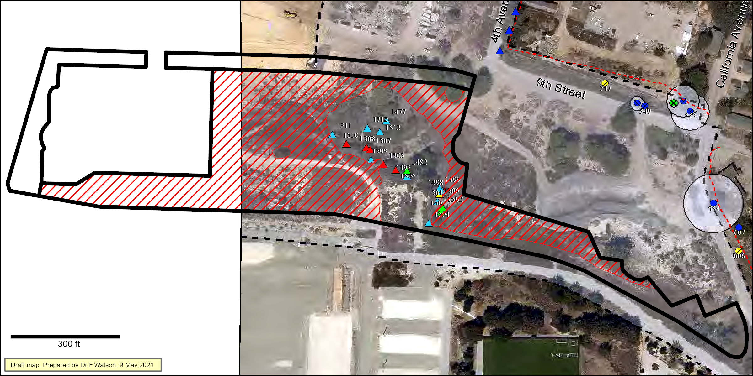
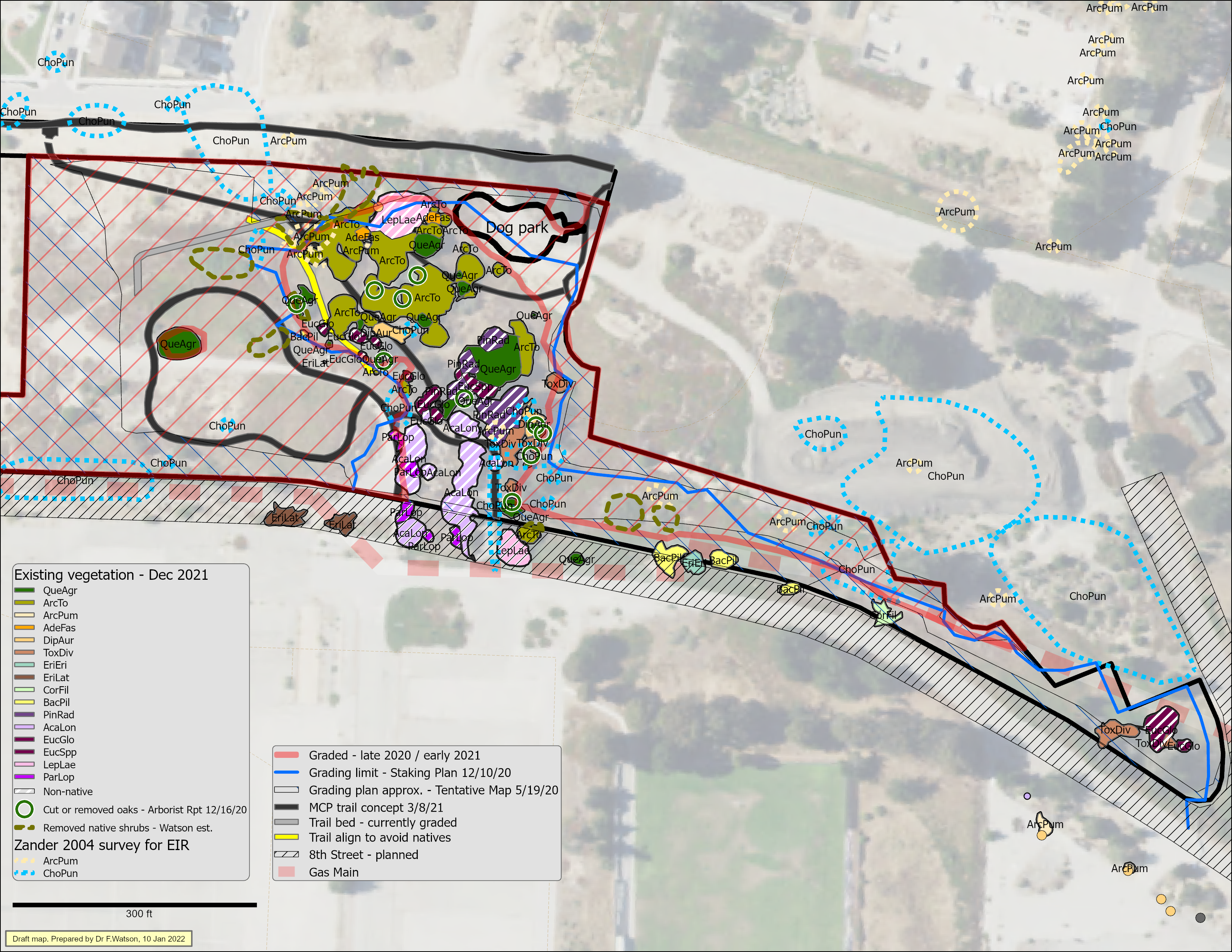
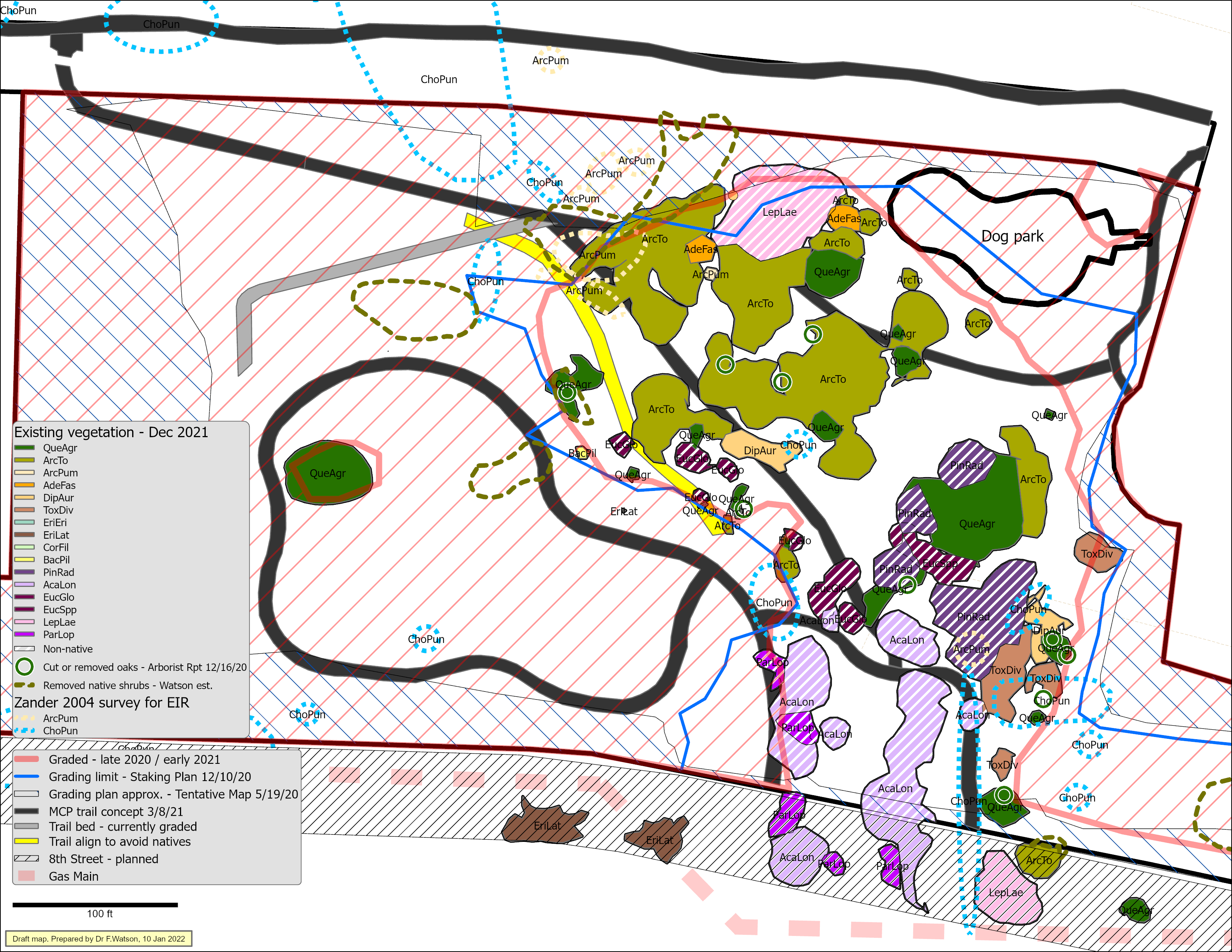
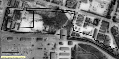
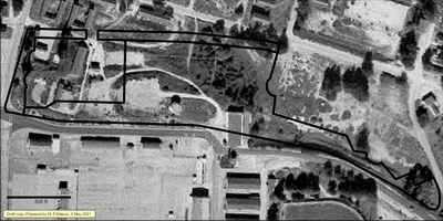
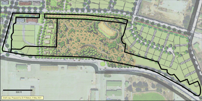
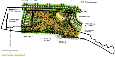
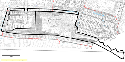
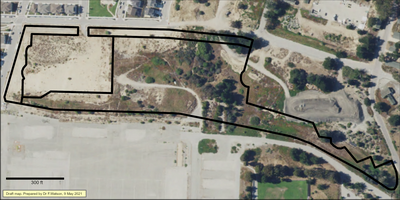
All the maps below have the same parcel boundaries drawn in, to create a consistent frame of reference. These boundaries are approximately the same as the actual intended boundaries of Hilltop Park and some nearby public facilities strips, as defined by an approved 2020 amendment to the Tentative Map.
Most of the maps below have been manually georeferenced - i.e. aligned to have somewhat correct geographical reference. This always involves some error, which in these maps is usually a few feet or less.
- 1937: The Hilltop Park area was a naturally vegetated shrubland with a cleared utility line running along the west side. My interpretation of this and other information sources is that most of the vegetation was maritime chaparral characterized by two manzanita species (Arctostaphylos tomentosa and Arctostaphylos pumila) and some small coast live oaks (Quercus agrifolia).
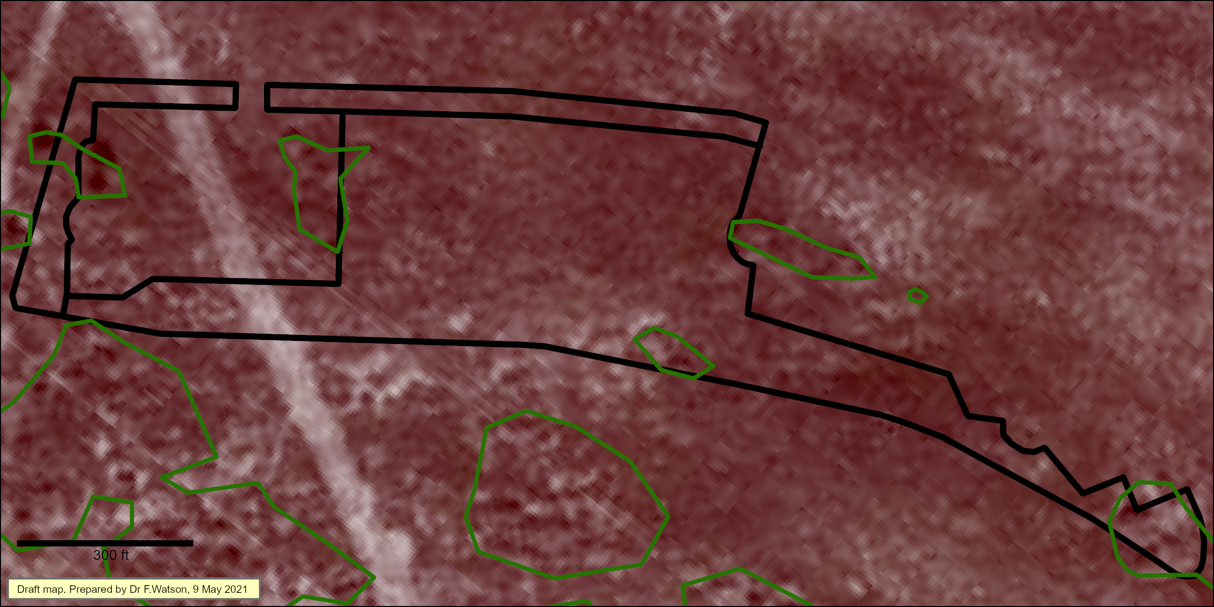
In the image below, I have outlined in green the areas with taller vegetation i.e. scattered large shrubs and some small trees at the western edge (almost certainly coast live oaks). These are identified by the size of their shadows. The lighter patches are relict dune crests with relatively sparse vegetation that would be probably be characterized as coastal sage scrub. The remaining medium gray would be maritime chaparral dominated by Arctostaphylos shrubs. All of this can be reasonably confidentally inferred from detailed study of the same imagery in areas near Hilltop Park that were subsequently less impacted by Army activities as Hilltop Park was, and from the species observed at Hilltop Park in 2020 & 2021 (see below).

Different dune-derived soils appear to determine the broader pattern of vegetation in the area of Hilltop Park. The small trees in the southwest of the above image are in a belt of what appears to be Oceano loamy sand that typically supports oak woodland. The more uniform, lower vegetation in the rest of the image are in a belt of Baywood sand that typically supports shrubs, scrub, and forbs.
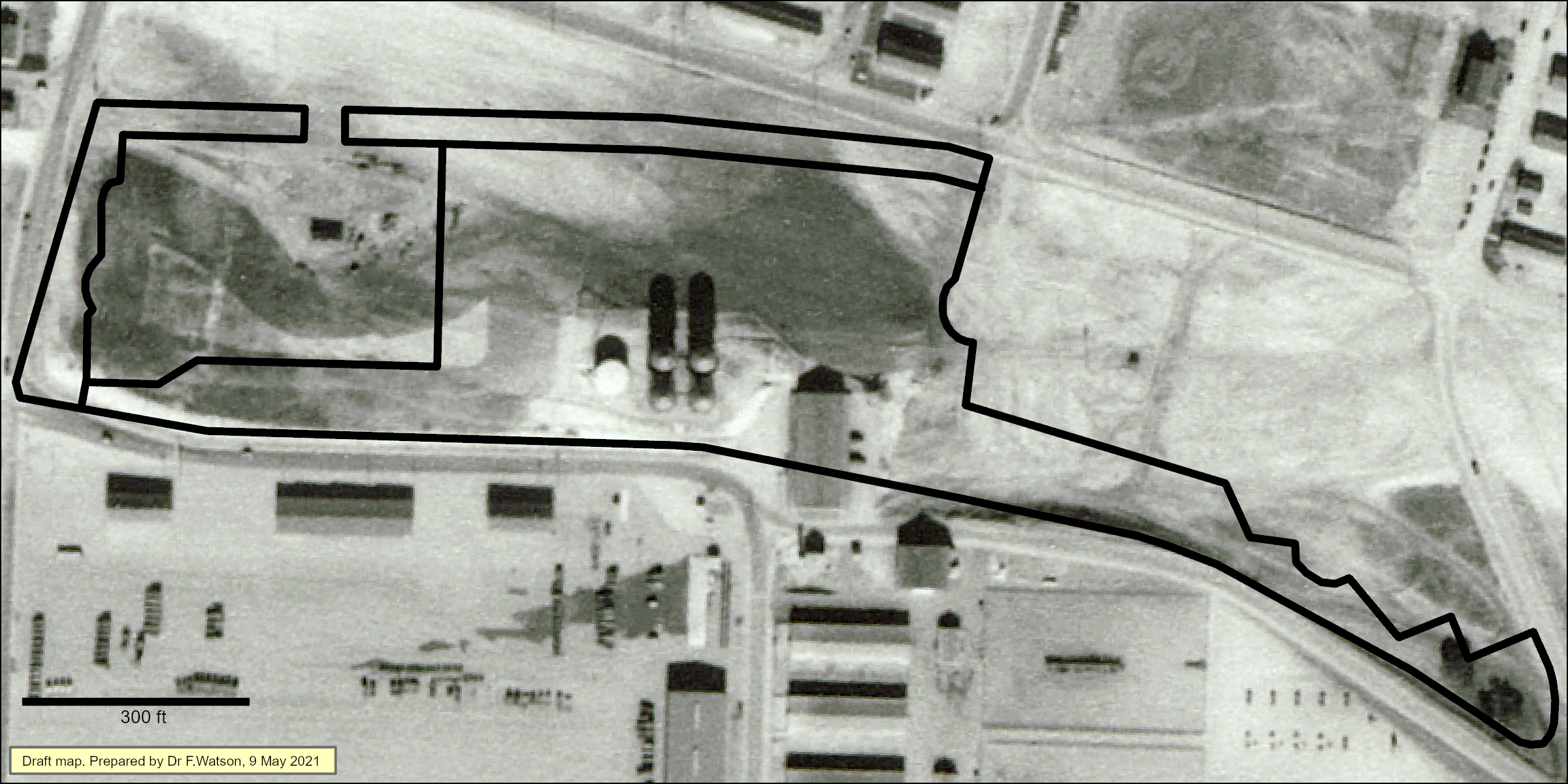
- 1941: The Hilltop Park area changed drammatically between 1937 and 1941. Almost all the vegetated had been cleared down to to near ground level, and about half the park area had been graded. Five water tanks and a building had been erected on the hill. My interpretation is that the medium gray areas were not graded and thus still exhibited somewhat intact soil and living sub-surface burls from which sprouts would have been growing - for at least two shrub species (Arctostaphylos tomentosa and Adenostoma fasciculatum).
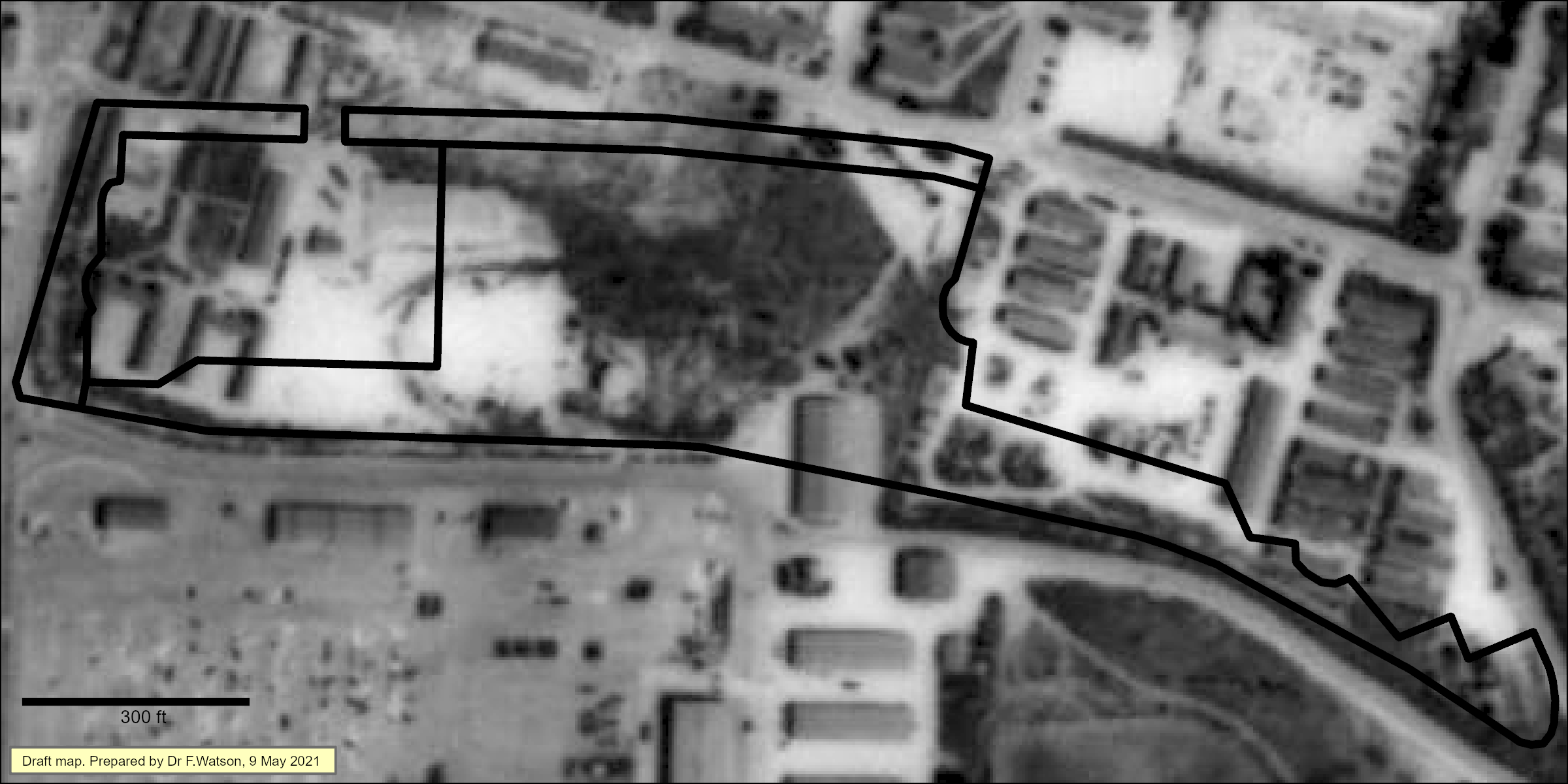
- 1956: Vegetation had grown back in the areas that were not graded prior to 1941, including many shrubs and possibly some small trees. Additional structures had been built.
- 1999: Trees and shrubs on the northwest flank of the hill. Only one water tank remaining. Several structures removed. Much of the area vegetated.
- 2004. Specific Plan for University Villages (previous name for The Dunes on Monterey Bay)
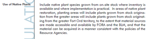
The Specific Plan indicated that Hilltop Park would emphasize native vegetation ... "grown from on-site stock" ... "originating from the greater Fort Ord territory".
Excerpts from Specific Plan text: - 2005 DEIR - Biological section
Zander (consultants) mapped the Hilltop Park area as exhibiting "Maritime Chaparral" (green) and "Degraded Maritime Chaparral" (red)
Special-status species mapped at Hilltop Park by Zander include Monterey Spineflower (Chorizanthe pungens) (Yellow) and Sandmat Manzanita (Arctostaphylos pumila) (purple).
- 2008 Amended Tentative Map
- 2015, October 16.
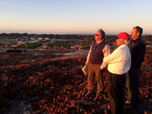
Early site visit for FORTAG planning by Mayor Bruce Delgado, City Manager Layne Long, and FORTAG proponents Scott Waltz & Fred Watson
- 2020, March 11: Planning Commission hearing on tree removal
- 2020, March 19th. DD&A Arborist's Report
- 2020, March 25th. FORTAG Final EIR certified by TAMC and FORTAG Master Agreement appoved by TAMC. FORTAG includes a trail segment in Hilltop Park.
- 2020, April 7. FORTAG Master Agreement approved by Marina City Council.
FORTAG includes a trail segment in Hilltop Park.
- 2020 May Amended Tentative Map
- 2020, June 17.
- 2020, November 19
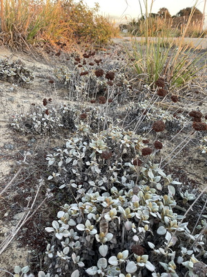
Casual survey of plant species by F. Watson
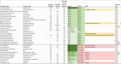
Relevant native species missing from above list:
- Coast silk tassel (Garrya elliptica) observed 4/11/21 just north of Hilltop Park
- Black sage (Salvia mellifera) observed 3/1/19 in east finger of Hilltop Park
- Peak Rushrose (Crocanthemum scoparium) observed near Marina Equestrian Center
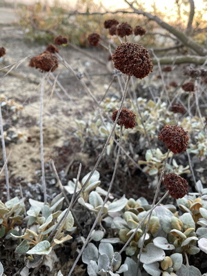
Eriogonum latifolium on the south side of the Hilltop Park area
(also observed 2/12/20 on north side)
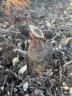
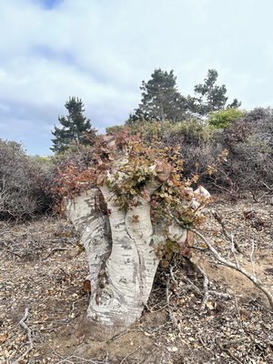
Arctostaphylos sp. half cut away (later completely removed)

Arctostaphylos tomentosa
(or possibly Adenostoma fasciculatum, but A. fasc. tends to have conical burls)
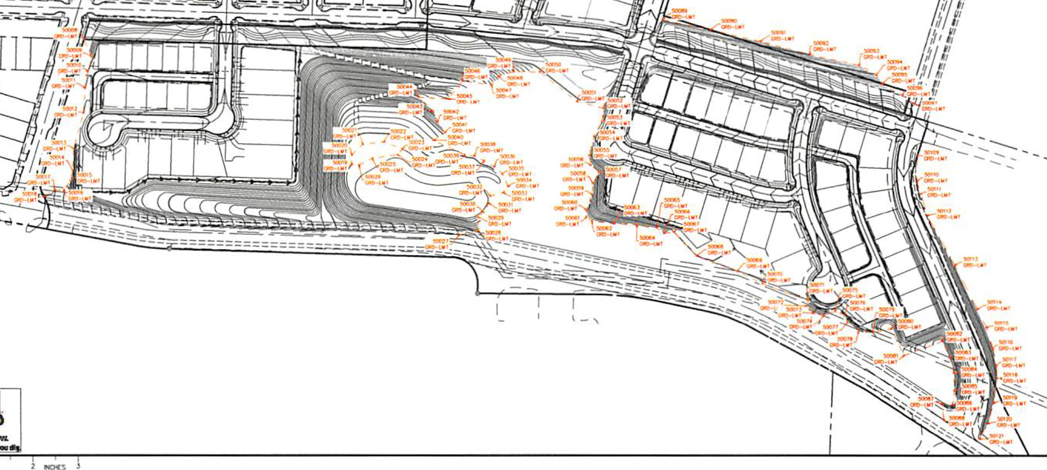
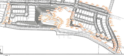
- 2020, December 10. Staking Plan. Grading limits. Map by Whitson Engineers.
- 2020, December 16: DD&A Arborist's report
Triangles indicate unintentionally removed trees (see 3/11/21 PC report below).
Pale blue triangles are coast live oaks:
- Late 2020 / Early 2021
Extensive grading, removal, and cutting of native shrubs and trees.
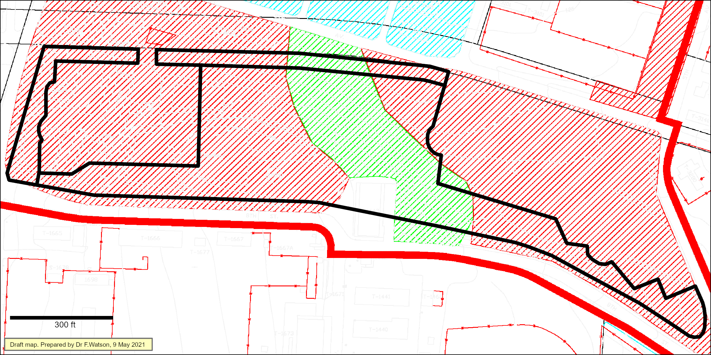
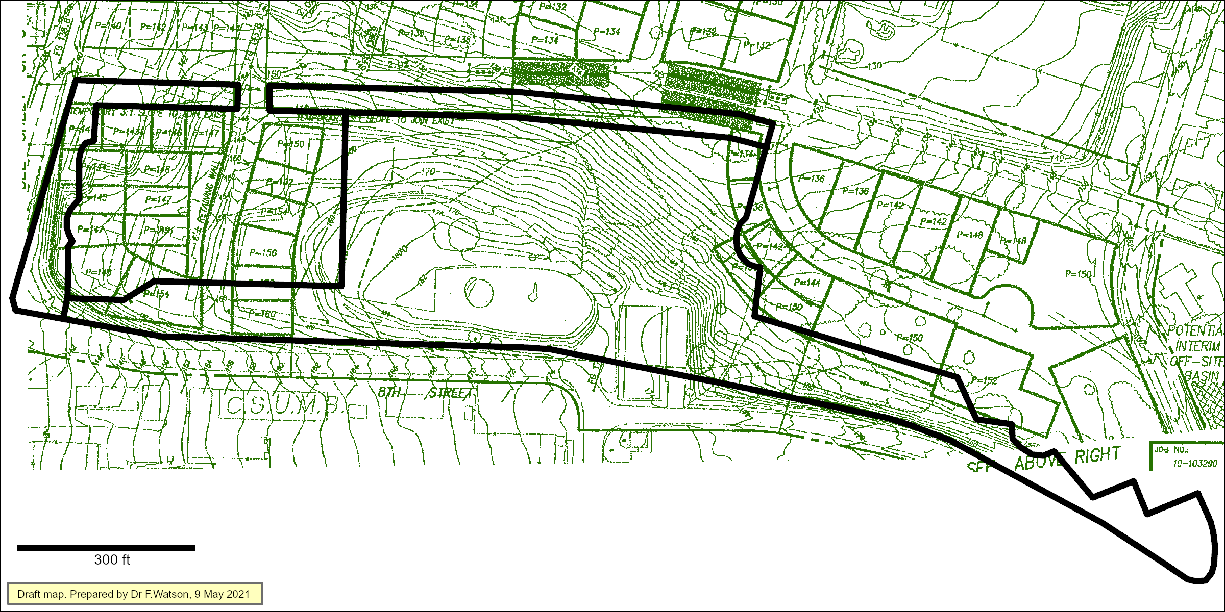
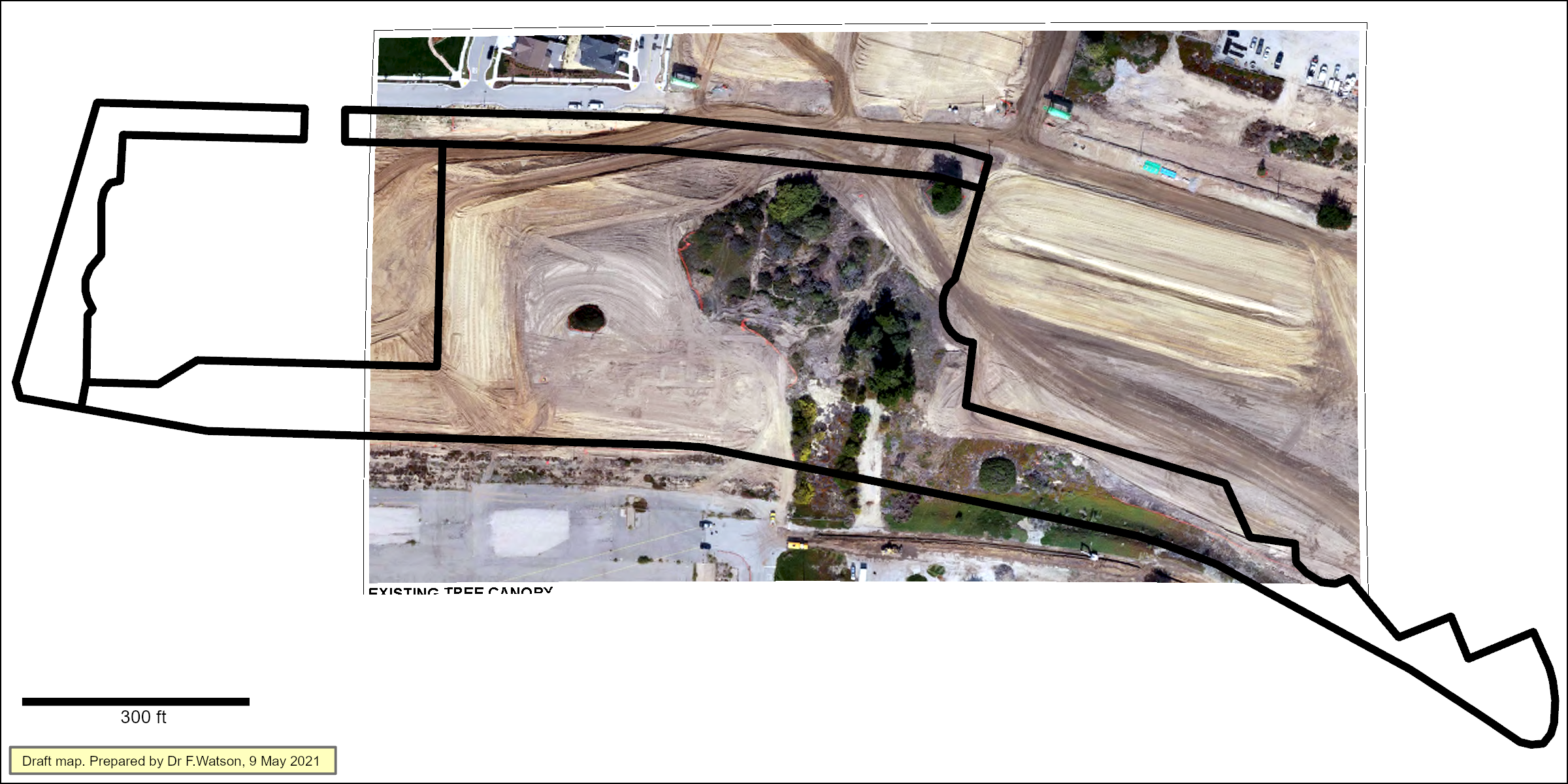
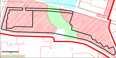
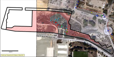
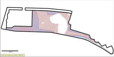
The grading as at 5/10/21 (red stripes, below, approximate) is a bit more extensive than is evident from the above aerial image.
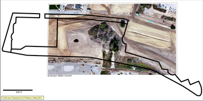
Same as above, but with a June 2020 background:
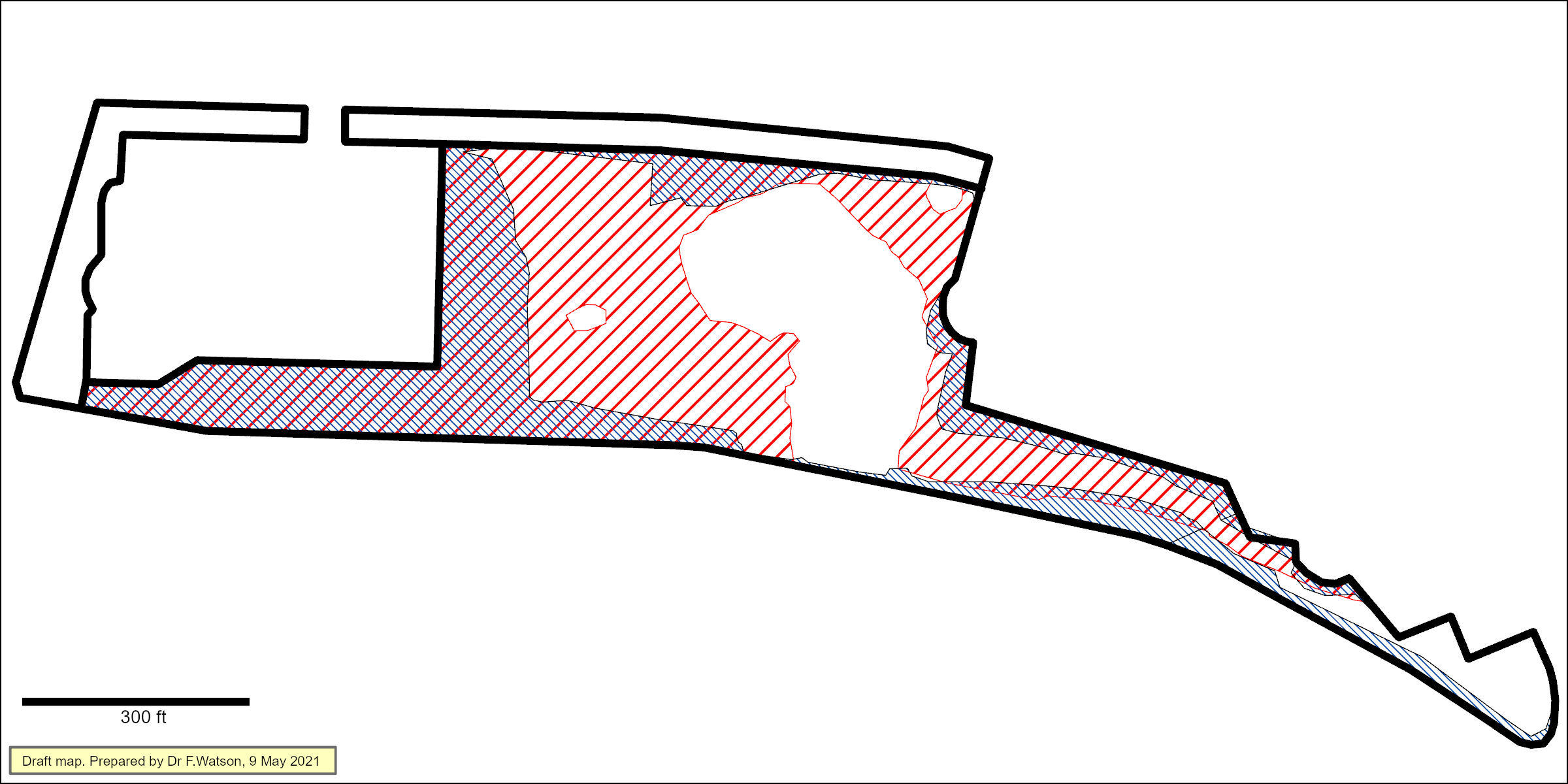
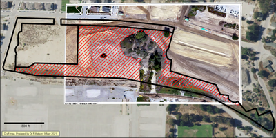
Difference between approximate actual grading (red) and "approximate limits of grading" (blue) indicated in 2020 Tentative Map:
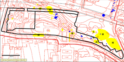
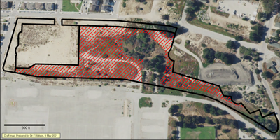
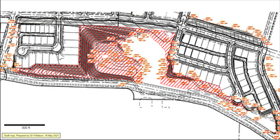
Difference between 12/10/20 grading plan (orange annotations, black lines) and approximate actual grading (red stripes).
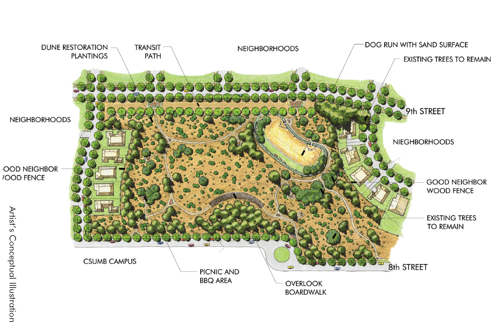
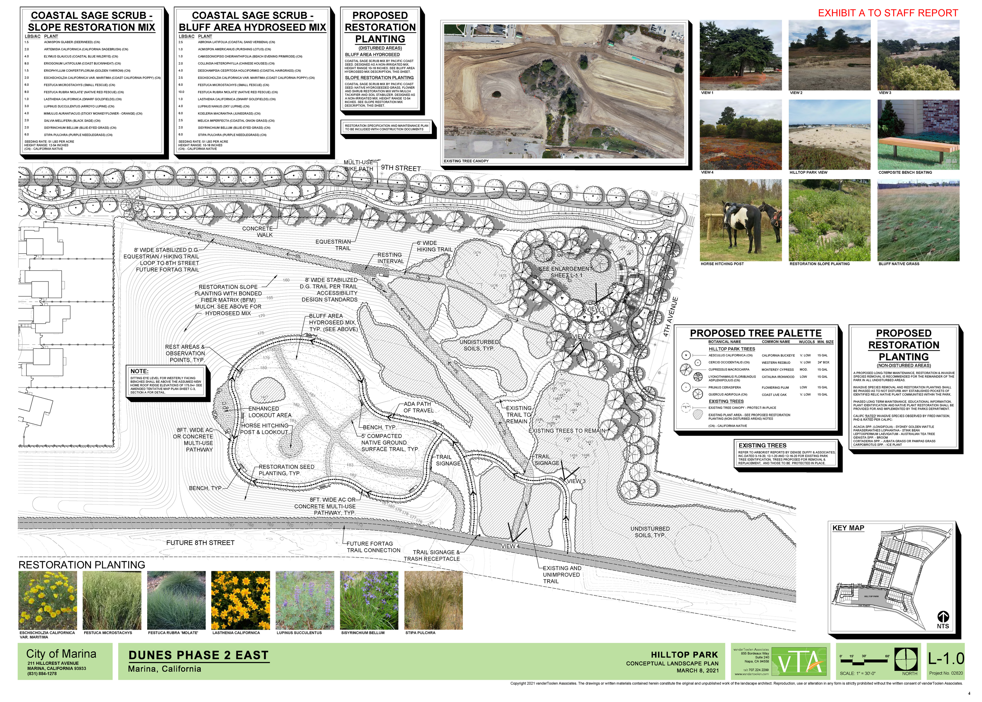
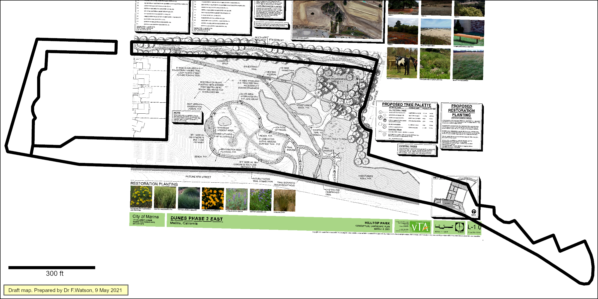
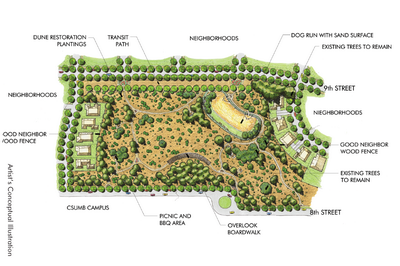
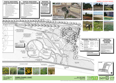
- 2021, April 20: City Council hearing on Hilltop Park Conceptual Landscape Plan
- F. Watson comments read at council meeting 4/20/21 and emailed to staff the next day
(the gray parts were not read, to save time)
- 2021, April 23.
Quercus agrifolia surveyed by arborist in 2020 then cut in late 2020 / early 2021
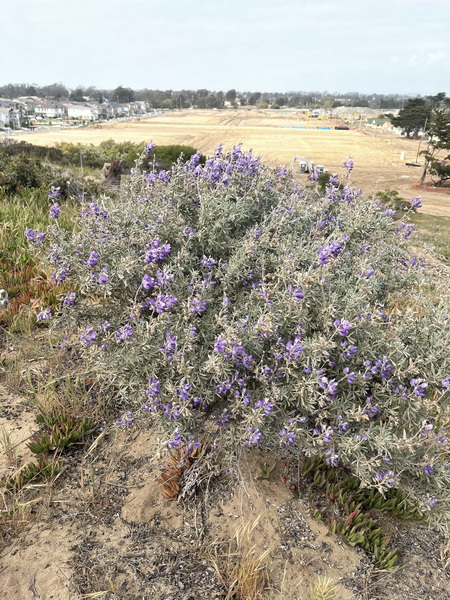
Lupinus chamissonis remaining after substantial grading & cutting nearby
-
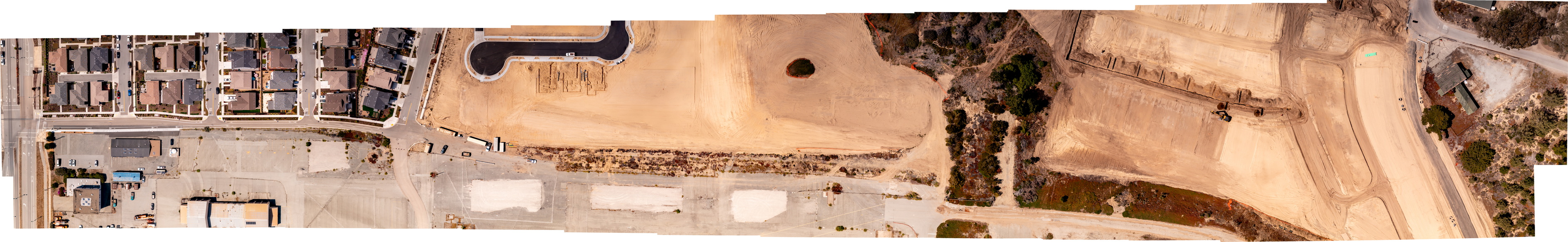
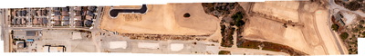
2021, May 17. Partial aerial image flown by Steve Zmak.
- 2021, May 26. Plant list by Karen Anderson
- 2021, May 26. Hilltop Park Ad Hoc Committee packet
- 2021, Sep 24. Sub-committee meeting Bruce, Fred, Byron, Don, Chris, Brian, et al.
- 2021, Dec 3. Sub-committee meeting Bruce, Fred, Byron, Don, Chris, Brian, et al.
- 2021, Dec 16. Planting list worksheet (updated 1/10/22 - see below)
- Trail concepts shared with City's Hilltop Park committee 12/16/21
Superseded. See below.
Northern flank trail concept 16-Dec-21
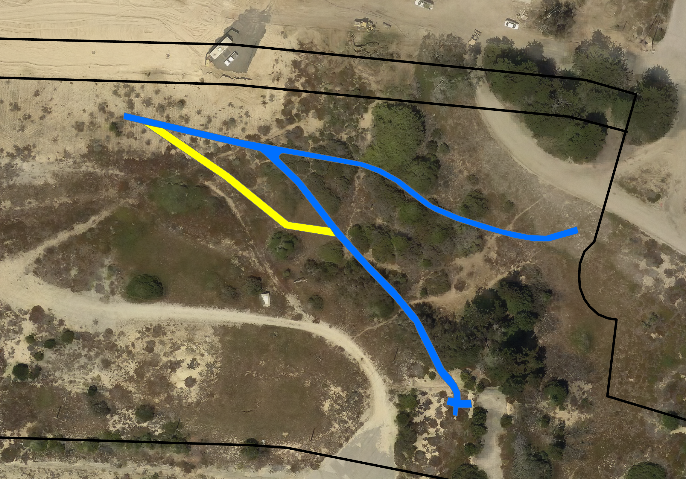
Blue is MCP 8-Oct-21. Yellow is FW suggestion 16-Dec-21.
Same thing with ROUGH indication of Acrtostaphylos & Quercus

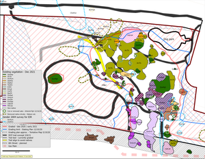
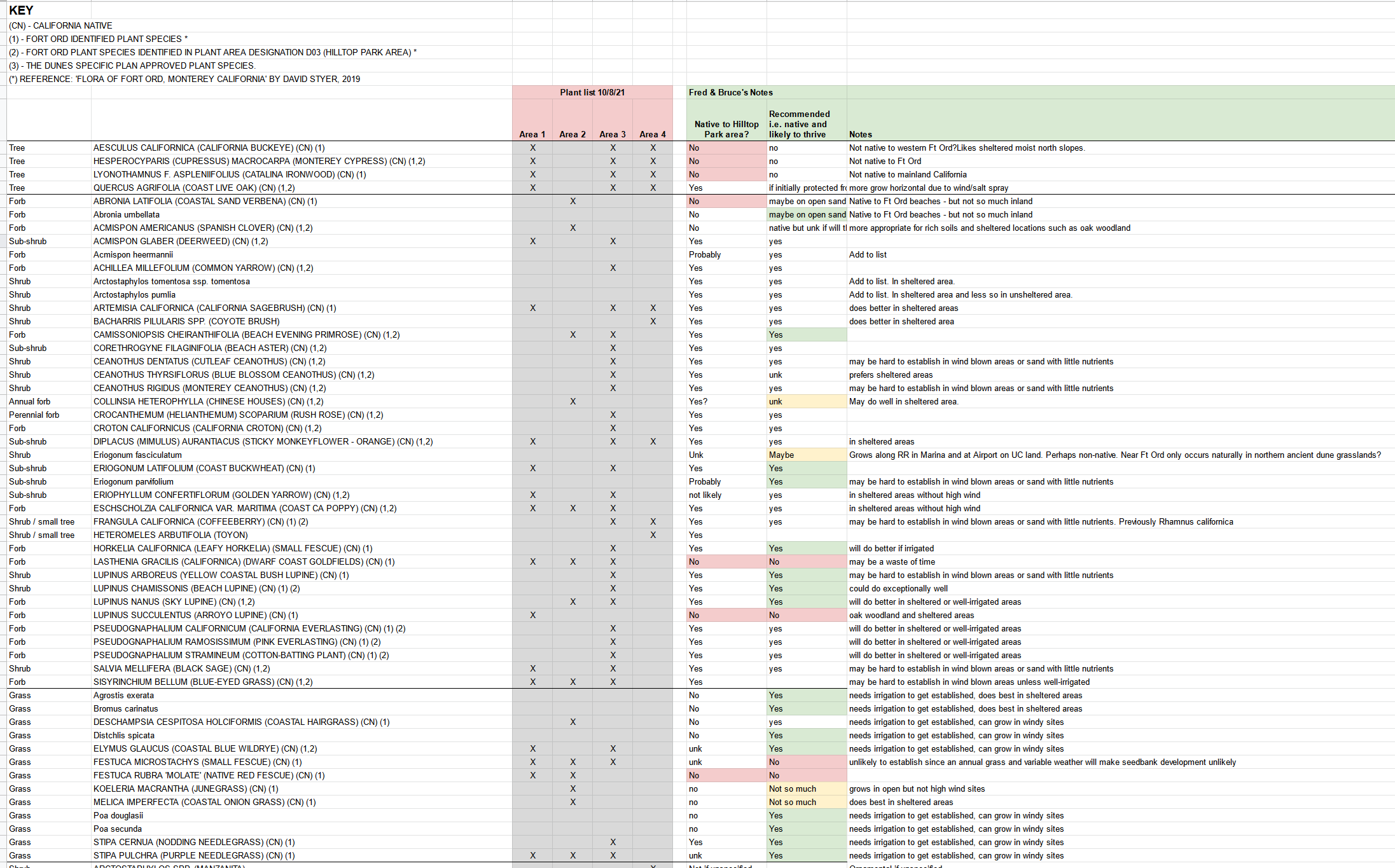
- Updated plant list 1/10/22
HilltopParkPlants_VTABasedVersion_220110.xlsx
- Maps of native and non-native vegetation and trail context
10-Jan-2022