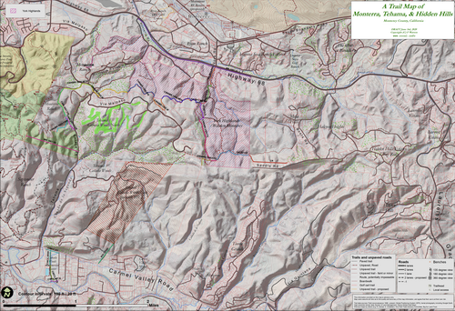
History and status of Monterey County trails:
Monterra, Tehama, Hidden Hills, etc.
| Part 3: Map Sequence | Back to index |
|---|
Fred Watson, PhD
(Copyright (C)). With Mike Weaver and Richard H. Rosenthal
These maps show information from older maps in a newer (2019-2020) context.
- 1971, March 30. Monterey County Recreational Trails Master Plan.
Adopted by the Board of Supervisors.
(Link to original map)

- 1985, circa. Carmel Valley Trails Plan.
Never adopted (as far as I can tell).
(Link to original map)

- 1990 Monterra Ranch Conditions of Approval pending trails.

- 1990s. Carmel Valley Master Plan map.
Indicates "Deeded easements" and "Pending easements".
(Link to original map)

- 1994, Sep. 12. Carmel Valley Trails Plan map.
Probably never adopted.
Contains useful information on "deeded easements" and "pending easements",
as well as "proposed trails".
(Link to original map)

- 2019. Selected outstanding easements. Plain version.
Original map based on original research by F. Watson et al.

- 2019. Selected outstanding easements. Detailed version.
Original map based on original research by F. Watson et al.

- 2019. Recordation date of major subdivisions.
Original map by F. Watson et al., based on county subdivision data.

- 2019. Selected major subdivisions.
