Fire fuel management in Monterey Gilia areas
at CSUMB East Campus
Preliminary data and analysis by Fred Watson, PhD.
Last updated: 12 June 2024
Many thanks to CM, SB, HK, & NN for helping with notes, interpretations, and photos.
- Overview
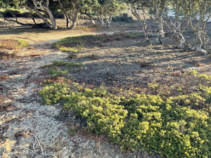
As far as I can determine so far, certain fuel management activities at East Campus beginning in late July 2023 have adversely affected patches of Monterey Gilia that occur there.
- The most concerning apparent activities include:
- Apparent use of mowing & chipping vehicles resulting in deep furrows and soil disturbance in known Gilia locations.
- The use of motor-driven mower blades that maybe have suspended and struck Gilia seeds at high velocity.
- The action of spinning mower blades may have spread non-native seed into the disturbed soils of the Gilia patches.
- Apparent use of mowing & chipping vehicles resulting in deep furrows and soil disturbance in known Gilia locations.
- Did take occur under CESA?
This is up to CDFW to determine.
Some of my observations and preliminary opinions :
- Some of the seed may have been killed by the physical action of the wheels and blades, which in my current opinion would constitute "take" under CESA.
- Some of the seed may have been buried beyond germination depth by the wheel-driven churning of the soil, which may constitute take.
- The soil disturbance and potential non-native seed dispersal into the disturbed soils may be leading to the Gilia plants being adversely affected by additional competition from non-native plants, which may consistitute take.
- Some of the seed may have been killed by the physical action of the wheels and blades, which in my current opinion would constitute "take" under CESA.
- How can there be a concern, given that Gilia are still growing in impacted areas in 2024 at an overall density that does not appear to differ substantially from previous years?
- Firstly, the apparent lack of compliance with take avoidance prescriptions is concerning in of itself. The evidence suggests that powered mowing vehicles went through Gilia patches, despite a clear direction against this and detailed mapping to prevent it.
If it happened, it should not happen again, anywhere.
- Secondly, the advantage given to the invasive grasses presents a long-term competive threat that could lead to extirpation or reduction of the Gilia patches. Weeds establishing in disturbed soil is one of the greatest threats to the taxon in general.
- Thirdly, it is likely that some of the seed bank was killed by the mechanical action of the wheels and mower blades. The 2024 plants likely represent only a fraction of the seed bank that was present in July 2023. Gilia seed banks persist many years, and seed germination rates have been shown to be higher in years beyond the first year (Fox et al. 2006). The fate of the seed bank from 2022 and earlier remains unknown and the processes affecting seedbank persistence and germination delay may have been affected by the disturbance.
- Firstly, the apparent lack of compliance with take avoidance prescriptions is concerning in of itself. The evidence suggests that powered mowing vehicles went through Gilia patches, despite a clear direction against this and detailed mapping to prevent it.
- What is this page?
This page is intended as a place where I can explore, document, and communicate some of the details to involved parties such as CDFW, campus planning, and consultants.
My motivation is to assure conservation of biodiversity. I'm writing in my capacity as a CSUMB professor with a certain degree of intellectual independence and freedom. I do not represent CSUMB management. Nothing here should be construed as an expression of the opinion CSUMB as an organization.
- The most concerning apparent activities include:
- Background
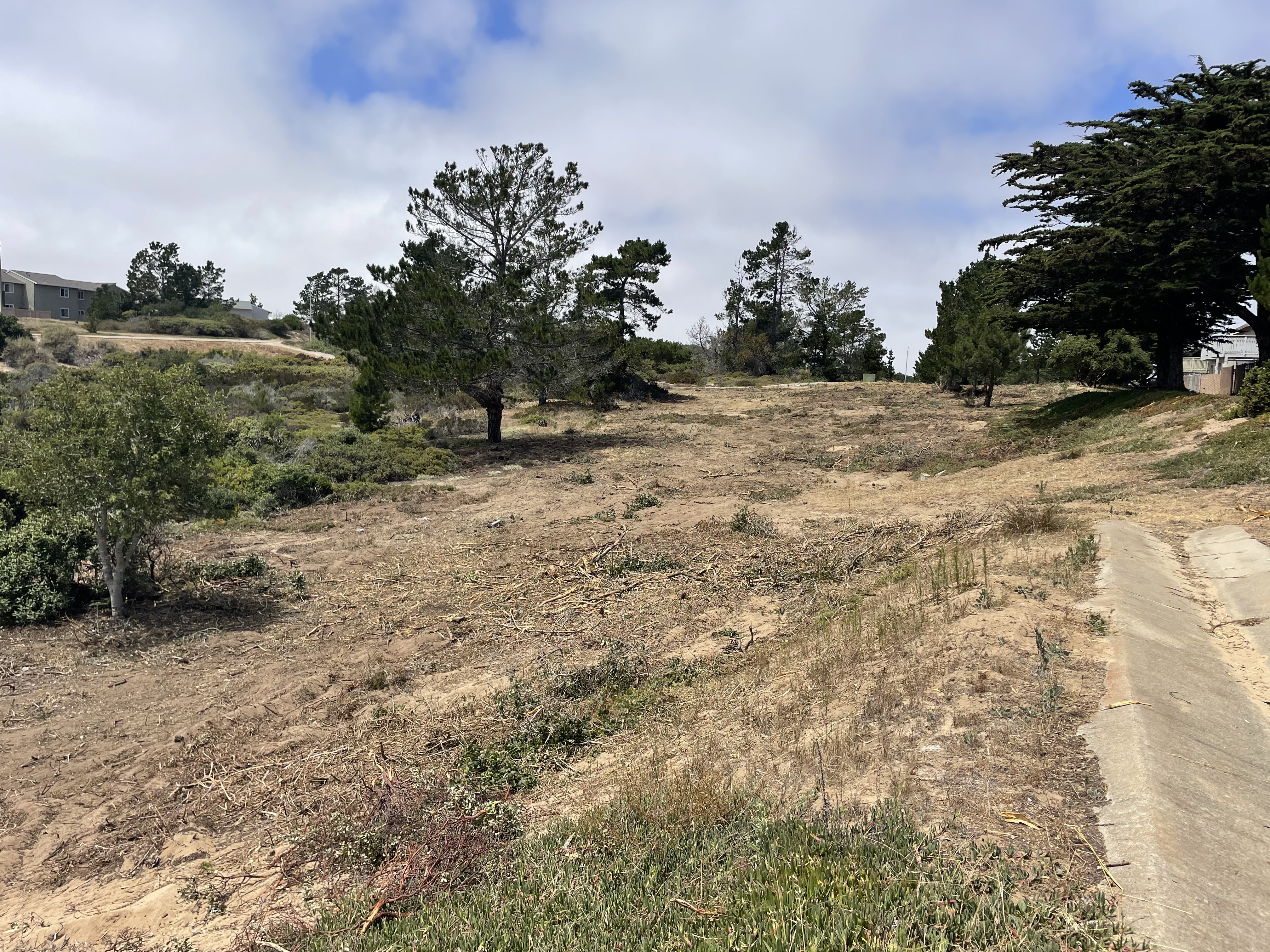
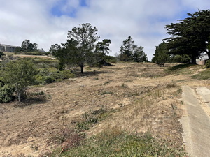
The 2023 East Campus fuel management activity was planned to reduce fuel loads by cutting shrubs, trees, and herbaceous plants within 100 ft of structures. It went through a CEQA processe which I understand included a Categorical Exemption on wildfire-related emergency grounds.
It was planned that "take" of Monterey Gilia under CESA would be avoided by: (a) not working when the plants were in their non-seed stage, and (b) stictly avoiding use of vehicles in any known Gilia area at any time. The general idea was that Gilia would not be adversely impacted if: (1) Gilia areas were clearly flagged, (2) activity in Gilia areas was limited to walking through patches, cutting shrubs with hand tools, and not piling up brush or woodchips in those areas; and (3) activity was limited to a period when the Gilia plants are in the seed stage and not in the the stages between germination and setting of seed.
The term "vehicle" was used in the project prescriptions. The dictionary definition of the word involves concepts like "transporting something" and being "mechanized". To me, this definition would encompass a machine that uses powered-wheels to transport an engine and mower blades.
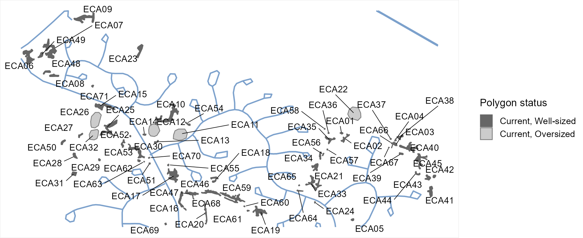
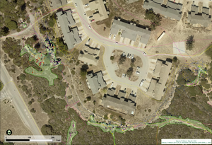
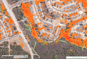
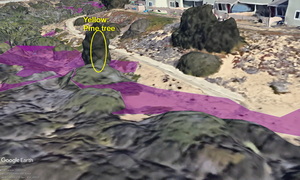
- Monterey Gilia summary maps
Overview map of all known Monterey Gilia patches at CSUMB East Campus
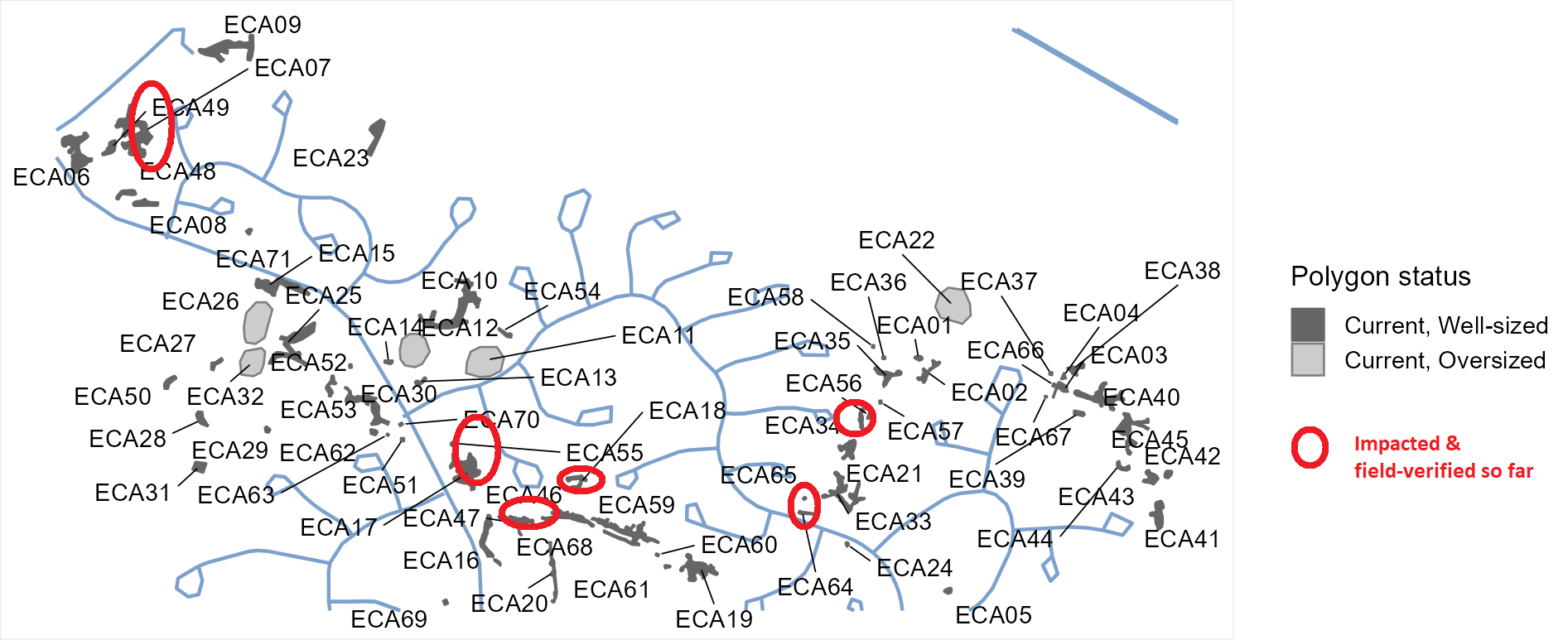
Same map but with red circles indicating patches known so far as having been impacted by vehicle-based mowing.
This map shows numbered Gilia patches (ECA17, ECA47, etc.) as well as Gilia GPS locations, and GPS tracks indicating Glia search routes.
Approximate extent of fuel clearing activity, estimated from satellite remote sensing data (change in NDVI between 11/3/22 and 11/1/23)
This QR code can be opened from within Avenza Maps to yield a live version of the above map, useable in the field.

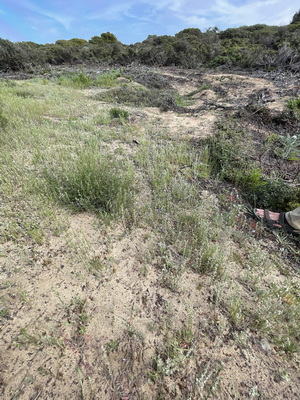
- List of known Monterey Gilia patches affected by the activity
Patch Mowed? Rutted? Documentation Nearby street ECA17 Yes Yes S, F Edde ECA47 Yes Yes S, F Edde ECA46 Yes S, F Edde ECA18 Yes Yes S, F Edde ECA59 Likely S Scott ECA19 Likely S Bundage ECA07 Yes S, F Trenton ECA10 Yes S, F Yorktown ECA30 ? -
Antietam ECA51 ? - Antietam ECA33 Likely S Jackson ECA56 ? S
Holovits ECA34 Yes Yes S, F
Holovits ECA21 ? S
Holovits ECA65 Yes Yes? O Jackson ECA64 Yes Yes O Jackson ECA37 ? - Eichelberger ECA04 ? - Eichelberger ECA66 ? - Eichelberger ECA03 ? - Eichelberger ECA67 ? - Eichelberger ECA41 ? - Wedemeyer ECA15 ? - Saratoga ? ? - Wilderness ? ? - Minuteman ECA49 Yes ? S, F Trenton
S: Satellite imagery
F: Photos by Fred
O: Photos by others
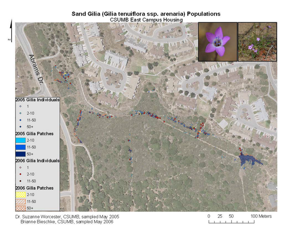
- Monterey Gilia survey by S. Worcester and B. Bieschke 2005-2006
Thw Worcester/Bieschke mapping was the first to precisely indicate Gilia patches in East Campus. Earlier mapping occurred but was more general. Later mapping by Watson, Solis, & Karshitsev (2017 onwards) refined and expanded the Worcester-Bieschke mapping. All of this mapping was used in the East Campus fuel management planning.
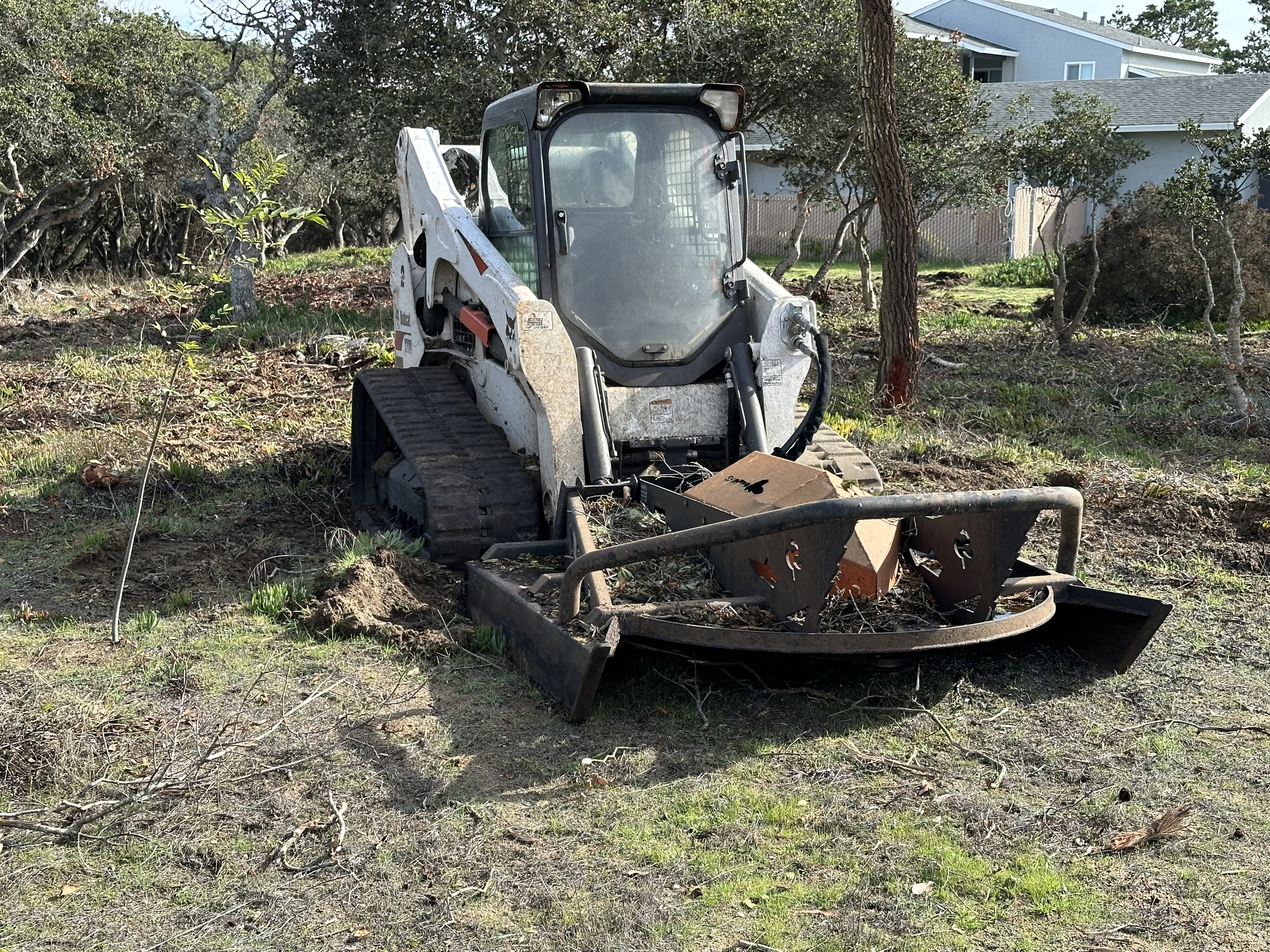
- Equipment used
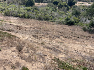
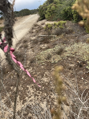
From the field evidence in the photos later in this page, my interpretation is that known Gilia occurrences were subjected to motor-driven wheels (or caterpillar tracks?) disturbing the soil down to depths of as much as 8 inches and powered brush mower blades operating just above the soil surface.
Here's some notes on specific equipment that appears to have been involved in the overall project.
- Walk-behind brush mower. As far as I have been able to determine, the model that was used appears to be a DR Pro Max 34, or similar. It has motor-driven wheels, power-steering, and is advertized as being able to cut saplings up to three inches.
Link to YouTube
promotional video for mower

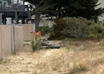
Photo: consultant.
- Skid-steer brush mower
It is unclear if this was used in Gilia areas or not. Some kind of power-driven brush mower was used in Gilia patches leaving deep tracks and about a 6 ft to 8 ft turning radius. The photo below was taken 1/15/24 off the end of Yorktown Ct where there are no known Gilia occurrences.
(Photo: HK)
This might be the same vehicle. The Photo is from Devers Ct.
(Photo: CM)
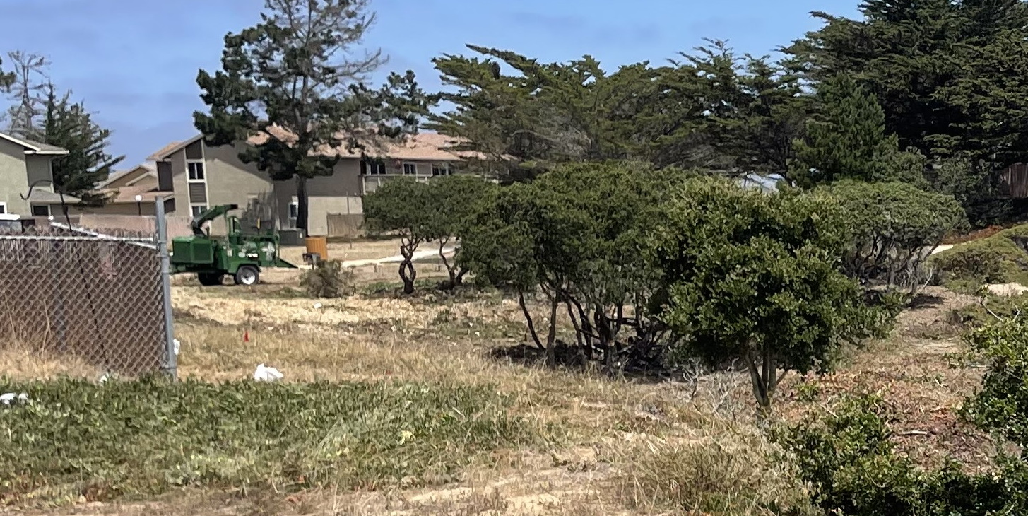
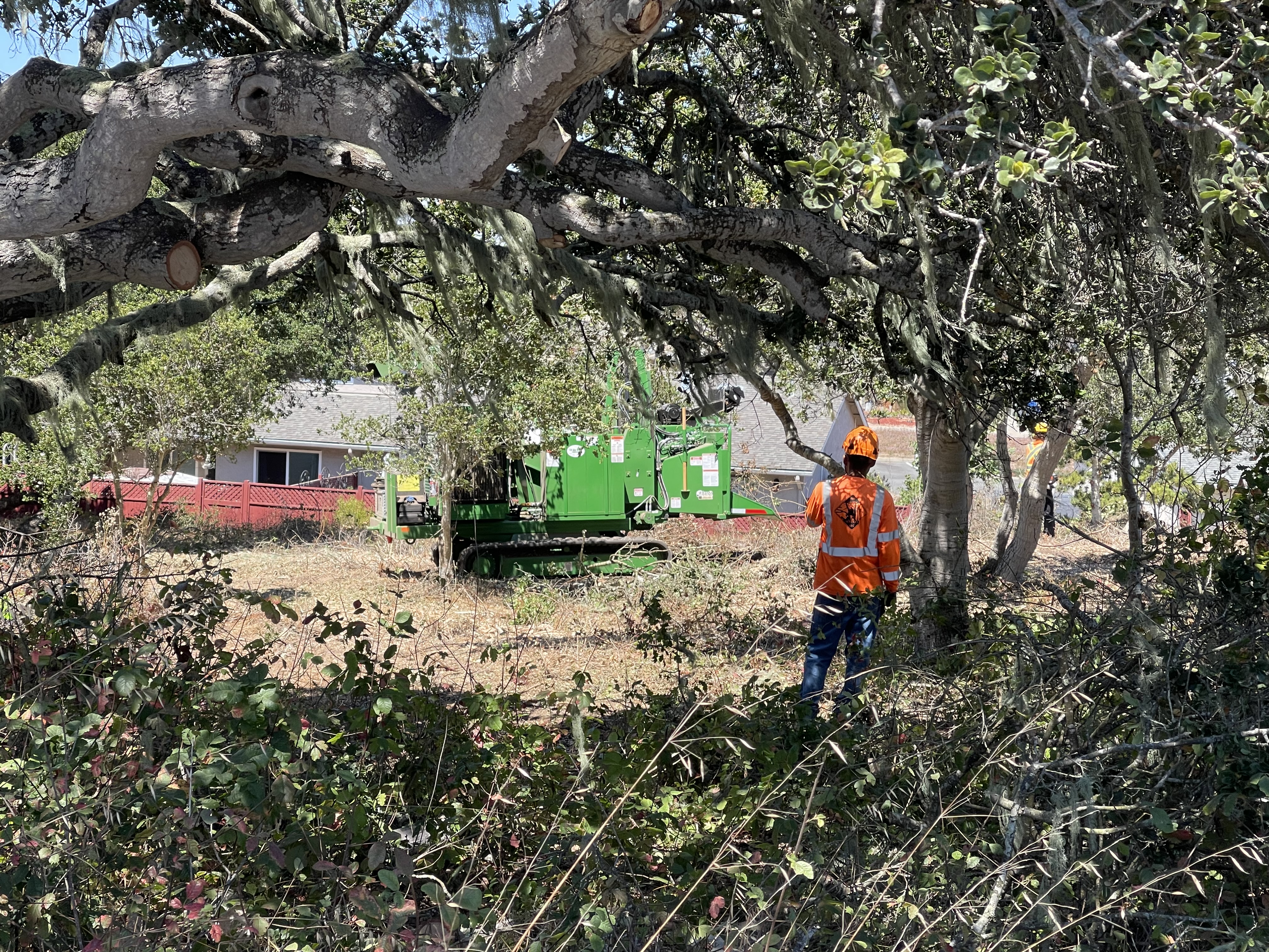
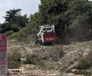
- Wood-chipper towed behind a truck
A truck-towed wood-chipper was used in the area of ECA17, ECA47, ECA46, ECA18 (CM pers. comm.). It was probably this one, shown at ECA18

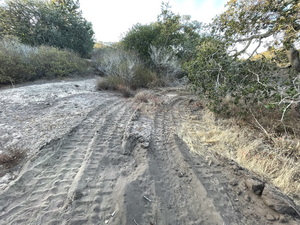
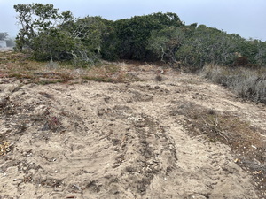
- A skid-steer chipper was also used in other areas

I think these might be tracks made by the skid-steer chipper or the skid-steer momwer:
About 100 feet from Gilia patch ECA02
About 25 feet from Gilia patch ECA58
- Walk-behind brush mower. As far as I have been able to determine, the model that was used appears to be a DR Pro Max 34, or similar. It has motor-driven wheels, power-steering, and is advertized as being able to cut saplings up to three inches.
- Commencement of work
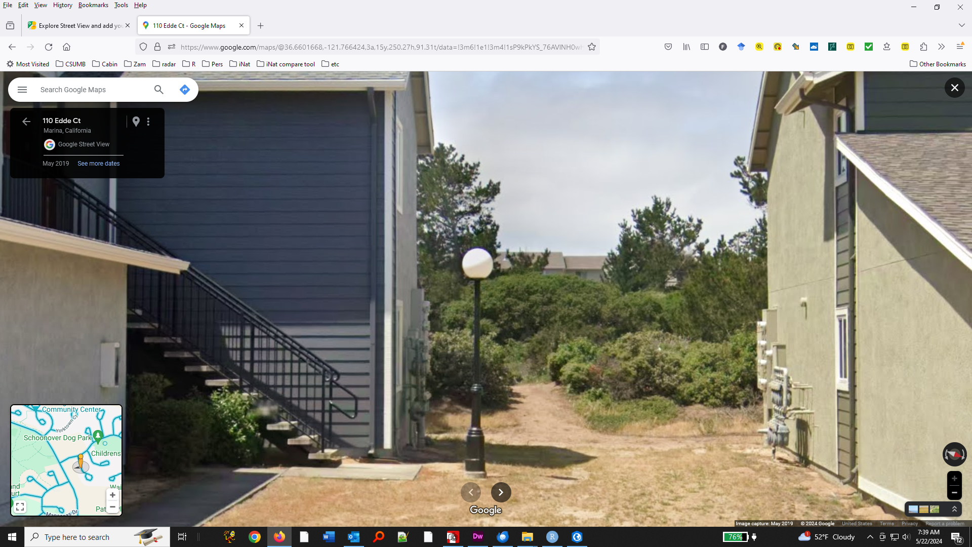
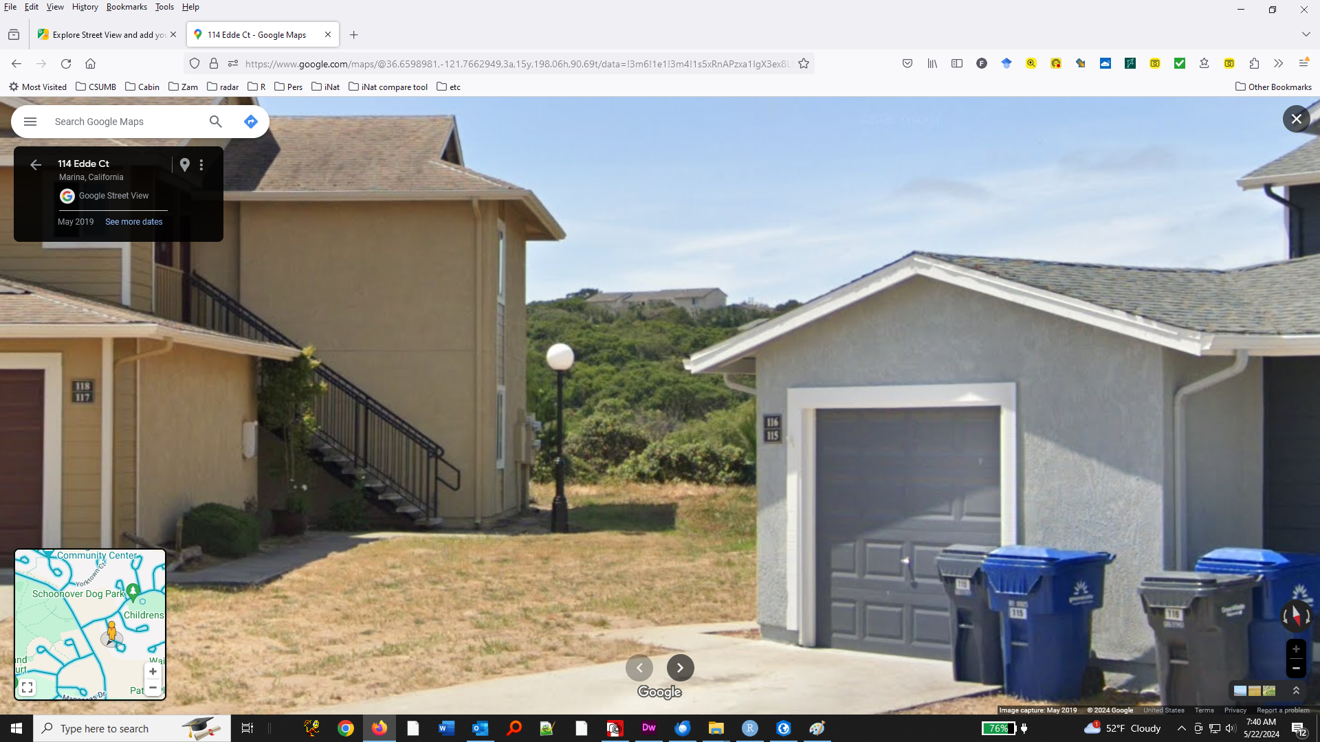
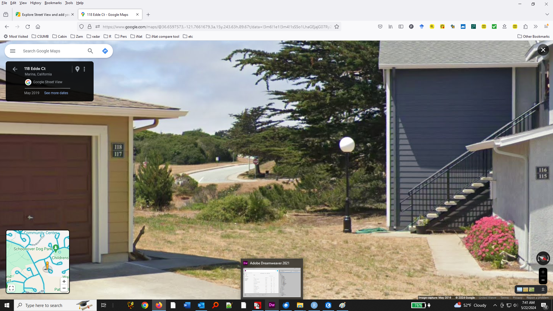
On site fuel removal commenced at Edde Ct on 7/24/23, according to a biological monitoring memo.
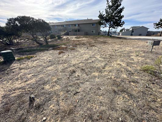
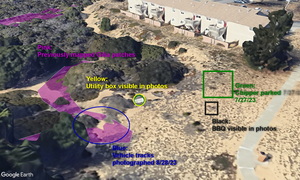
- Gilia patch ECA18. Evidence that a mowing vehicle or truck-towed chipper manoeuvered back and forth directly on a known Gilia patch.
The photo on the left (10/12/23?) was represented as "Sensitive area avoided". However, a chipper was parked in the middle of this photo on 7/27/23 (see photo below) and the photo includes the edge of a large Gilia patch (ECA18) that was mowed and trampled by heavy equipment that directly overlapped the known boundaries of the patch. 10/12/23?
5/23/24
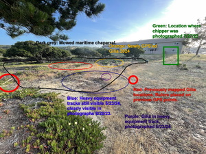
Photo from 7/27/23
Same area, showing a chipper just behind Gilia patch ECA18. For alignment of the photos, note the barbeque stand visible in both photos. There's no evidence of clear flagging in any of these photos, notably this one when the chipper was on site.
Google Earth rendering of ECA18
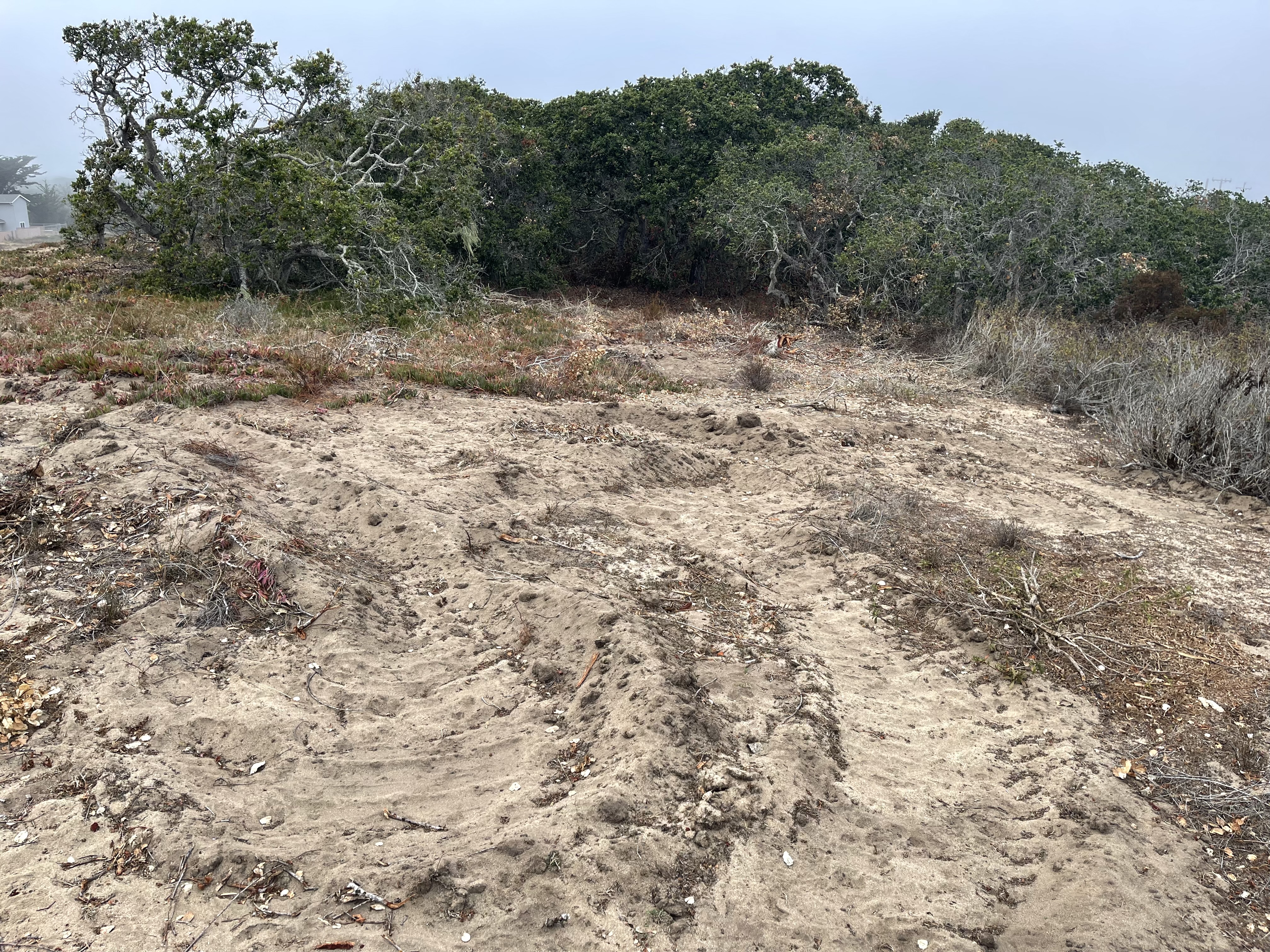
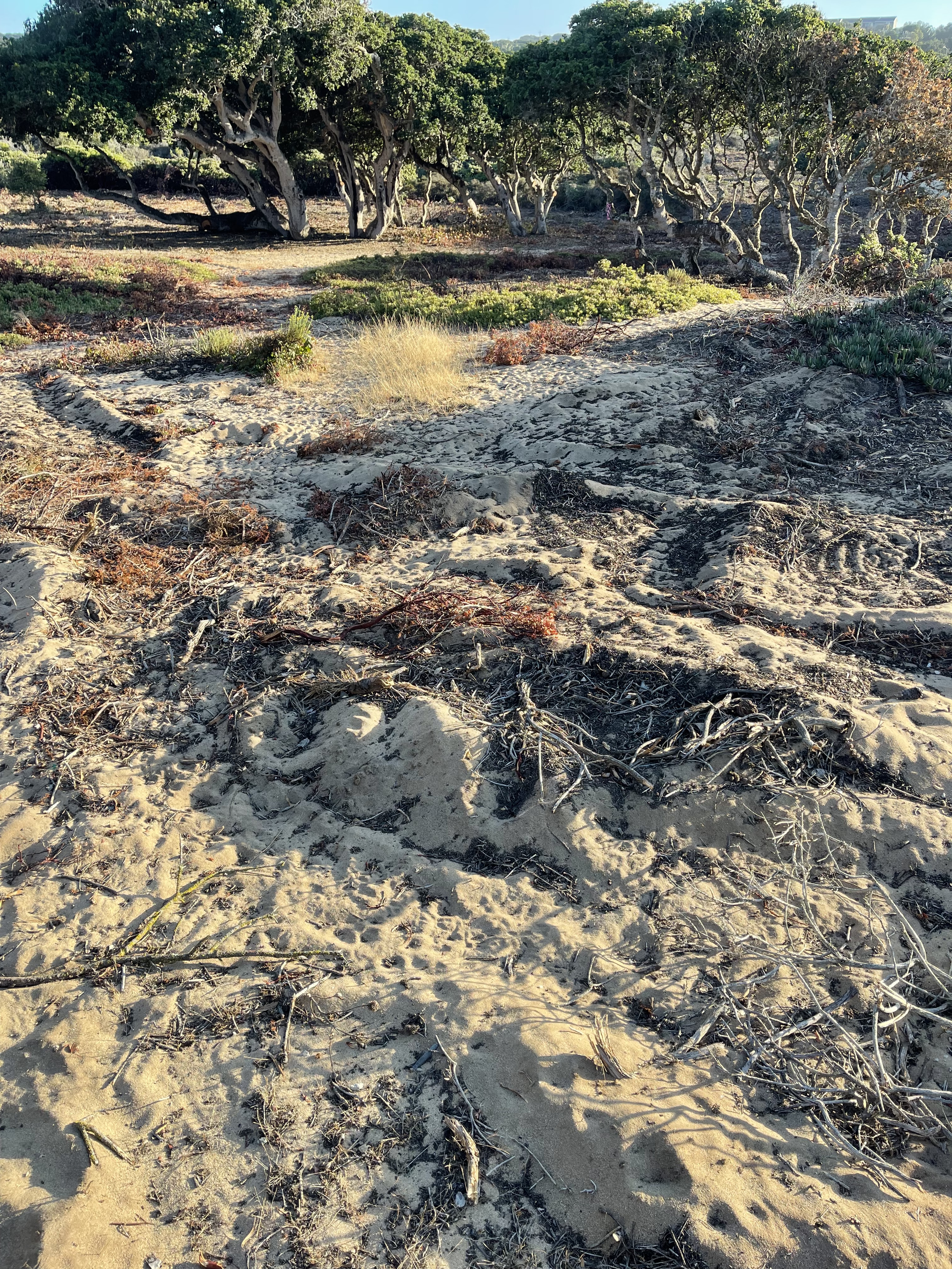
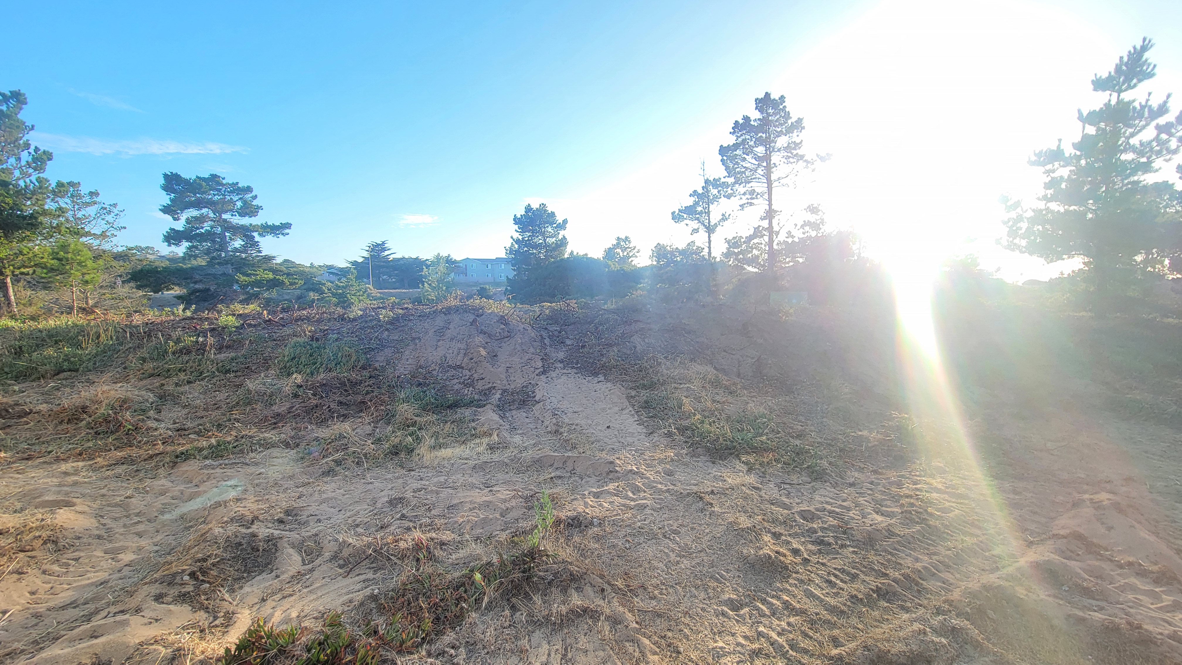
Photos from 8/28/23. The photo shows the same location, but viewed from a different angle and with a low sun angle. Large vehicle tracks are clearly evident in the same location. The size and pattern of the tracks is consistent with a mowing vehicle or truck-towed-chipper or being manoeuvered. The tracks are directly on a known Gilia patch and a Gilia plant was later observed growing in the tracks (see 5/23/24 below).

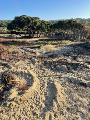
5/23/24 Monterey Gilia plant growing on 4/18/24 at a location where vehicle tracks were evident on 8/28/23. Tracks are hard to see in the photo in overhead sunlight.

Same location as the photo above from 8/28/23.
A gilia plant is growing in the vehicle track (5/23/24). Tracks are easier to see in the photo in the late afternoon sunlight.

This is the Gilia plant in the center of the photo at left.
5/23/24

The evidence suggests that all the cutting at this site was done by mower. All of the cuts are ragged and shredded and none of them are clean cuts as would be expected from hand clipper. I have five photos illustrating close-ups of cuts made this inside patch ECA18 (not posted).
The same basic story holds for ECA17 and ECA47: vehicle travel in previously known Gilia patches, everything mowed using a mower with powered wheels, nothing hand cut, no evidence of clear flagging of Gilia patches, Gilia documented in vehicle tracks, and tracks measured to 6-inches deep 9 months after the activity.
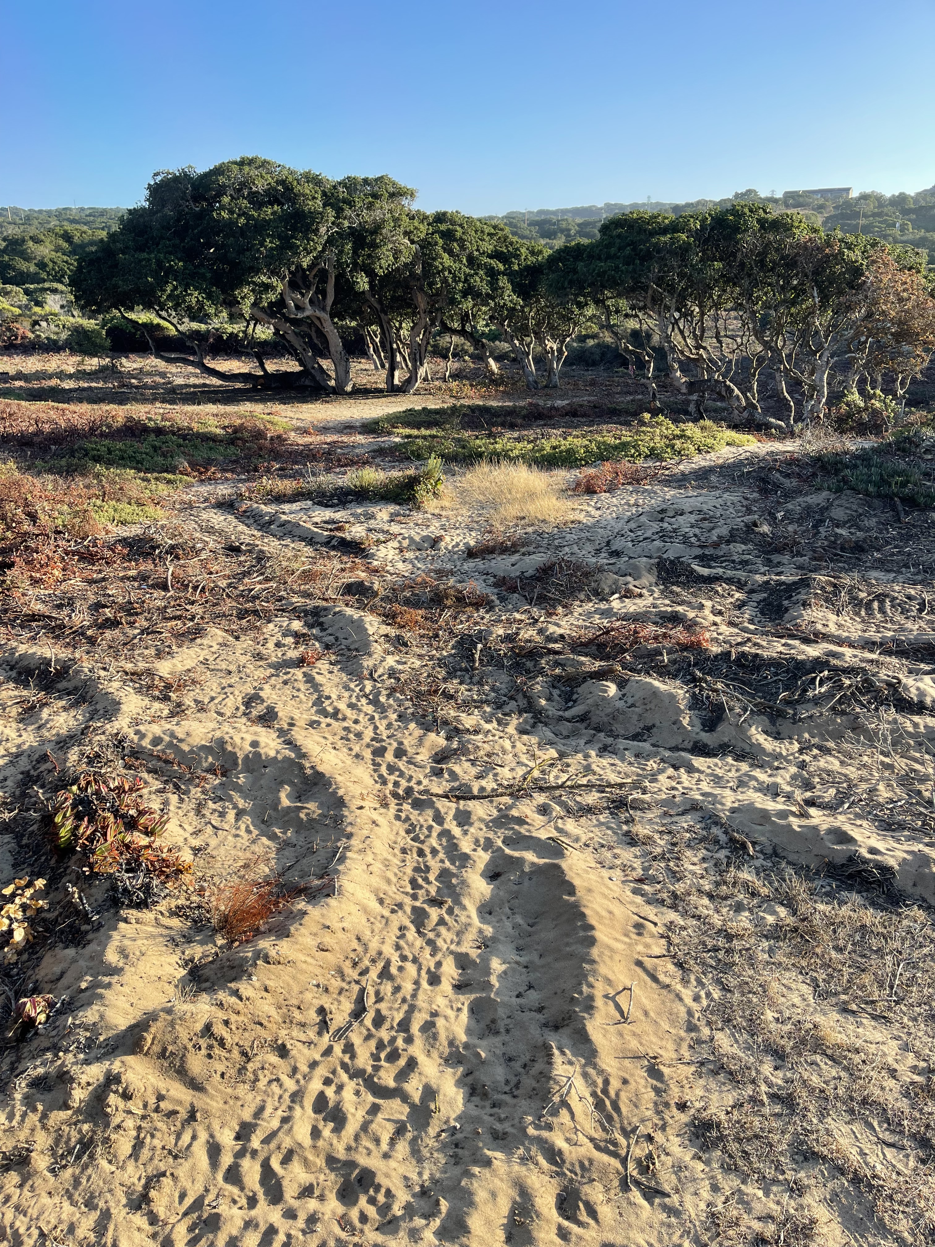
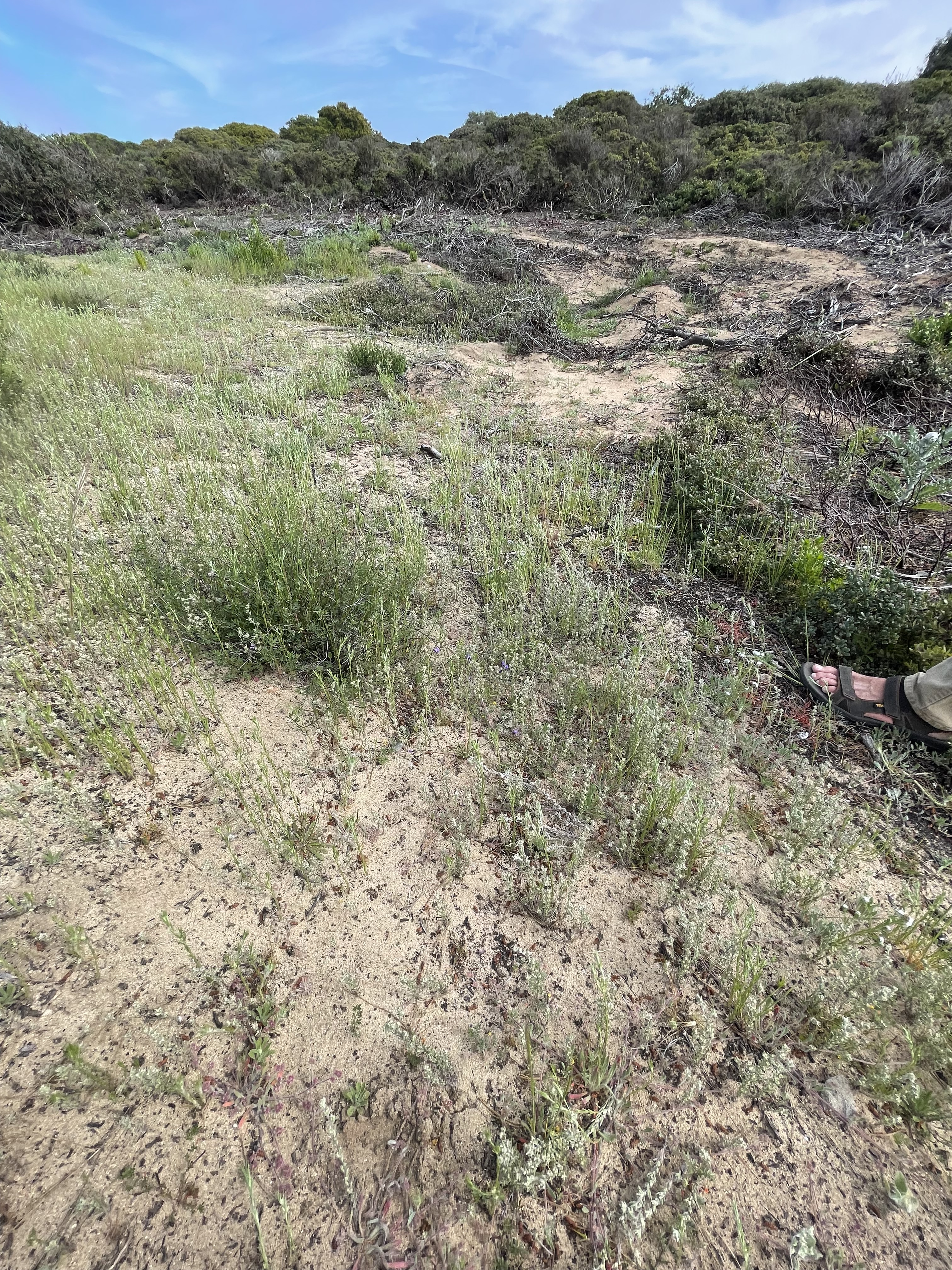
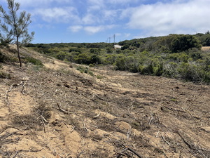
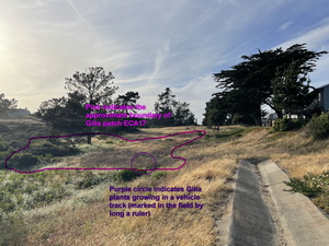
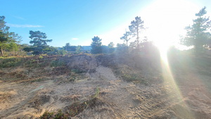
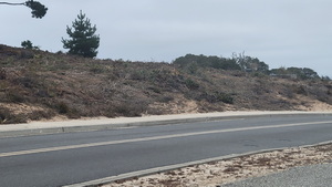
- Gilia Patch ECA17. Evidence of substantial vehicular impact to large portion of a large Gilia patch
7/27/23
A mowing vehicle was used to clear this area. All the cuts are ragged and shredded. Tracks persist 9 months later at 5-inches depth. The photo date is within a day or two of the clearing but there is no evidence of any clear flagging to avoid the gilia.
These photos show the area just to the right (east) of the above photo. The vehicle tracks are more clearly visible.
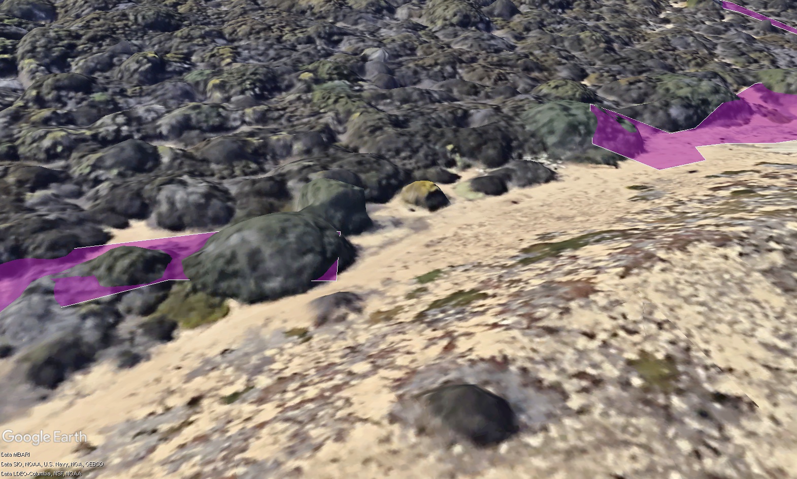
A Google Earth simulation of the same area from the same viewpoint. Purple indicates the previously known Gilia patch
(shapefile uploaded to Google Earth).
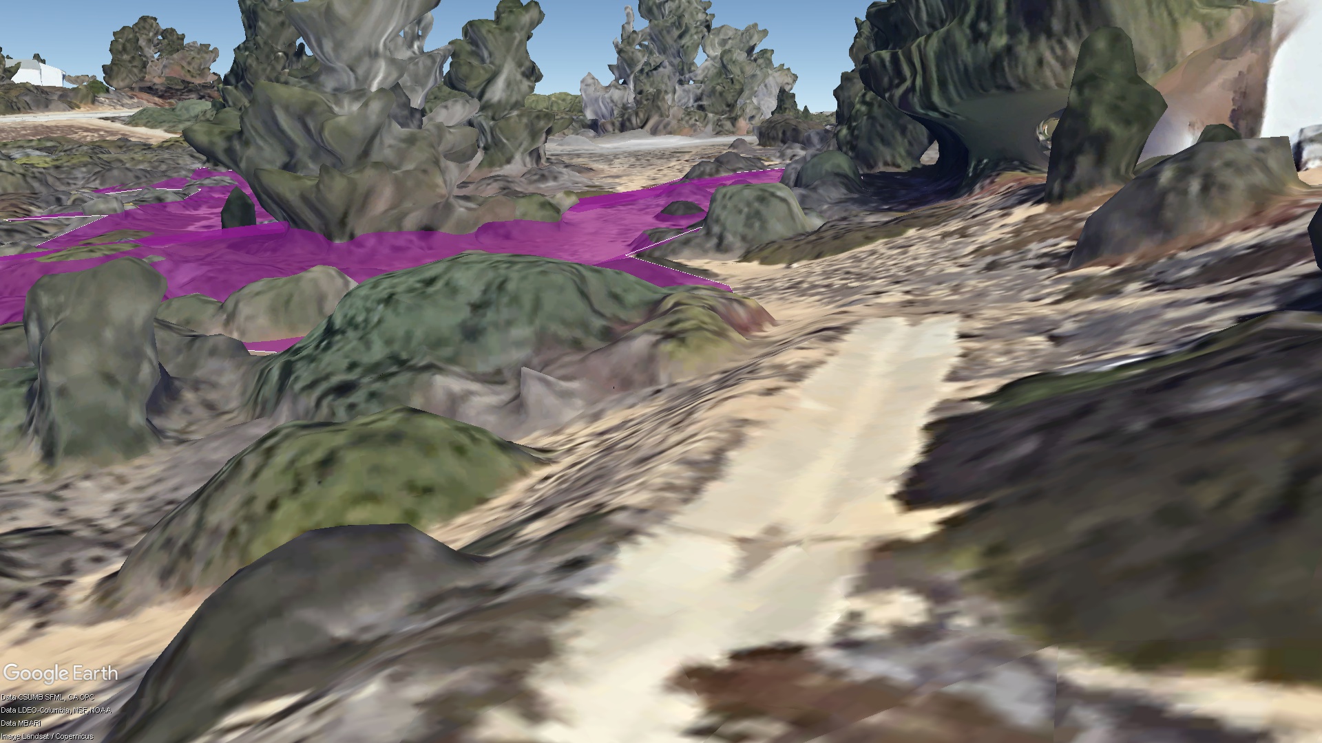
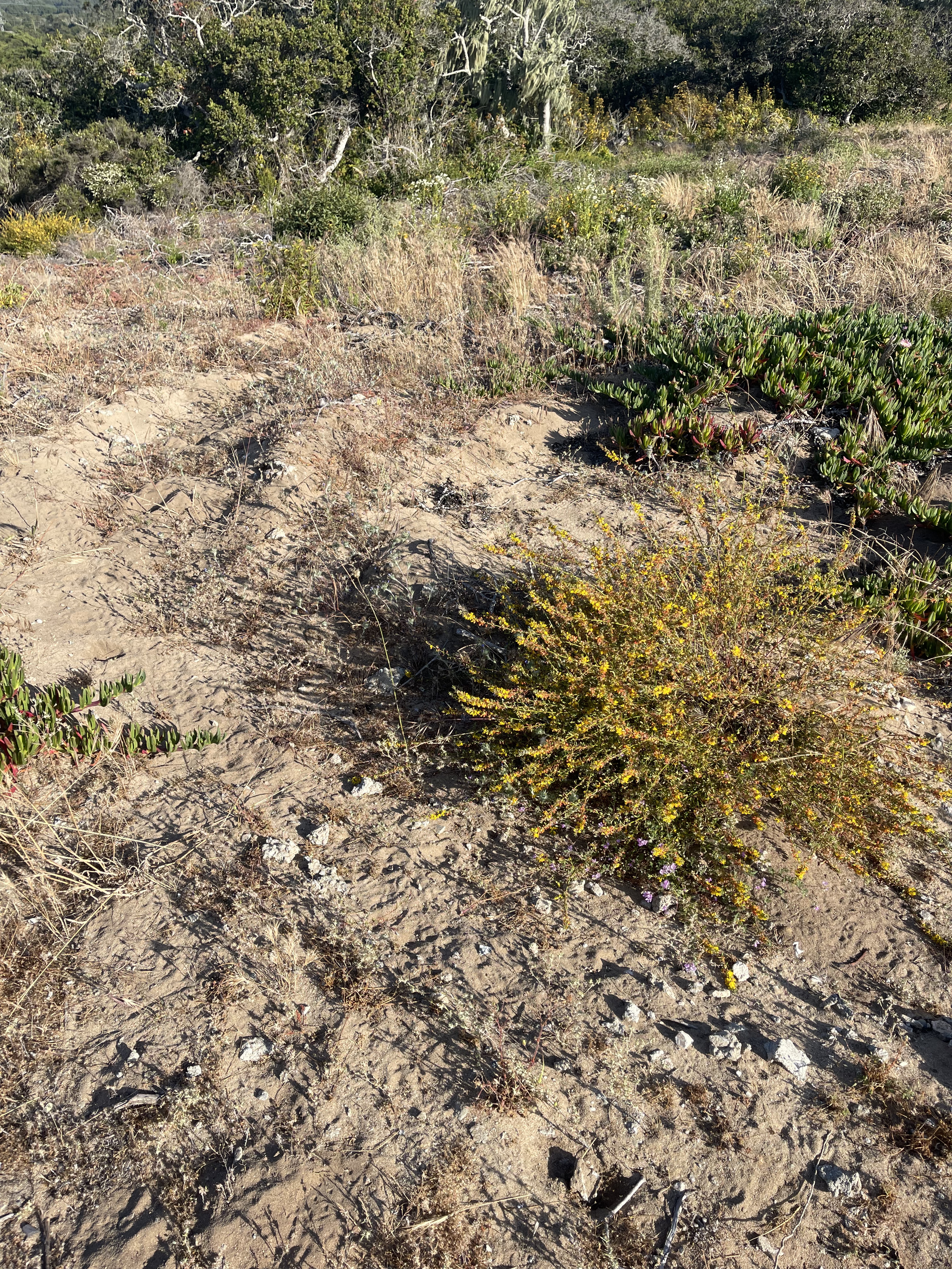
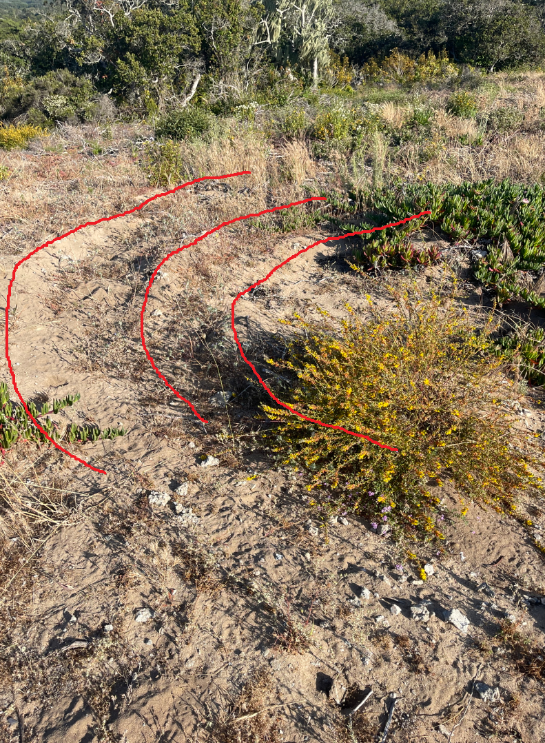
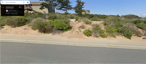
5/23/24
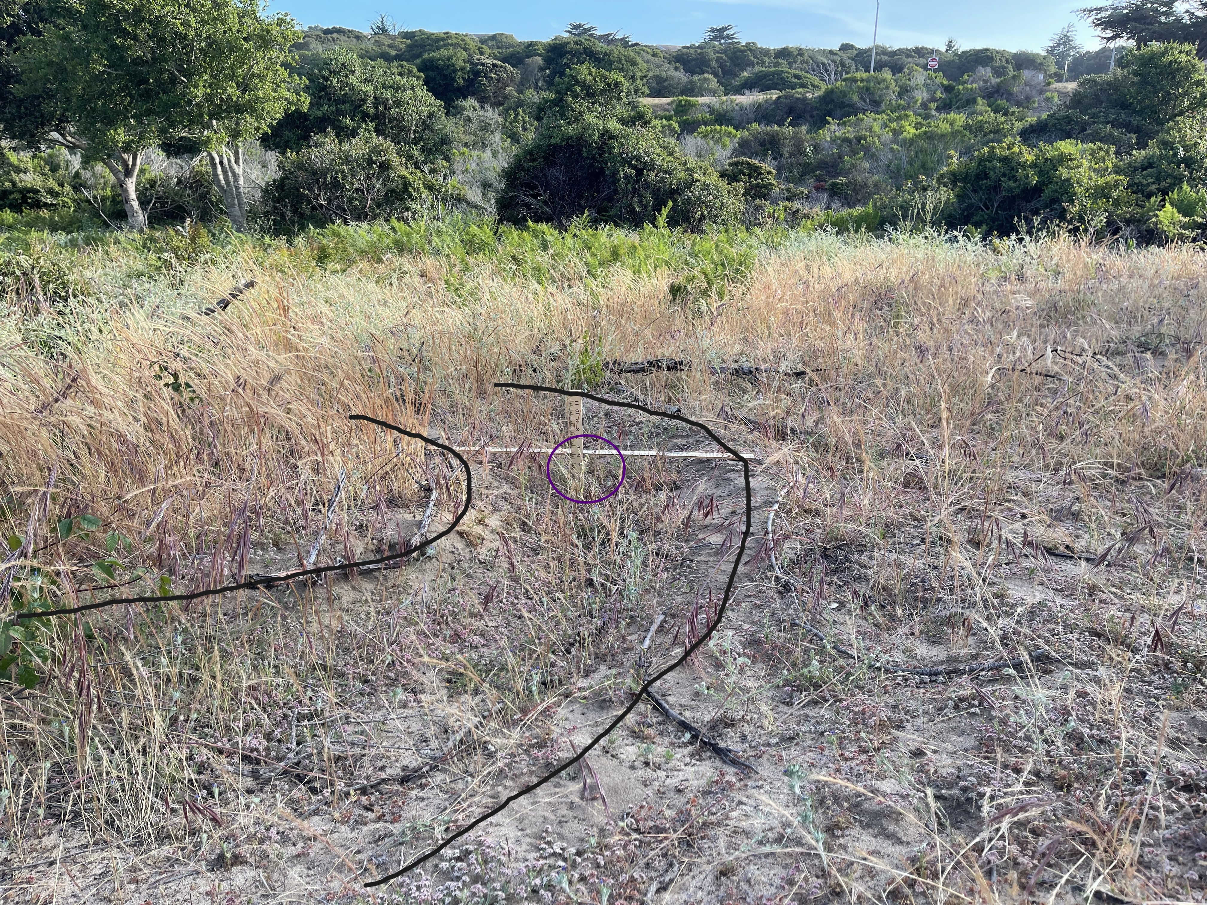
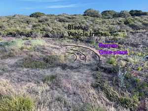
Same view as above showing where Gilia were photographed in a vehicle track, and how the site appears to have transitioned from open maritime chaparral to non-native grassland. CDFW officials visited this track on 5/22/24.
5/23/24
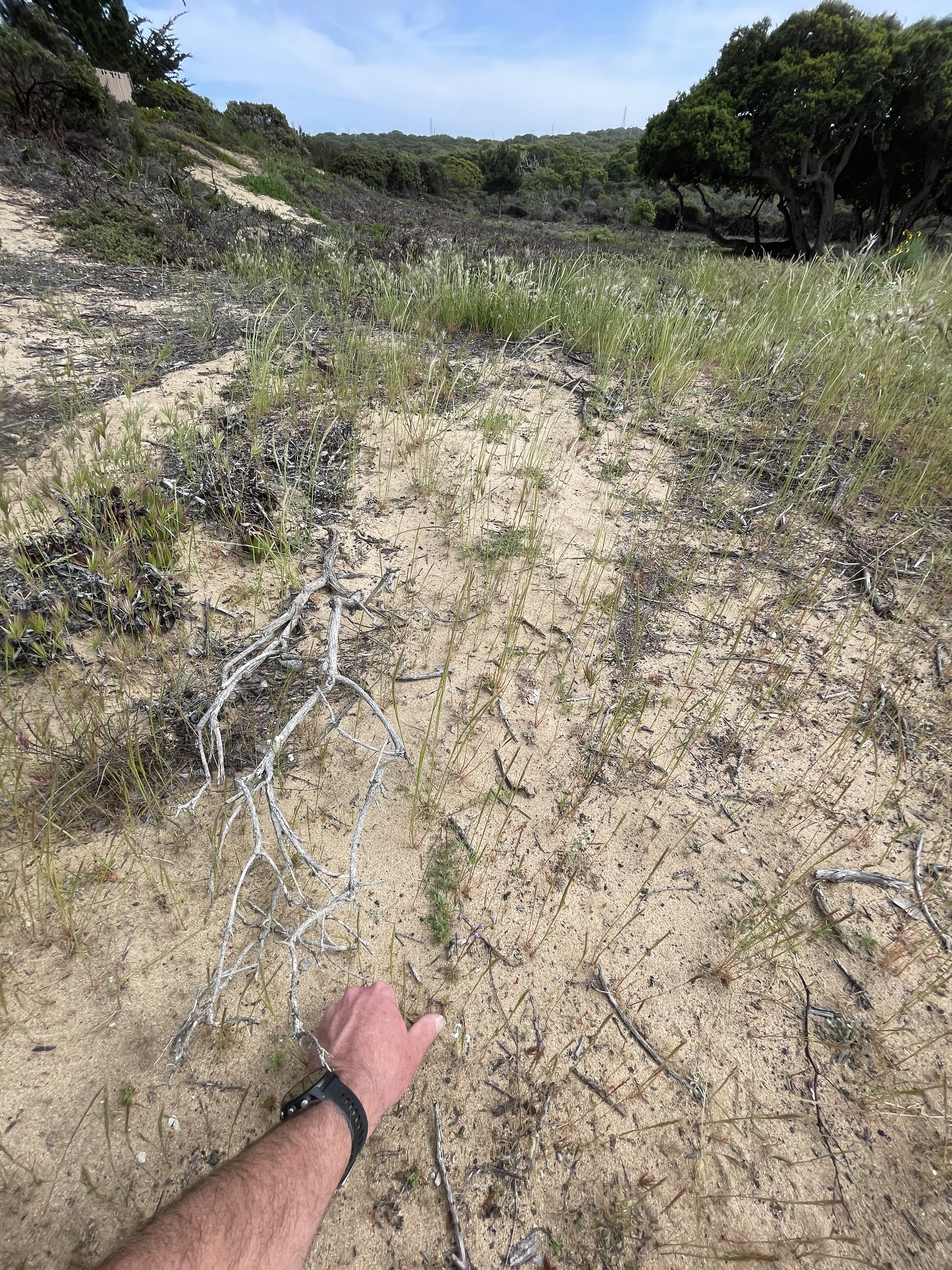
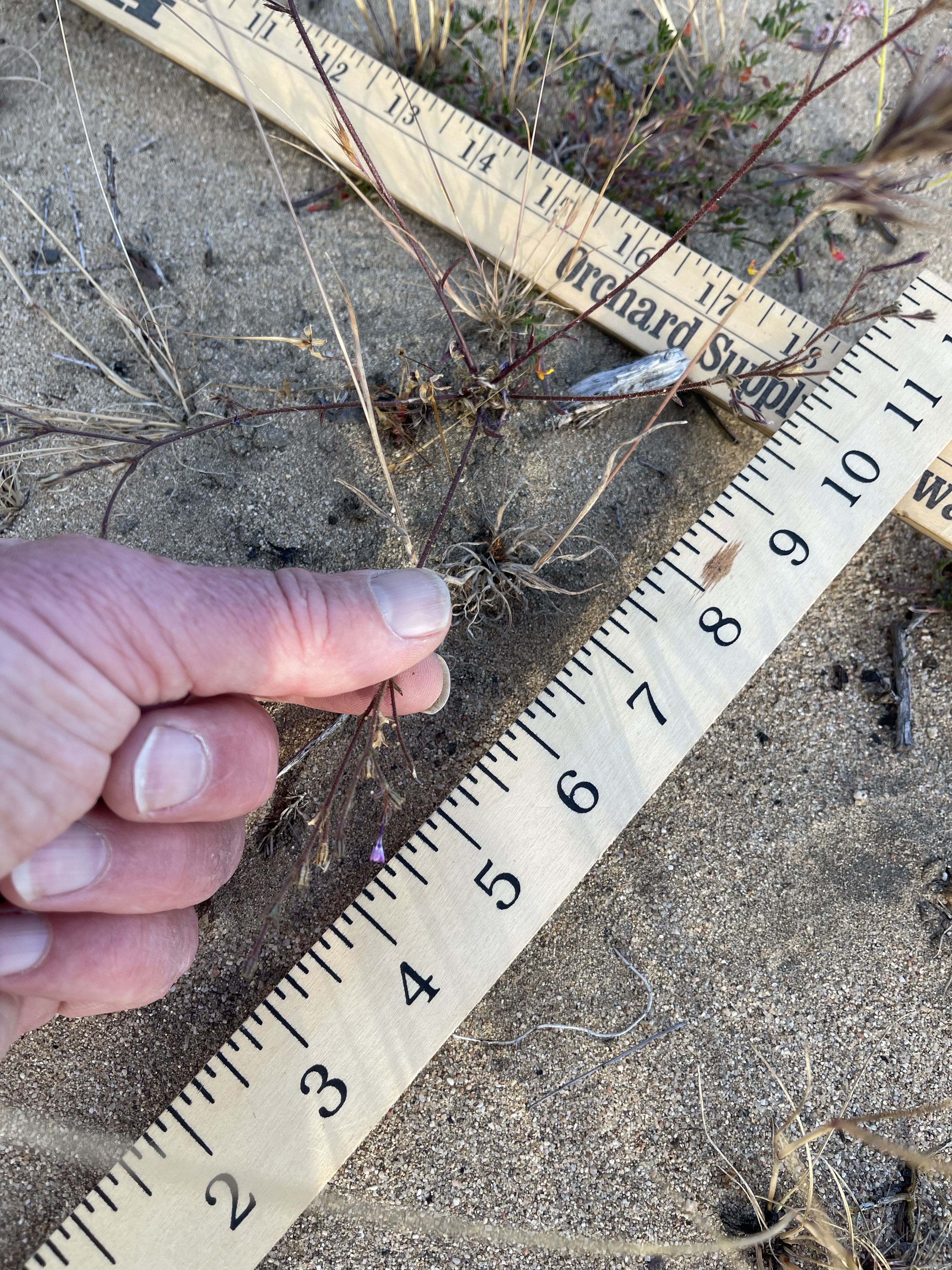
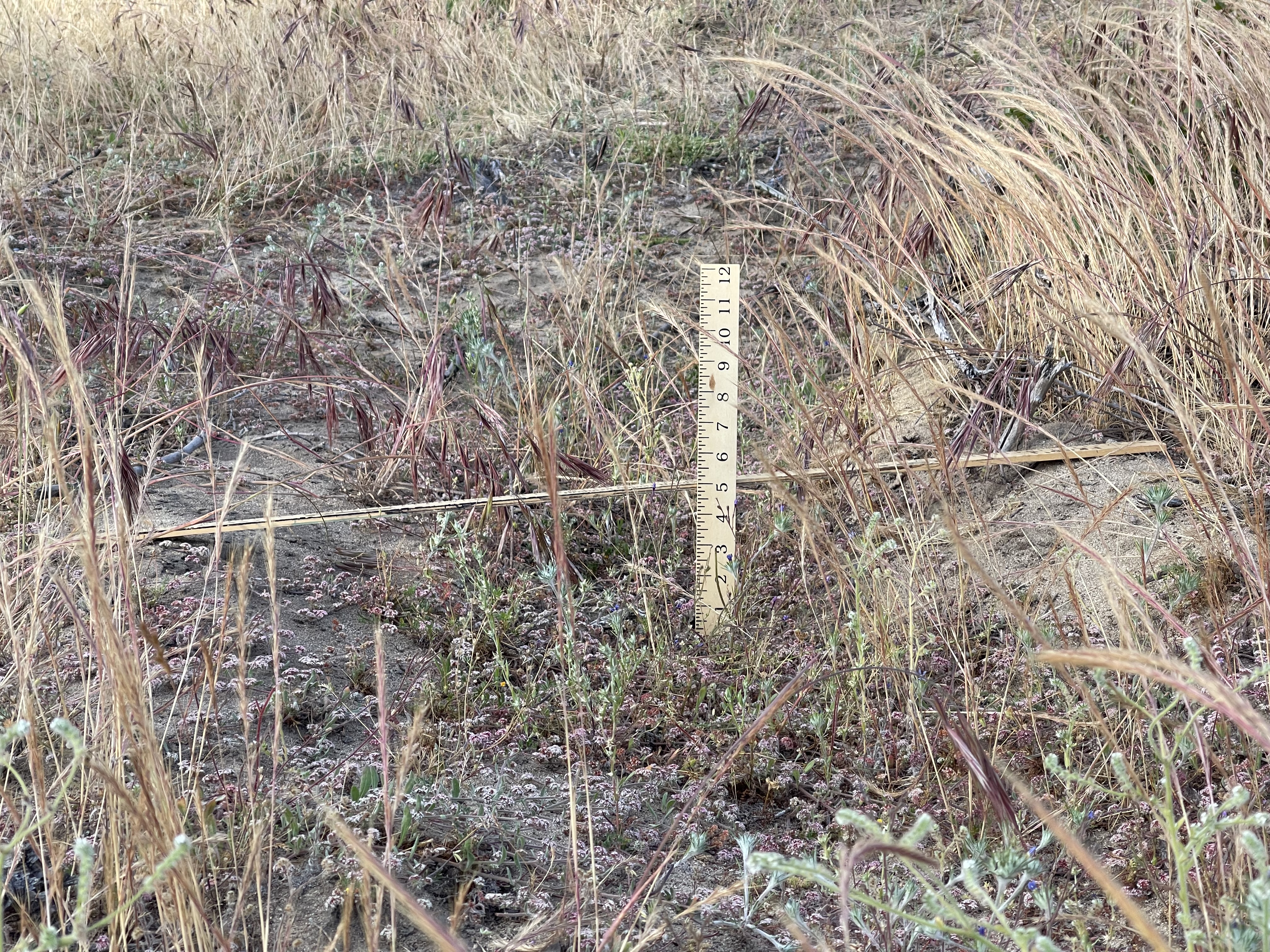
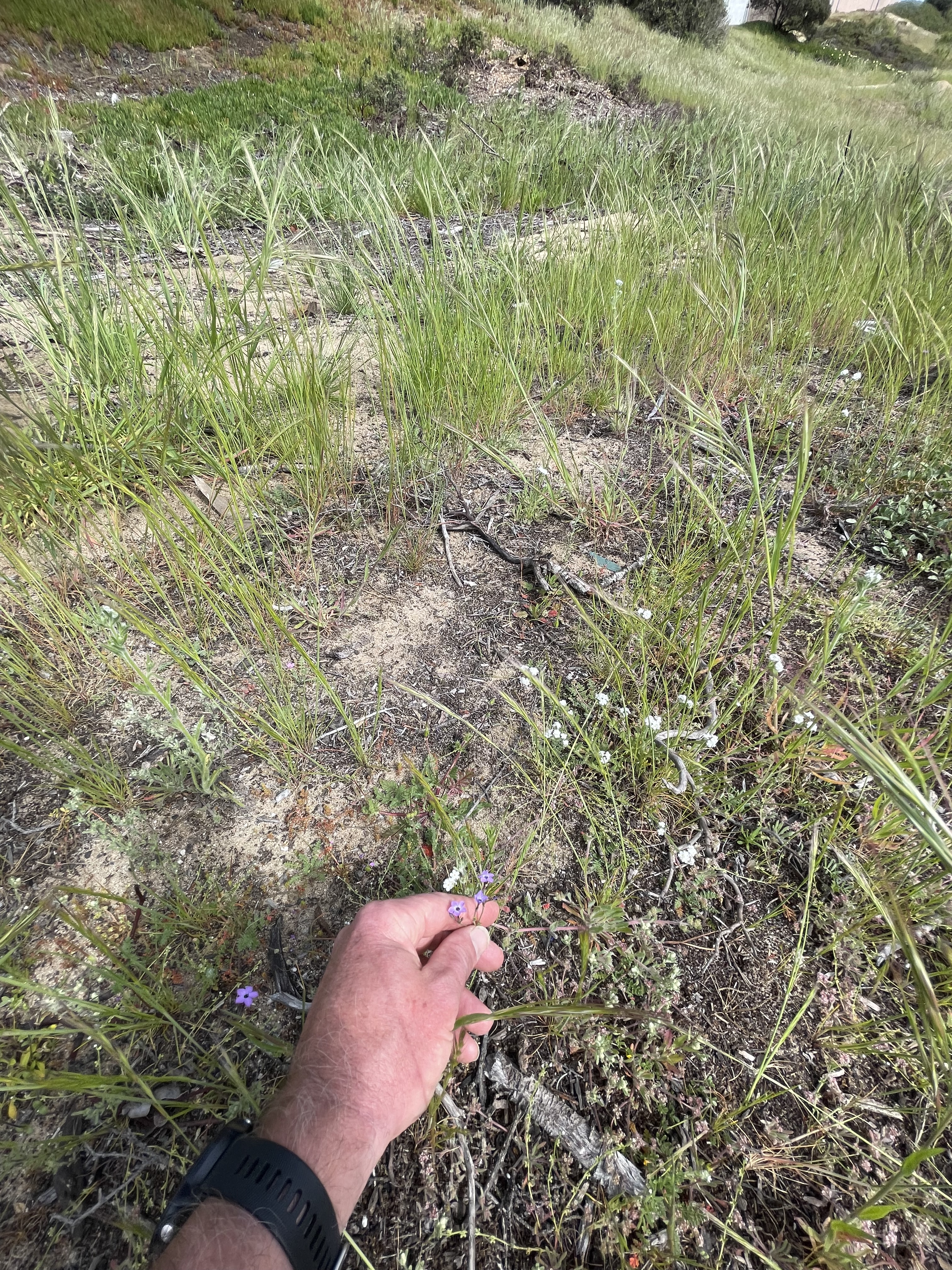
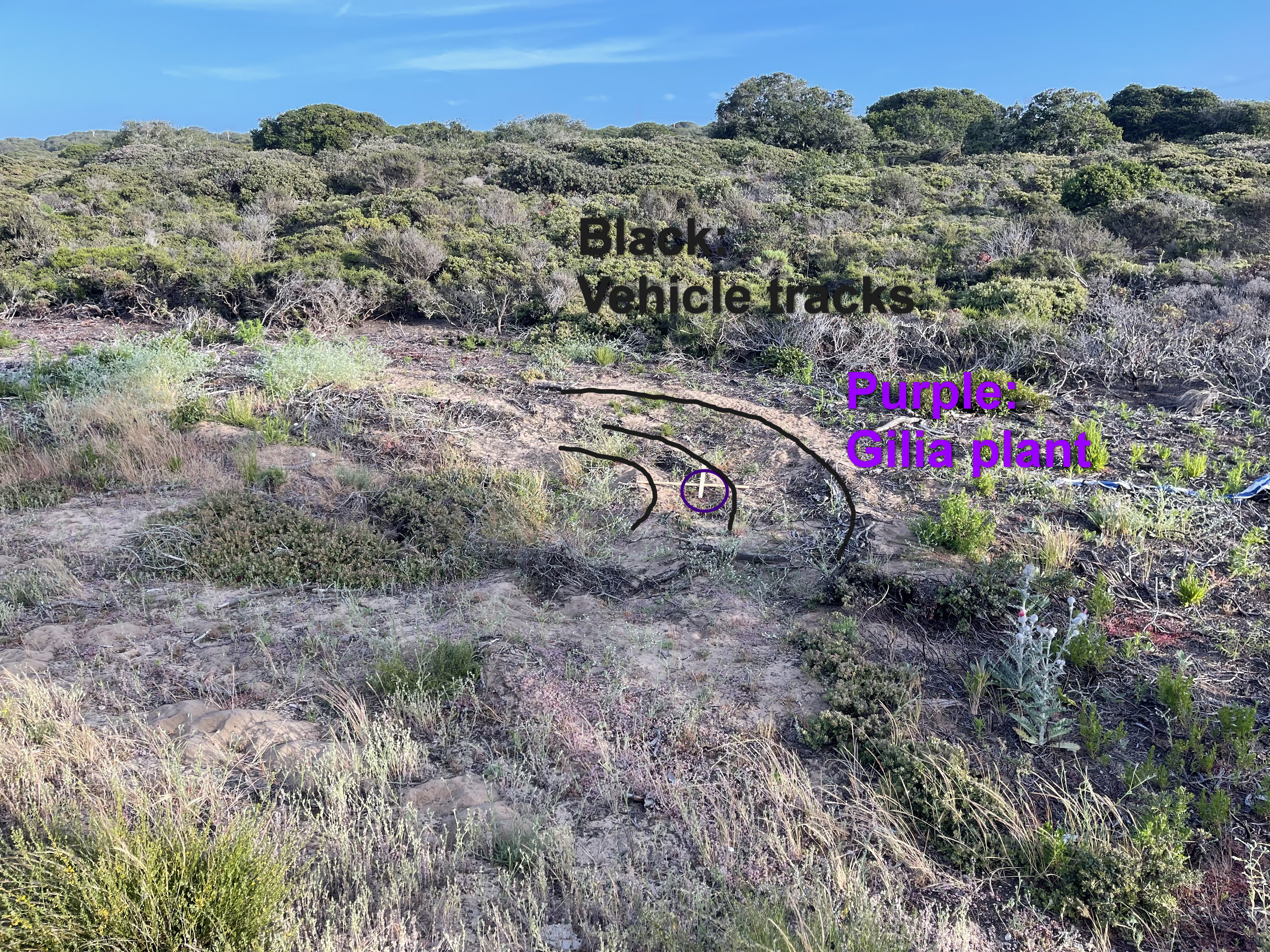
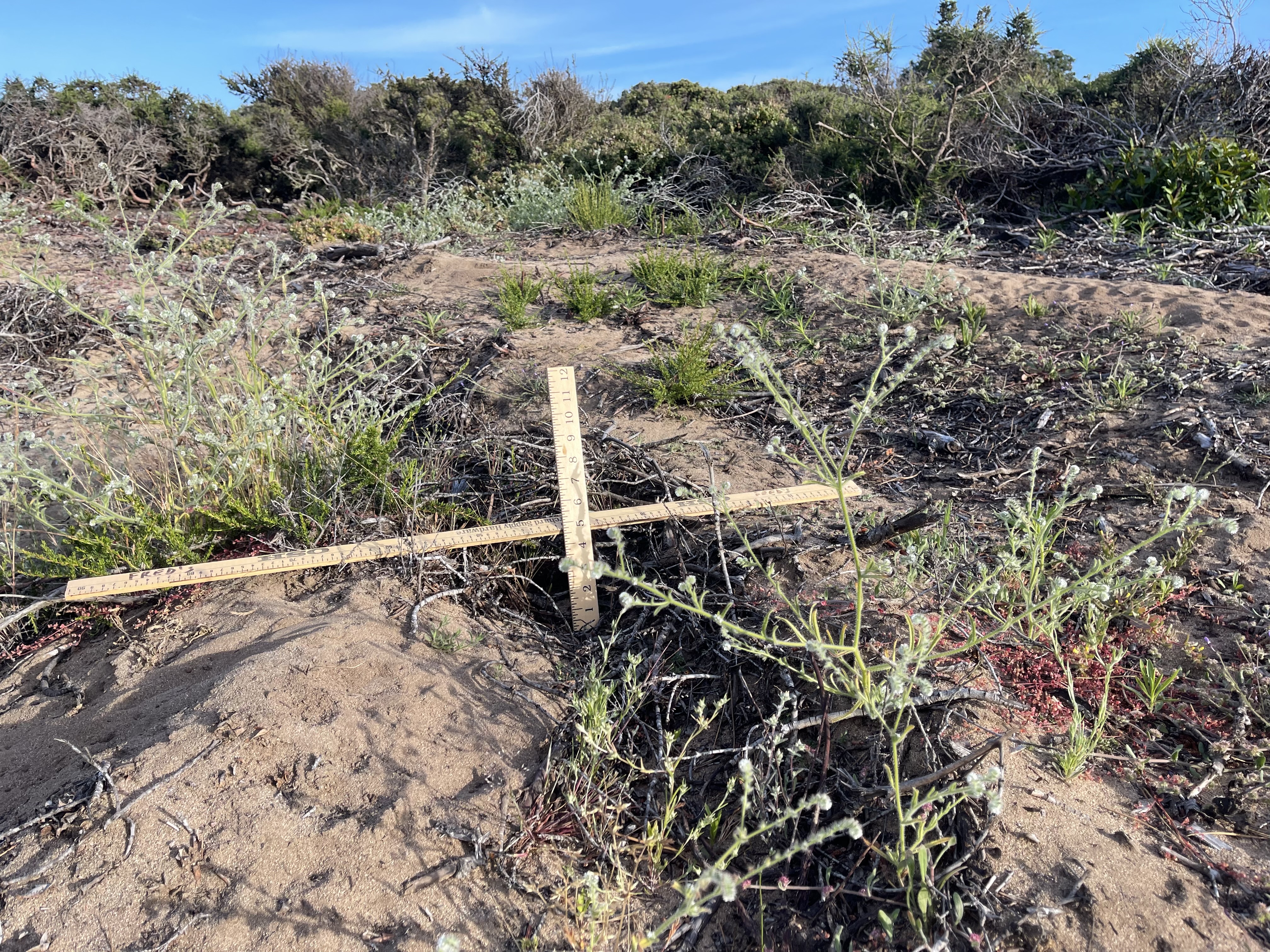
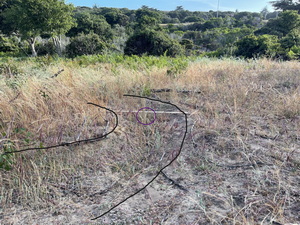
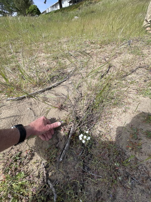
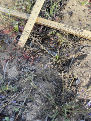
Close-up of Gilia growing in vehicle track.
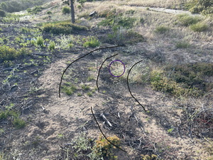
Close-up of the arc of the vehicle track.
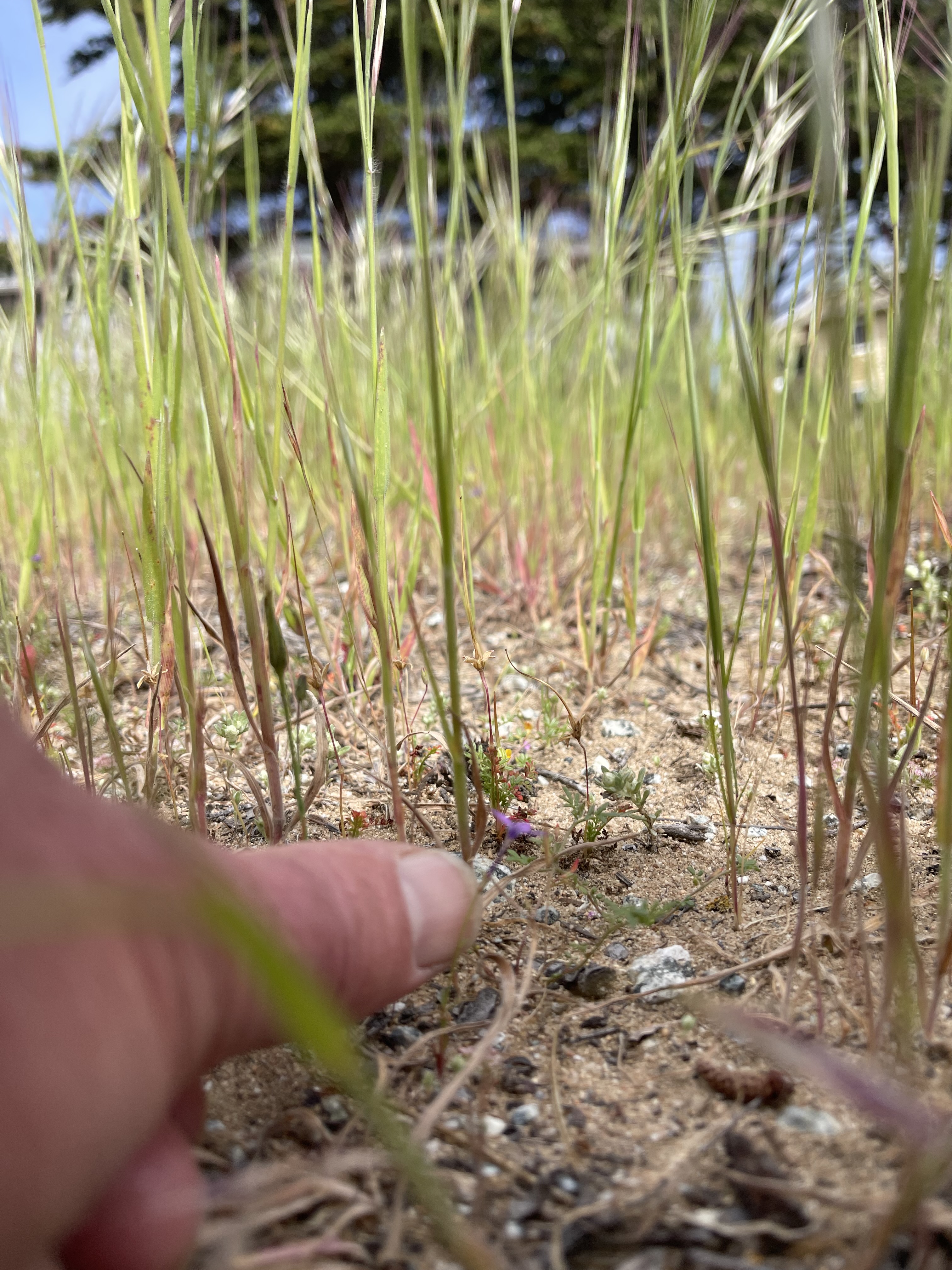
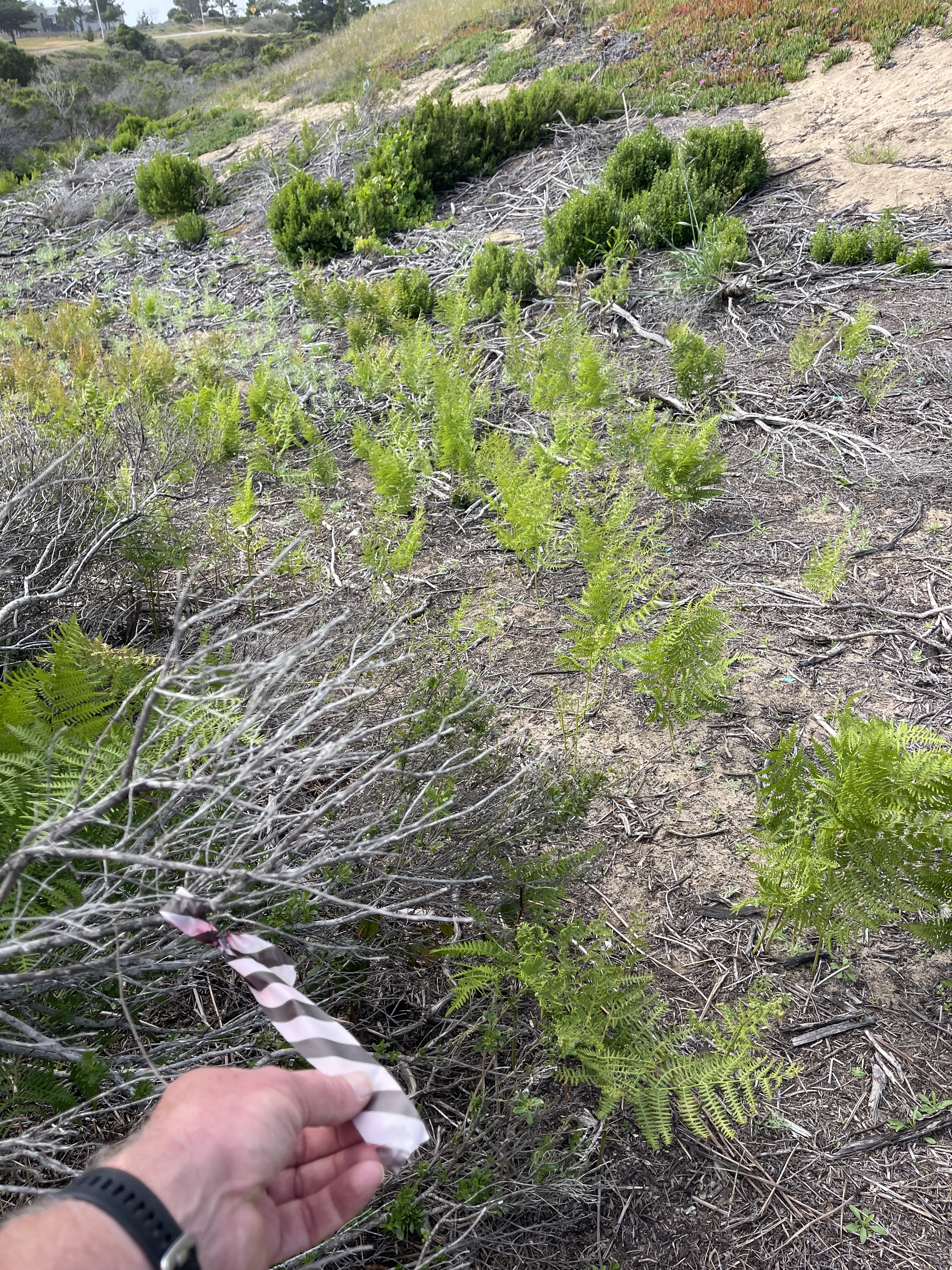
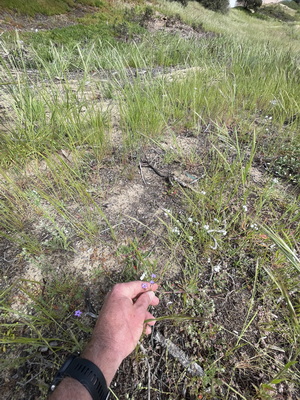
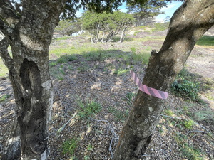
Monterey Gilia plant experiencing competition from non-native grasses at ECA17. 4/18/24
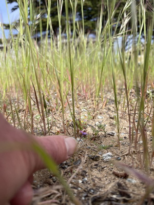
Monterey Gilia plant in an area that was formerly dominanted by native maritime chaparral plants (still visible as carcasses or re-sprouting root crowns), now experiencing competition from non-native grasses at ECA17. 4/18/24
Monterey Gilia plant in a track made by a vehicle used in fuel management at ECA17. The track is hard to discern in the midday light 9 months after the vehicle was there. CDFW officials visited this track on 5/22/24. I took a better photo on 5/23/24 (see above). 4/18/24.
Skid-steer tracks 50 ft north of ECA17
and 30 ft east of ECA55.
These are probably the tracks of the skid-steer chipper, given that wood chips are visible in the photo and piles of woodchips remain about 30 feet from this location.
(Photos: SB 7/27/23)
- Gilia patch ECA47. Vehicle tracks through a previously known Gilia patch. All shrubs mowed; none hand-cut.
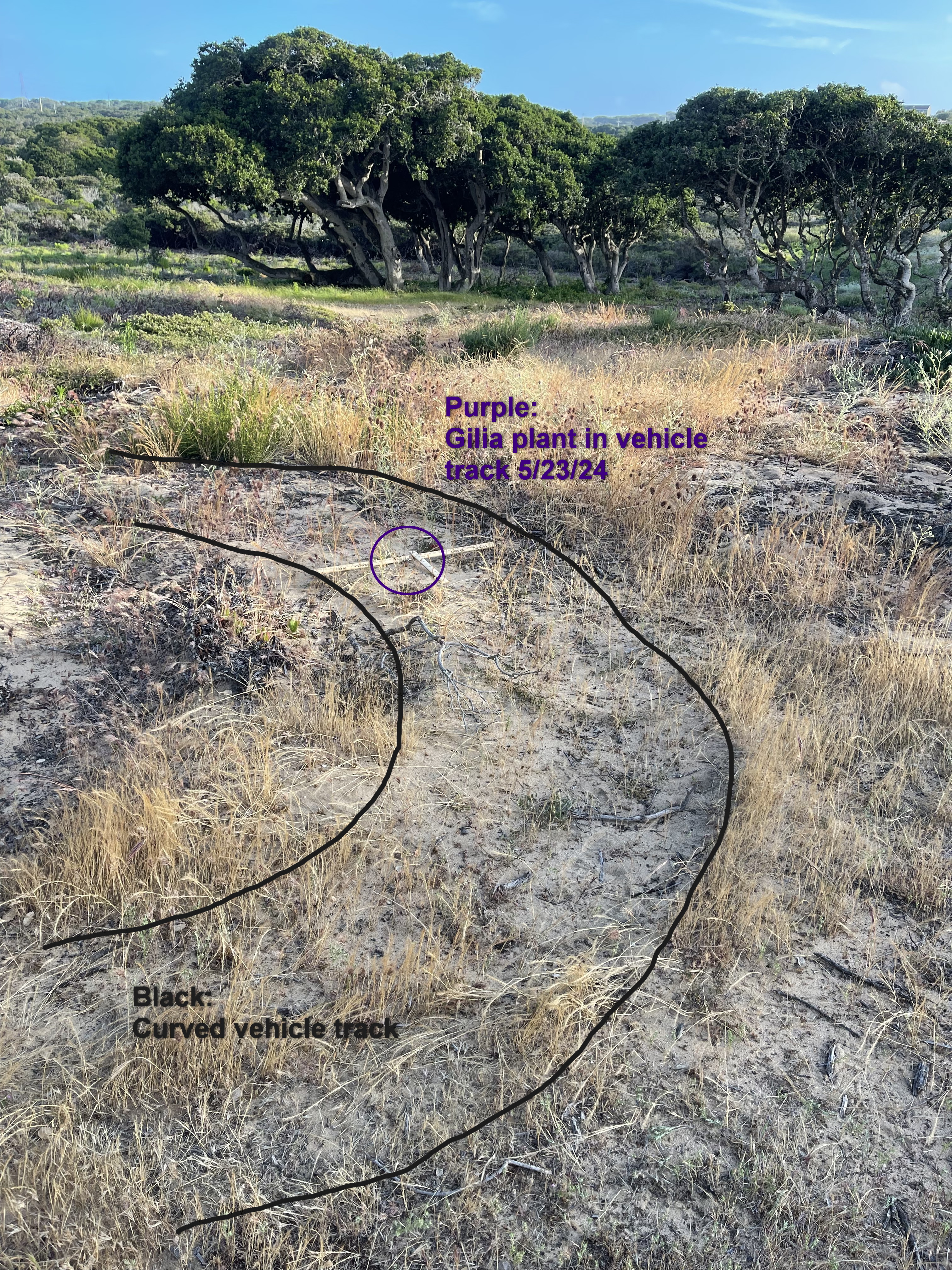
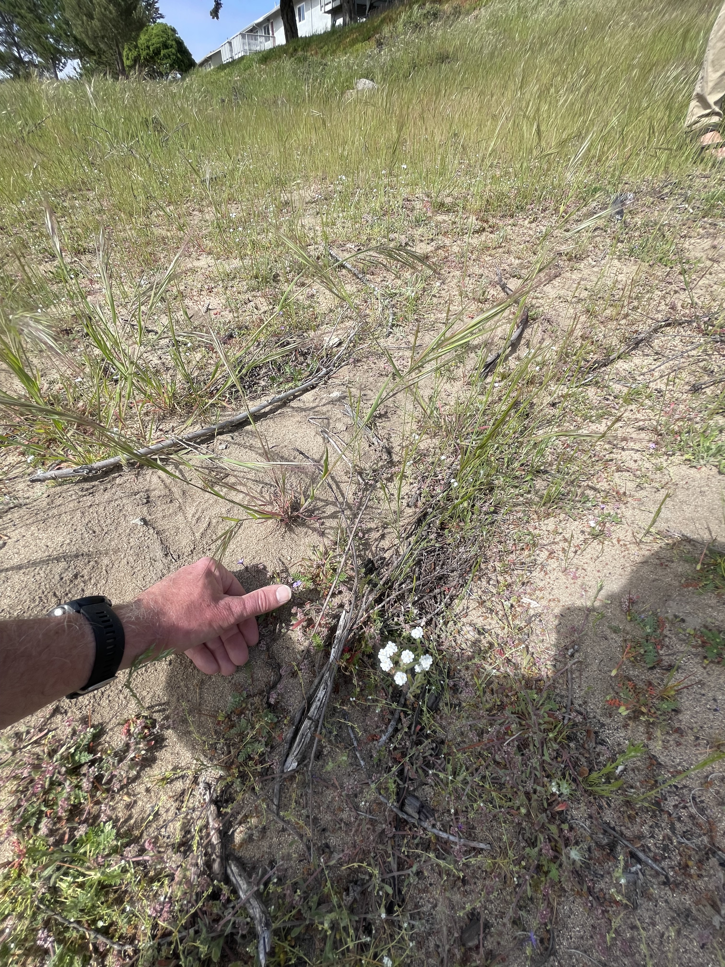
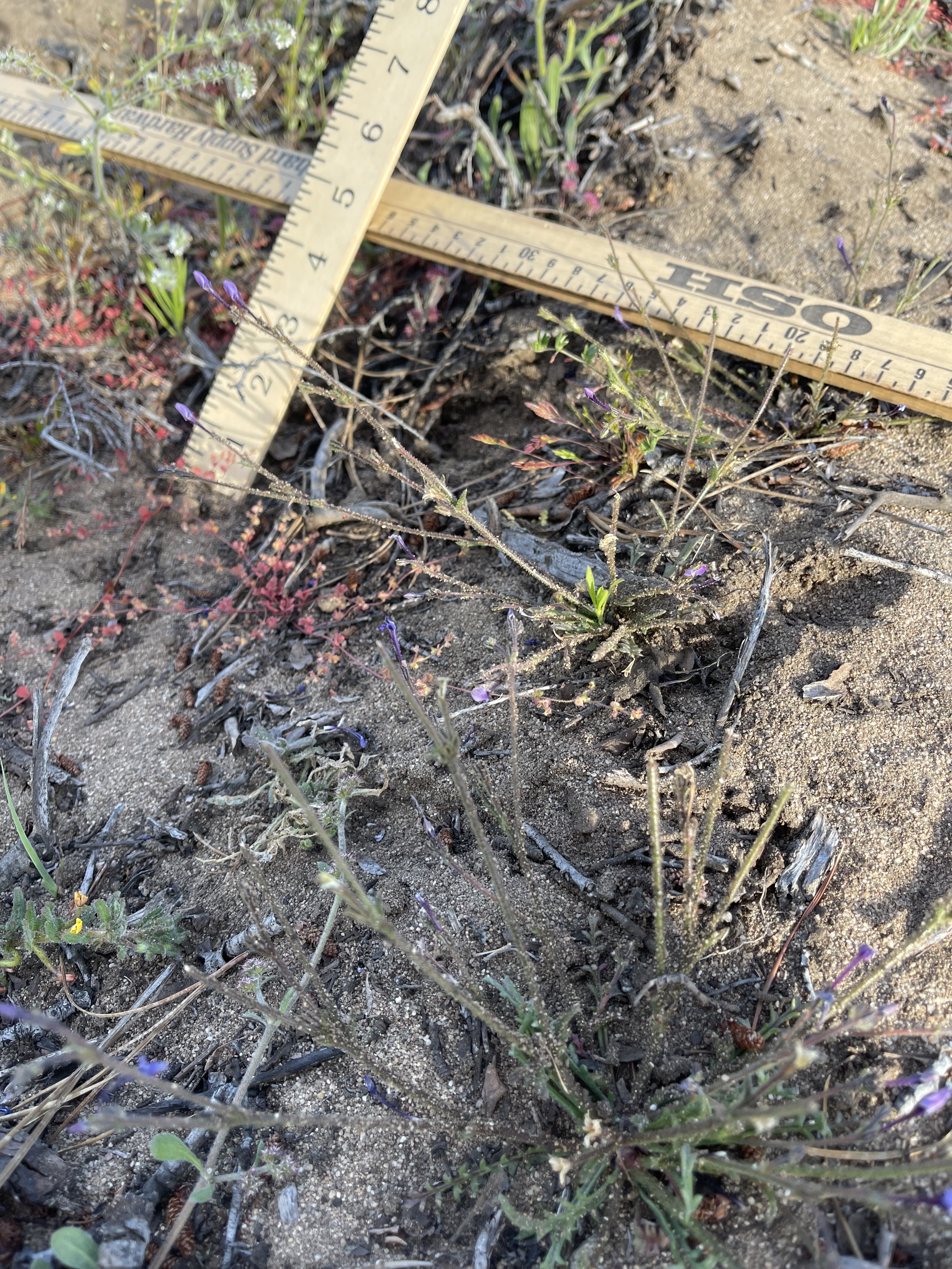
5/23/24 Gilia plant growing in vehicle tracks. Gilia patch ECA47. CDFW staff visited this location on 5/23/24.
Close-ups of the plant visible in the wide shot at left.

Reverse view of same area as above
Google Earth rendering of the same reverse view. Note pine tree for reference.
Monterey Gilia plants near tracks made by a vehicle used in fuel management at ECA47. The tracks are the large curved furrows in the background. CDFW officials visited this specific location on 5/22/24 and observed Gilia growing in the tracks themselves. In the photo, a Gilia plant can be seen in the foreground.
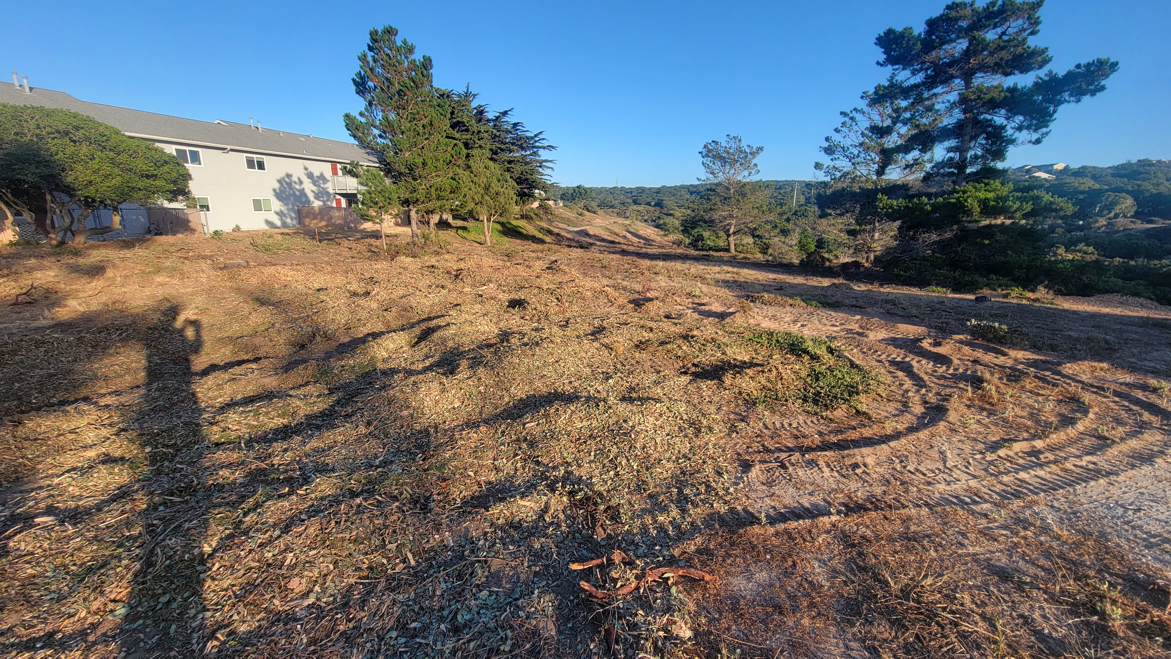
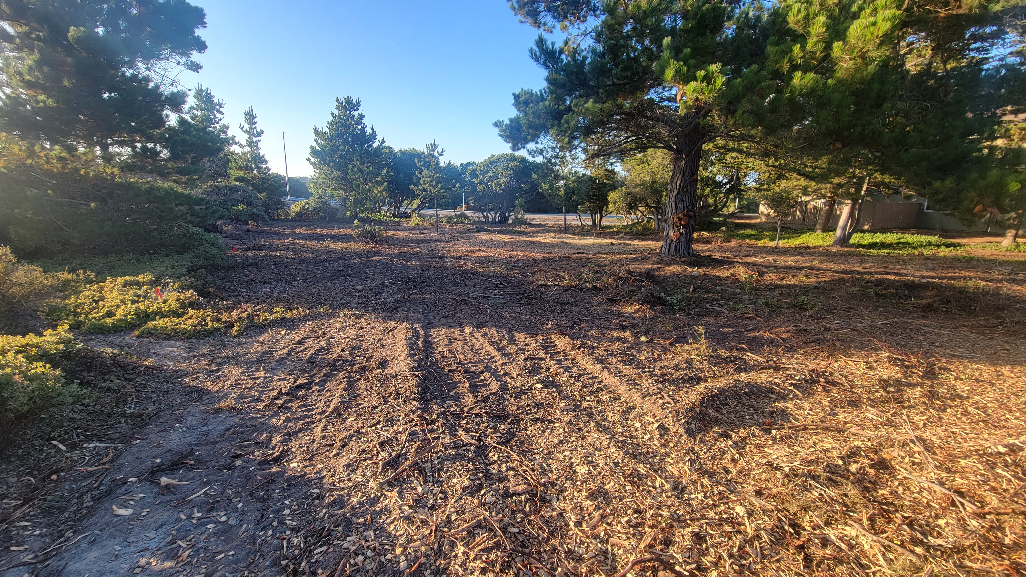
- Gilia patch ECA46.
Fuel clearing activty photographed 7/27/23.
ECA46 is on left, and ECA47 is on right.
Google Earth rendering of the same location. Previously known Gilia areas shown in pink. Images can be aligned by observing the large coffeeberry shrubs that remained after clearing.
- Gilia Patch ECA34
Deep circular vehicle ruts through previously known Gilia patch. Ruts have same general dimensions as those documented at ECA17 and ECA47.


- Gilia patch ECA64
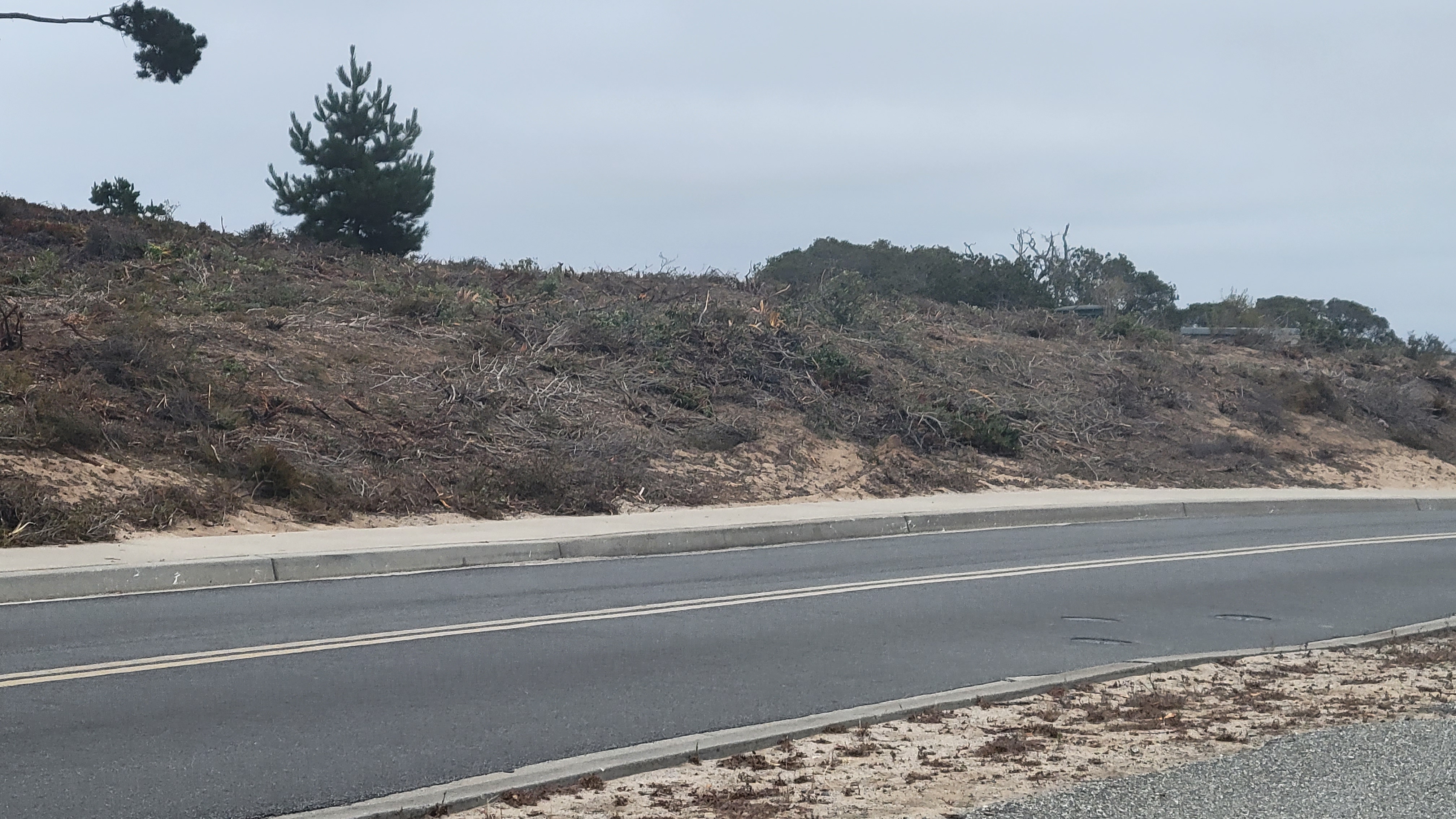
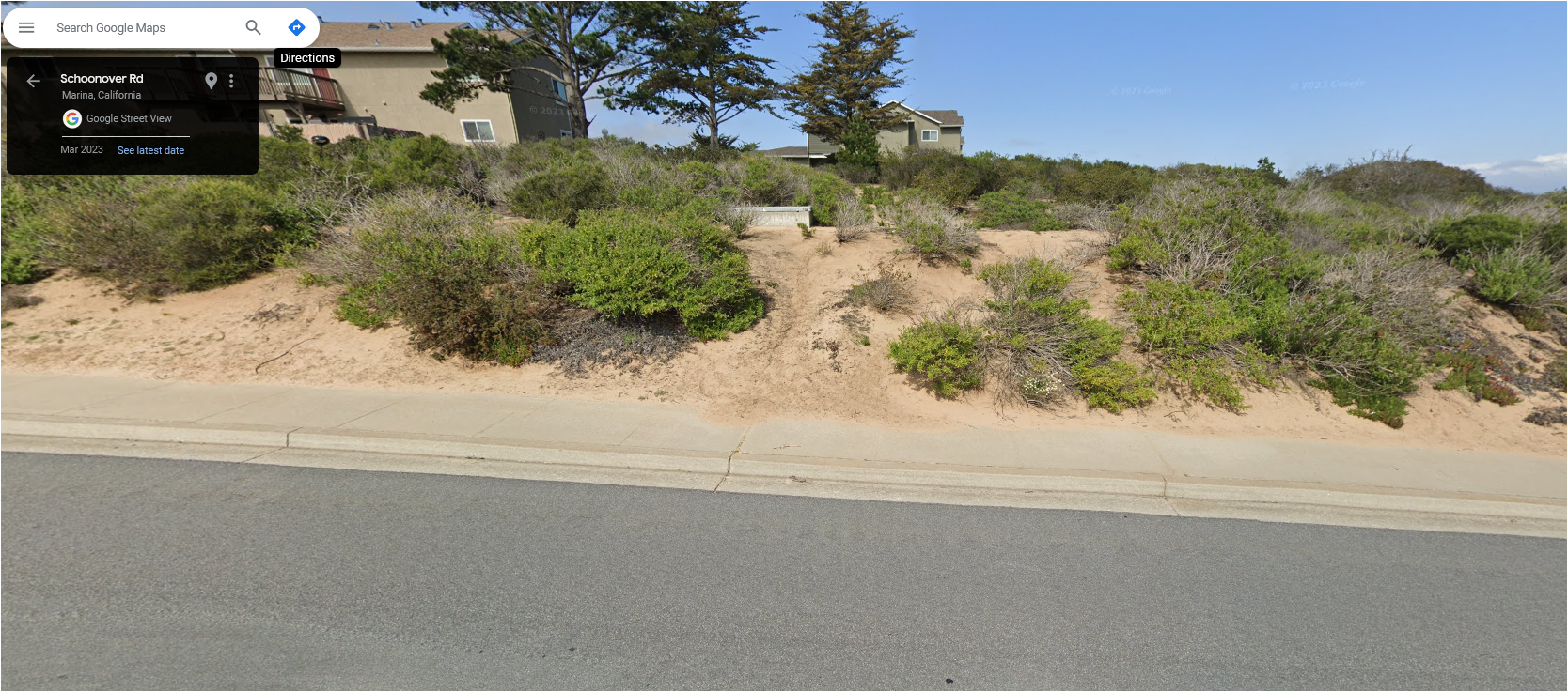
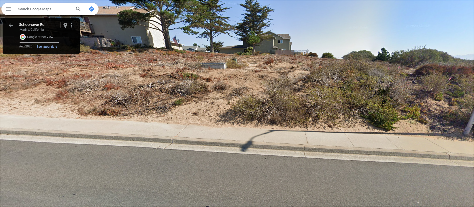
Previously known Gilia location immediately to right of the gray utility box on the far side of the road. Heavy soil disturbance. 8/28/23.
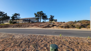
Photo: SB 8/28/23
Deep vehicle ruts in same location (gray utility boxes visible in right background)
Google StreetView before/after March/August 2023 (credit SB)

- Gilia patch ECA49
Mowed like the other patches. Photos not posted yet.
- Jagged cuts indicative of mowers not hand-clipping
The cuts to shrubs in these areas are all jagged and shredded, consistent with a mower. I have detailed photos of this in the focal parts of ECA18 and ECA47. I'm fairly sure I haven't seen any cuts indicative of hand clipping.
- Flagging
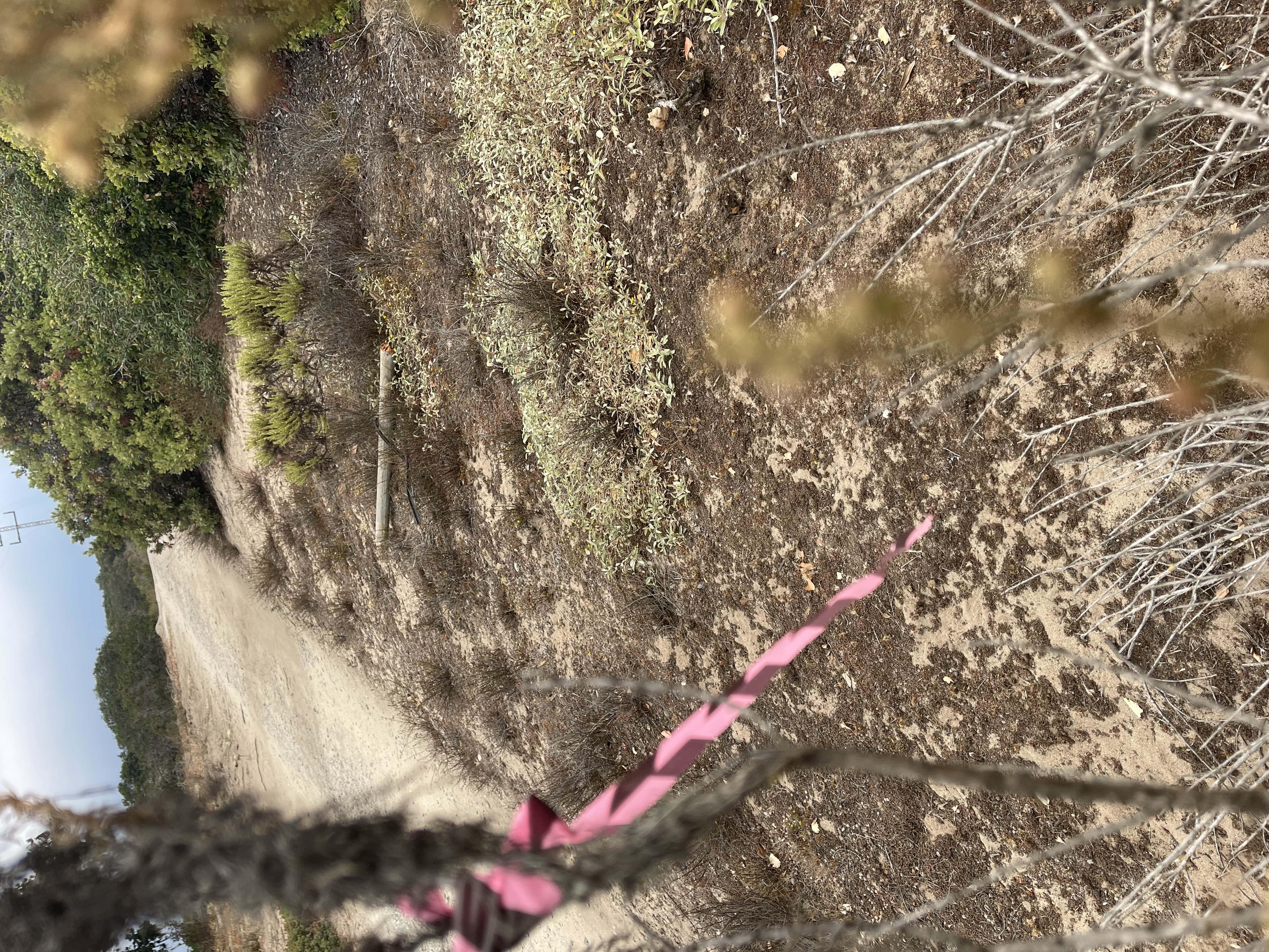
As far as I've been able to determine, Gilia patches were delineated by pink and black flagging tied to nearby trees and shrubs. If this was all there was, it was not sufficiently clear or precise.
In one case in early 2024 I observed a worker standing in the center of a small Gilia patch (ECA24) clearing adjacent brush. Pink and black flagging was hanging from nearby trees. I told him about the patch and asked him to step off it. He indicated he was aware of the ping flags nearby, but not that he was actually standing on the patch. He moved off the patch and continued his work.
Here's some examples of flags tied to trees and shrubs near Gilia patches .
Gilia patch ECA18 occupies most of the area behind this flag. 4/25/24.
Gilia patch ECA04 is below this flag
Gilia patch ECA47 is next to this flag

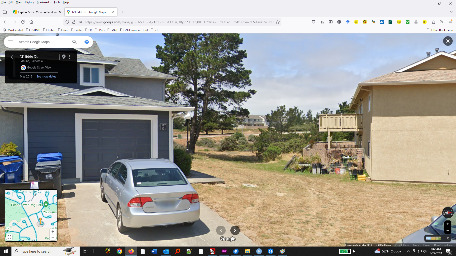
- Google Street View showing the area in 2019
- From Eddie Ct
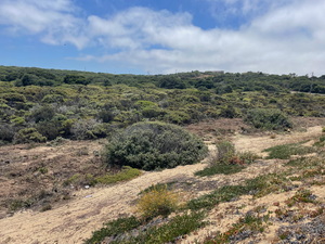
Shows the martime chaparral in and near ECA17 (visible behind the buildings). Much of this chaparral was cut as part of the fuel management work.
1 2 3 4 2019 
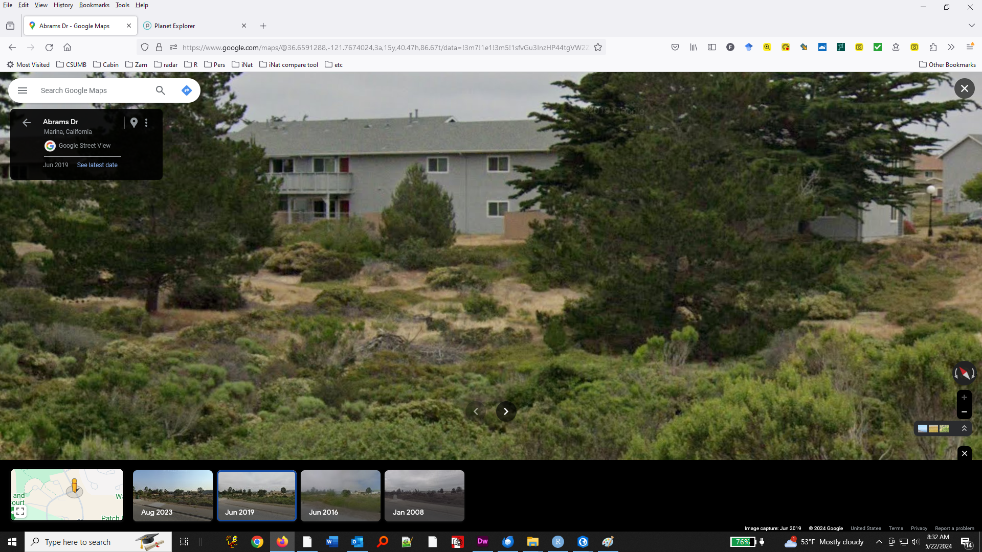
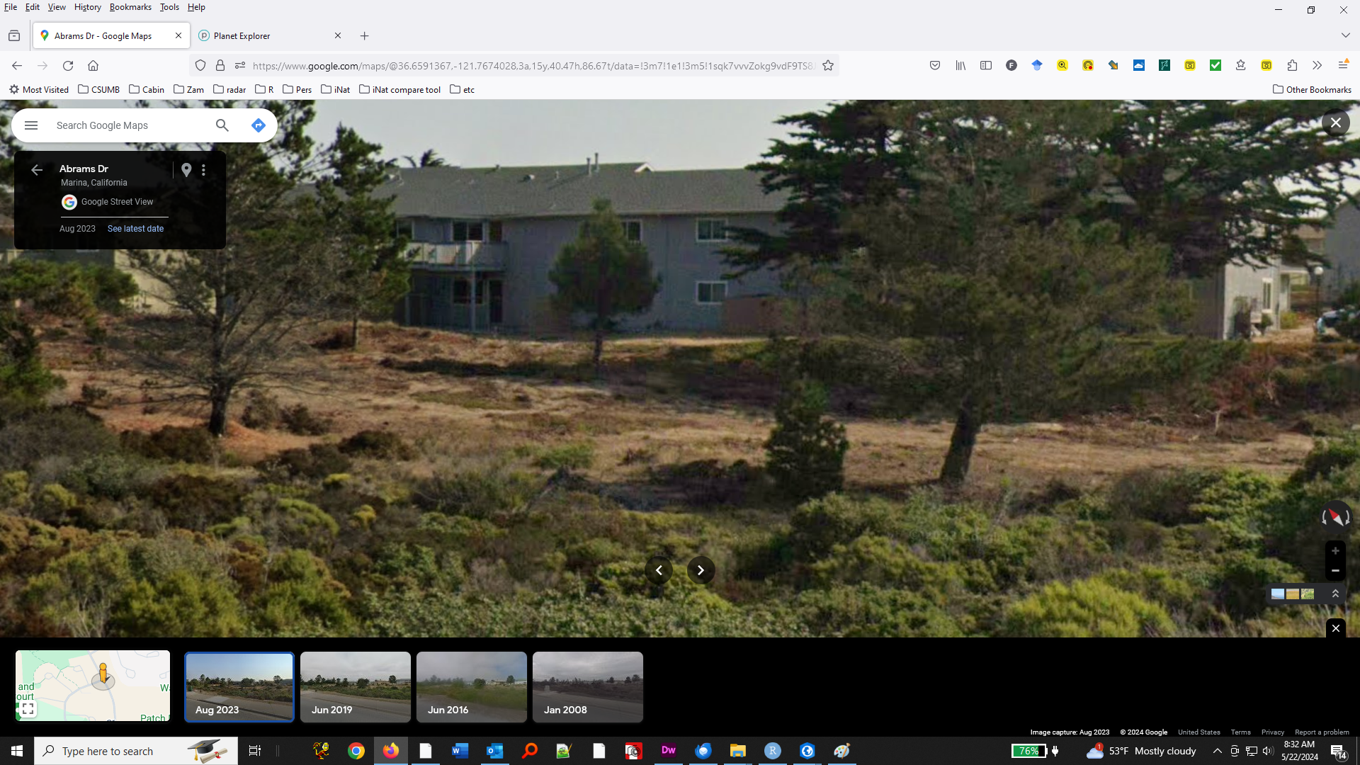
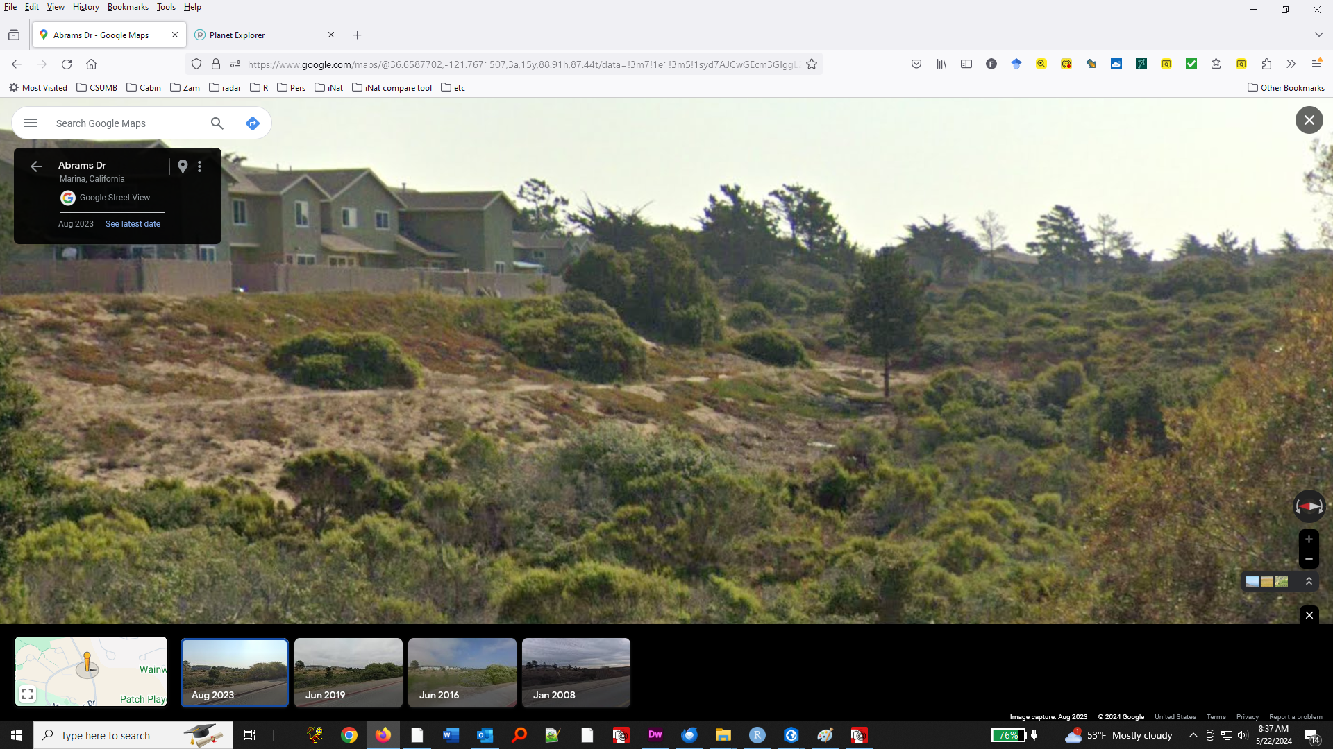
- From Abrams Drive
Patches ECA17 (left) and ECA47 (right) can be seen in these before-after views. As planned, a suite of maritime chaparral shrub species were cut down to a few inches above ground level. Trees were limbed up.
These photos serve to illustrate how the dense non-native grasses now at ECA17 were not the dominant vegetation before the fuel management.
5 6 7 2019 
2023 
- From Eddie Ct
- Where did things wrong? What lessons can be learned?
I have two theories:
- The first theory says that there was that all parties understood where the Gilia was, that the biological monitor was aware of the Gilia locations and had the correct data at hand, but there were problems in the development and implementation of the protocol:
- Not involving CDFW when there was potential for take
(even though the intent was to avoid take)
- Not being specific enough in prescriptions of allowable activities and how to mark Gilia areas.
- Insufficient implemention of on-site biological monitoring. Powered-wheel mowers should have been recognized as a clear inconsistency with the intended protocol.
- As far as I can tell from the reporting I've seen, insufficient documentation of clearing activities and how Gilia areas were flagged.
- Not involving CDFW when there was potential for take
- A second theory says that there was some kind of confusion in the use of the the planning documents.
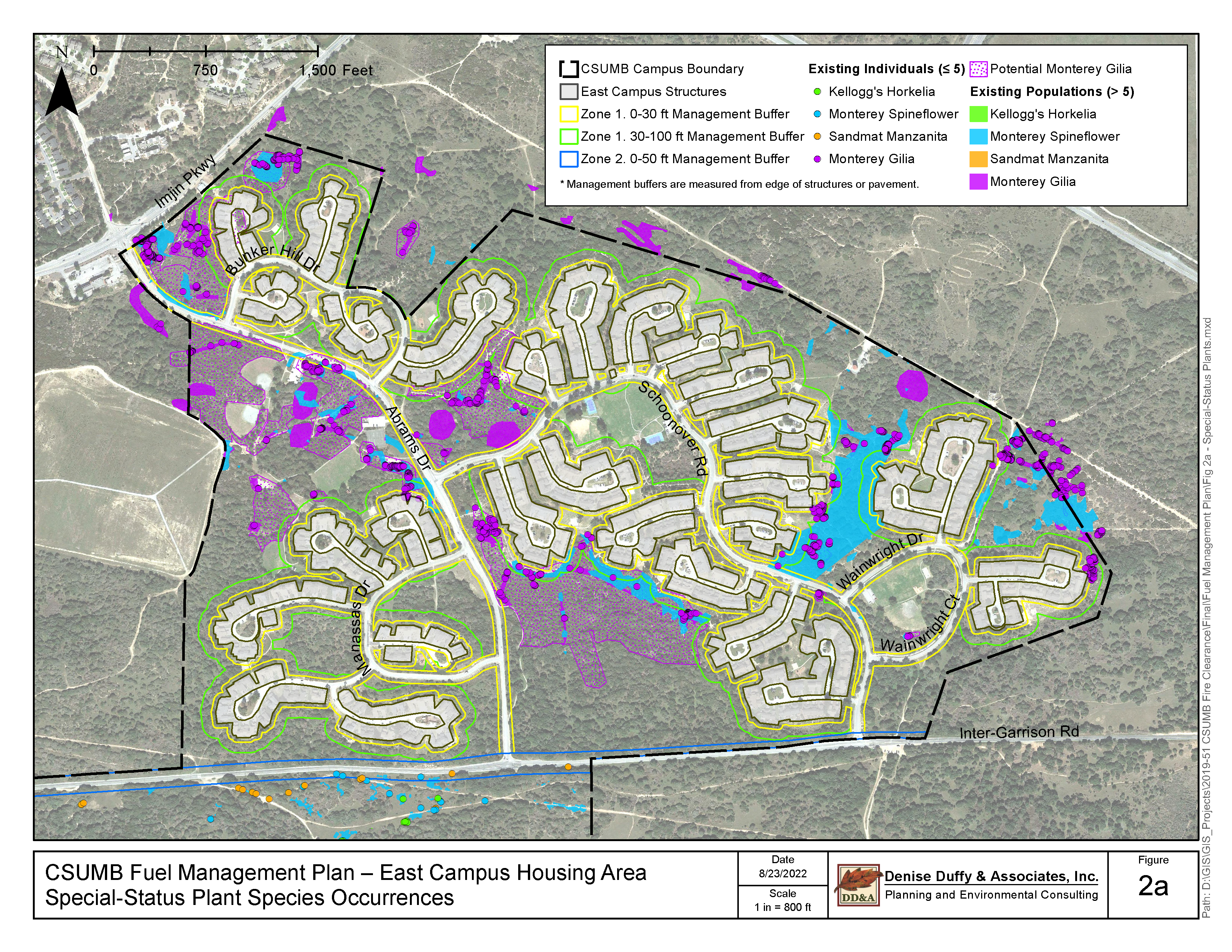
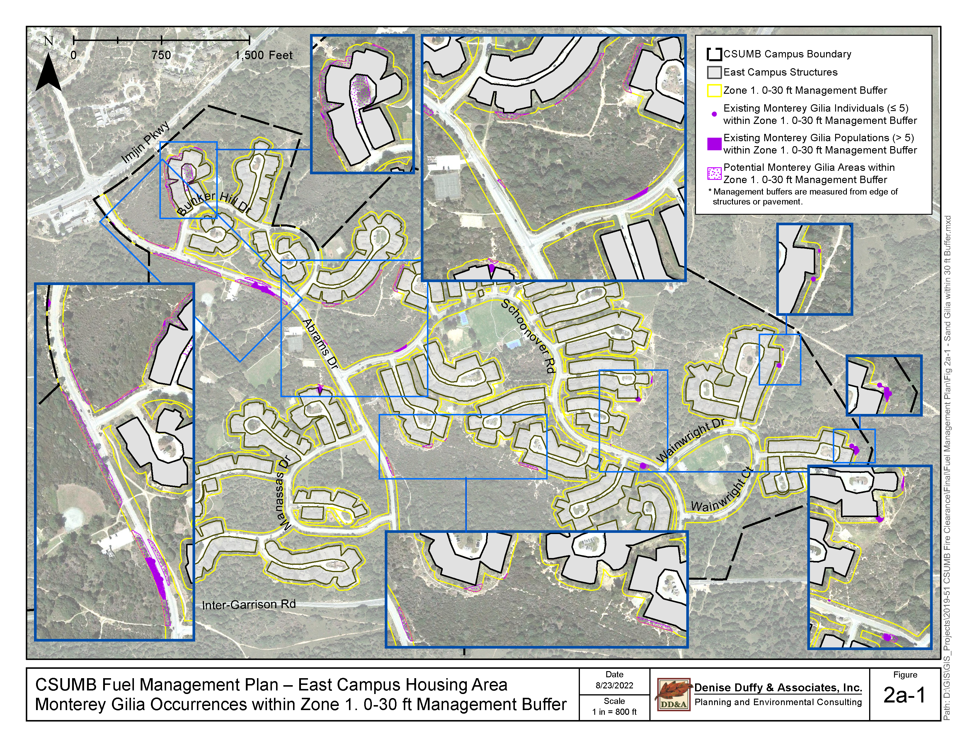
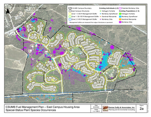
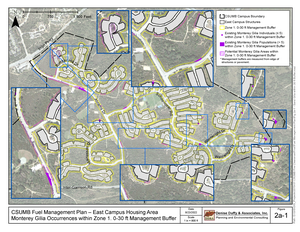
The two maps below are Figures 2a and 2a-1 from a May 2023 draft of the Notice of Exemption. There seems to be a correlation between non-impacted Gilia patches and areas that appear in the right map but not the left map, as if the right map was used as the basis for avoidance in the field, when actually the left map should have been used.
It's just an idea. I could be wrong.
- The first theory says that there was that all parties understood where the Gilia was, that the biological monitor was aware of the Gilia locations and had the correct data at hand, but there were problems in the development and implementation of the protocol:
- What can be done in the immediate future?
- Rehabilitate these sites
- Remove non-native grasses
- Remove non-native trees, to enhance likelihood of Gilia persistence
- Monterey pine
- Monterey cypress
- Torrey pine
- Remove other non-native plants
- Non-native grasses
- Erodium
- French broom
- etc.
- Remove non-native grasses
- Rehabilitate these sites
- How can this situation inform future policy?
It should be clearly understood by all sectors going forward that correct management of Gilia populations should not involve unplanned mowing or substantial soil disturbance.