A history of Fort Ord Native Plant Reserve 10
Compiled by Fred Watson, PhD
Copyright (C) F. Watson. Last updated: 14 May 2020.
(See also overview of all CNPS Reserves on Fort Ord)
Timeline:
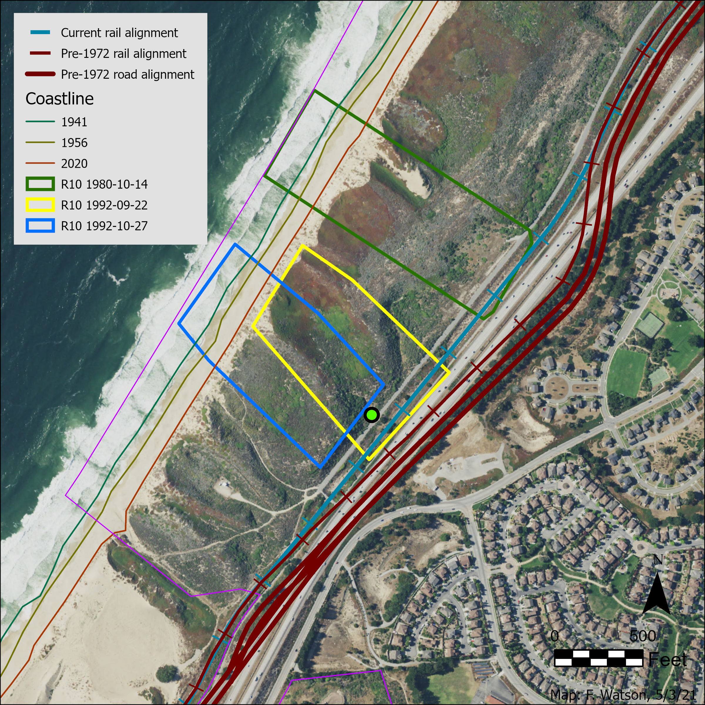
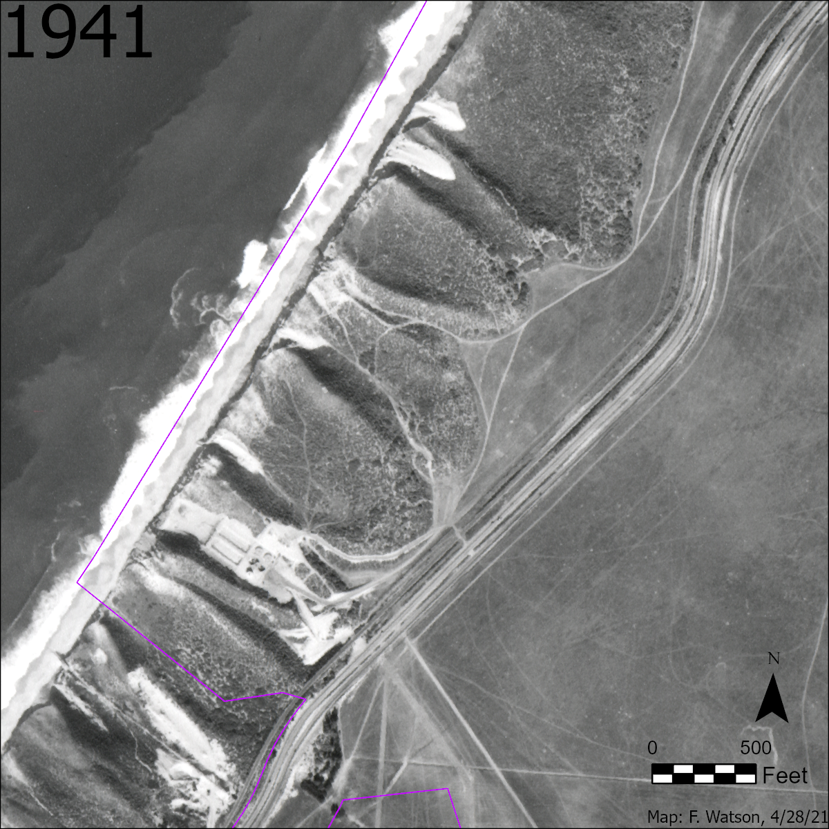
- 1941. Beach Range Road didn't exist yet. Highway 1 and the railway were in their pre-1970s easterly locations. There were some 12 ft dirt tracks at the inland base of the dunes near where Reserve 10 would eventually be designated.
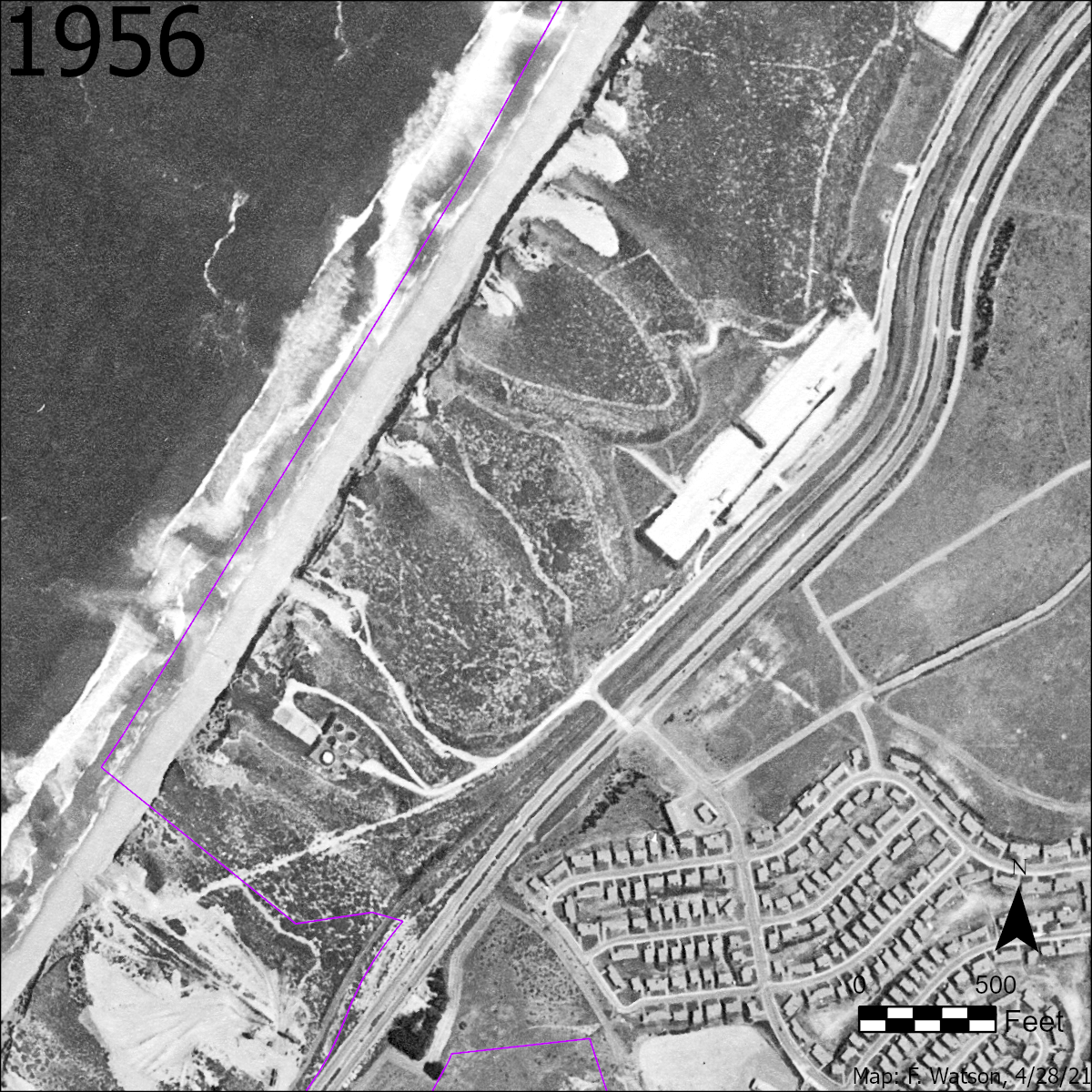
- 1956. Beach Range Road had been constructed in its pre-1970s easterly location, along with infrastructure relating to Beach Ranges 1, 2, and 3.
- 1967. CNPS encouraged Fort Ord's Commanding Officer to set aside some protected areas for plants (Griffin, 1976).
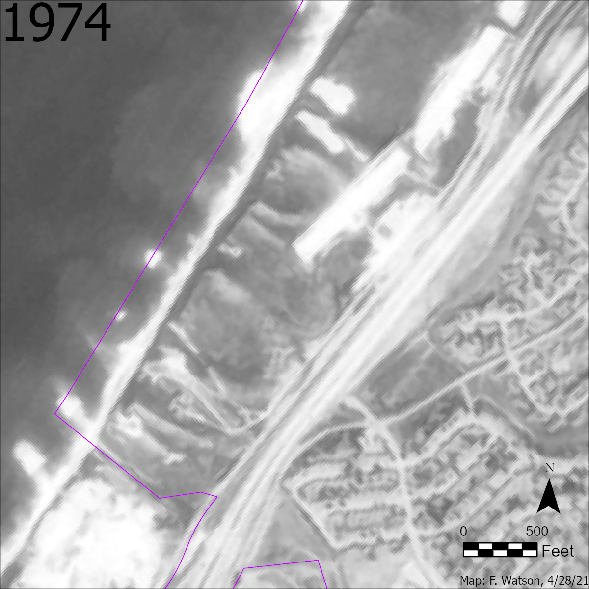
- 1974. Bike / ped trail between the highway and the railway not yet constructed.
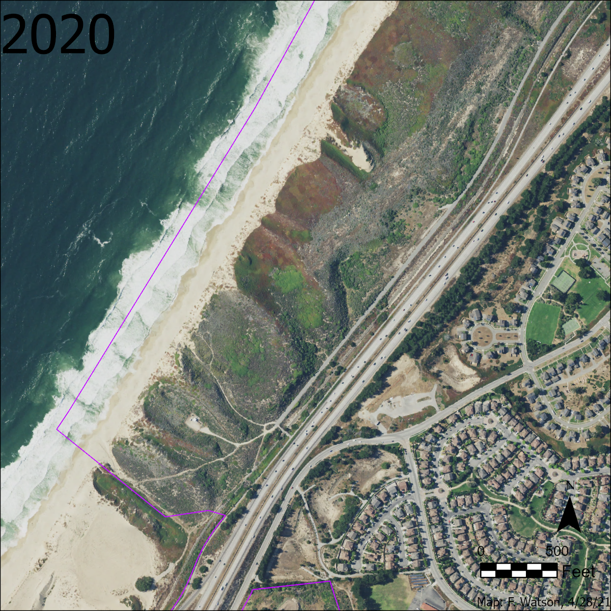
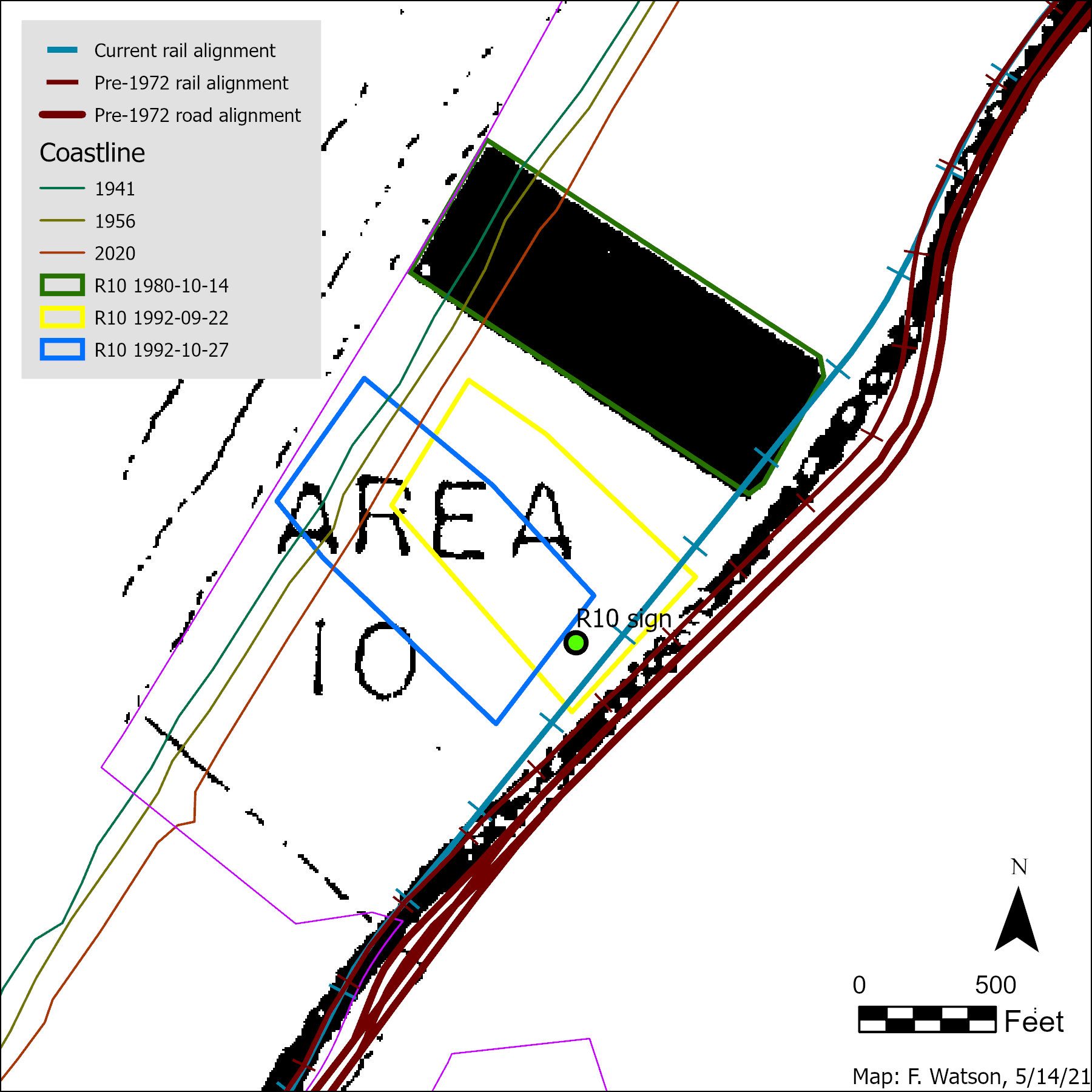
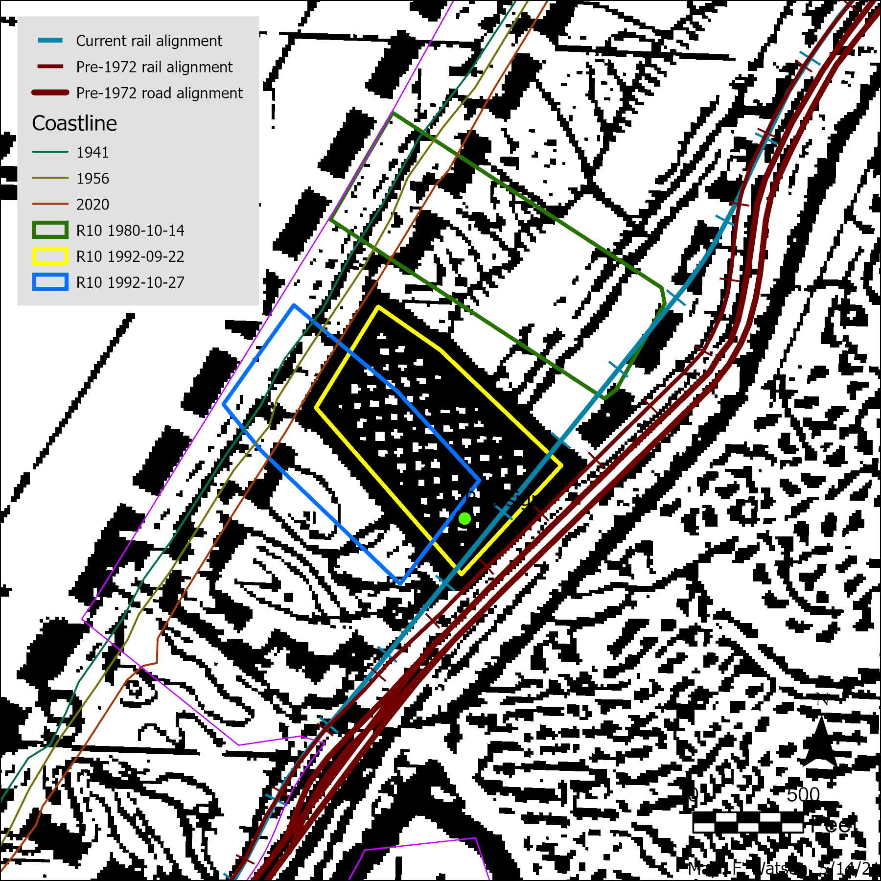
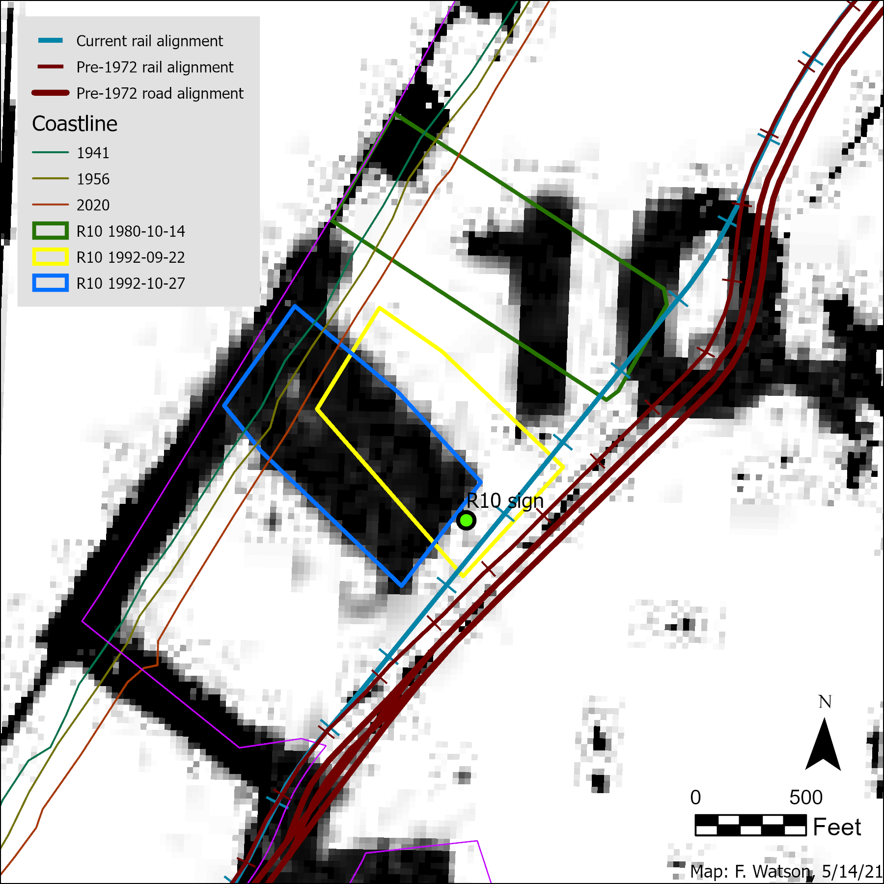
- 1972 & 1973. In the vicinity of R10, Highway 1, the railway, and Beach Range Road were moved west. The amount of movement ranged from about 120 ft at the location of R10 to a maximum of 235 ft just north of R10. This movement was discerned through examination of a series of historical aerial images. (Also, between 1941 and 1956, a small section of the highway south of R10 was moved east.)
- 1974. Bike / ped trail between the highway and the railway had been constructed.
- 1973. Federal Endangered Species Act passed, raising the importance of rare plant protection on federal land.
- 1975. First documentation of the eventual California Native Plant Society (CNPS) Native Plant Reserve system on Fort Ord. "Fort Ord Natural Resources Program" report by Army. Describes the reserve system (9 reserves and a note about a 10th in the "coastal strand").
- 1976, July. Article on CNPS Fort Ord reserves published in Fremontia.
Griffin, James. Native Plant Reserves at Fort Ord. Fremontia 4(2):25-28.
- 1980, Oct 14. Army map of CNPS Fort Ord reserve numbers 1 to 10.
Map draws R10 relatively precisely, but georeferencing potential of this map is relatively imprecise owing to the relative scarcity of suitable useable points on the map.
Highway 1 appears to be shown in it's pre-1972 location.
- 1989 Nov 20. Army map showing the locations of the CNPS reserves. Includes R10.
Not georeferenced yet by FW.
- 1990s early. Undated sketch map showing locations of CNPS Fort Ord reserves.
Refers to "Butterfly Reserve Area 10" - i.e. that R10 is intended to support one or both of the two host plants on which the Smith's Blue Butterfly exclusively depends.
- 1990s early. Undated map indicating the generalized range of various special status species on Fort Ord. Species listed for the southern dunes area include Smith's Blue Butterfly, Black Leglass Lizard, Peregrine Falcon, and White Pelican.
- 1991. Fort Ord closure.
- 1992 Sep 22. Army map showing the locations of CNPS reserves.
R10 is drawn relatively precisely, and the map is relatively more precisely georeferenceable than the 1980 map.
Highway 1 is shown in it's pre-1972 location.
Map repeats the information on the "1990s early" map above about the generalized range of various special status species.
- 1992 Oct 27. Revised Draft Fort Ord Ammunition Supply Point Project Mitigation and Monitoring Plan, prepared for Army by Jones & Stokes Associates. 22 pages. Maps Reserve 10 as one of 12 reserves whose protection and restoration forms mitigation for the new Ammunition Supply Point.
Not georeferenced yet by FW.
- 1992 approx. Fort Ord Native Plant Resreves. Brochure by Jones & Stokes. Lists Smith's Blue Butterfly and Black Legless Lizards as species found at Reserve 10.
- 1993 June. Environmental Impact Statement. Fort Ord Disposal and Reuse. US Army. Includes map (Fig. 4.11-12) of "plant and butterfly reserves" that closely resembles map in 1992 ASP mitigation plan. Reserve 10 is referred to as a butterfly reserve (i.e. protecting host plants for the Smith's Blue Butterfly).
- 1995 Feb 27. Map of Proposed BLM acquisitions at Fort Ord. Appears to have been produced by BLM. Includes Reserve 10.
Not georeferenced yet by FW.
- 2019, October. Reserve 10 shown in Figure 4.4-1 of DEIS/EIR for Fort Ord Multi-Species Habitat Conservation Plan Publc Draft
Historical aerial imagery
Maps of plant reserves
Composite maps with various information,
set against both historical and current imagery