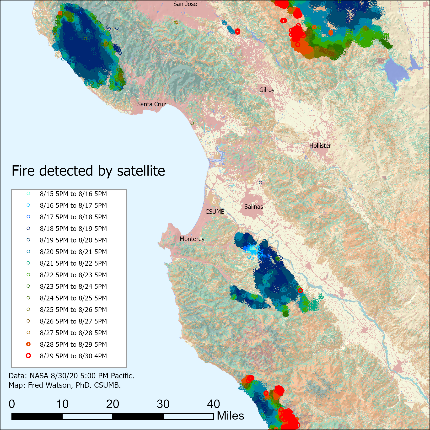
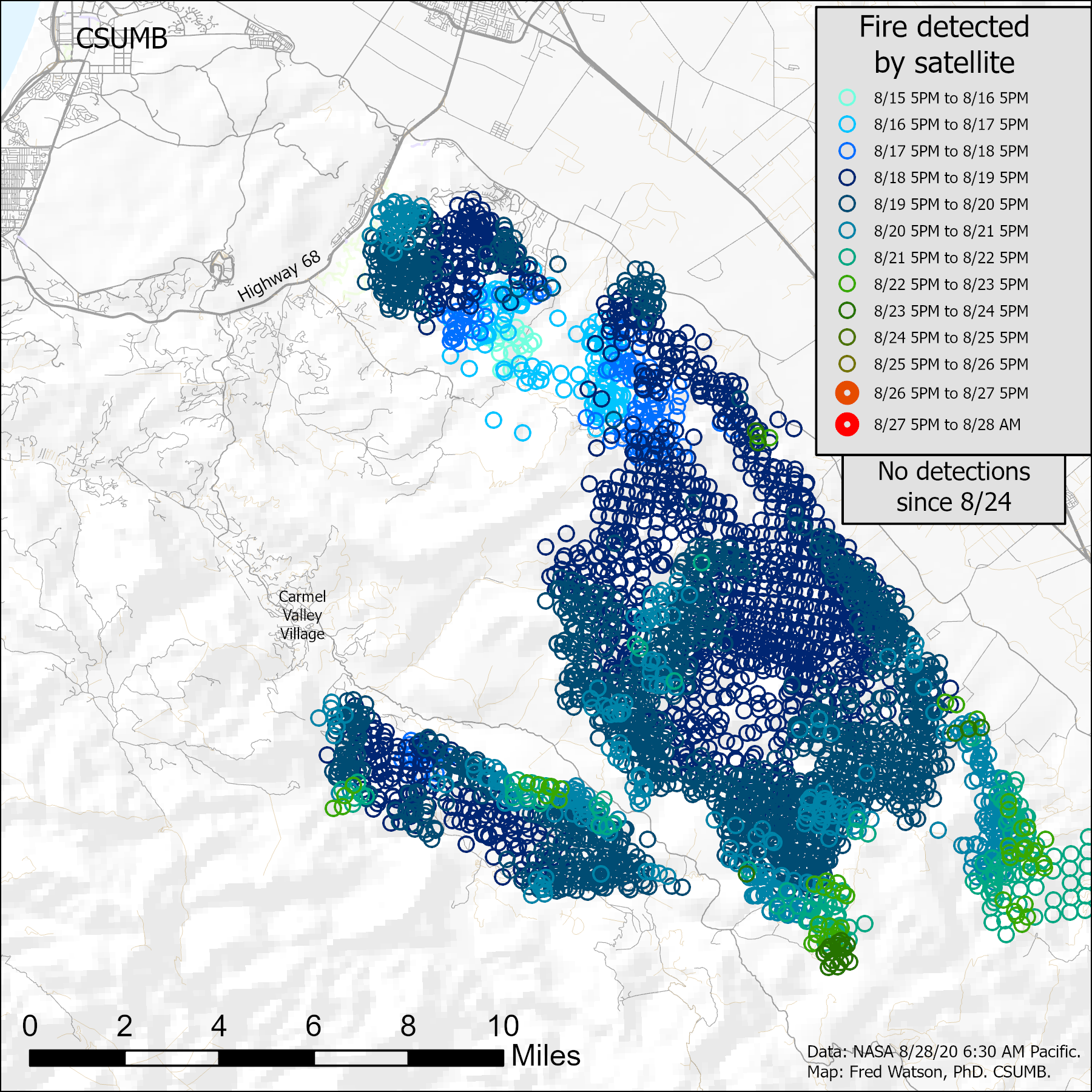
Some non-official maps of satellite-derived fire detections in 2020
By F.Watson, an academic not acting in any official capacity
These maps attempt to show the day to day progression of the fires, which I have found to be a little tricky to discern from some of the other map resources available.
For the best current information, use official alerts and maps such as are available through county web sites in Monterey and Santa Cruz. Absence of a fire detection on the map below does not imply that a fire is not there or might not be there in the near future given changes in weather etc.
Last updated Sunday afternoon 30-Aug-2020 5 PM Pacific
North-Central Coast wide view:
South of Monterey Bay (map not upated since Friday morning 8/27/2020 8:30 AM):
North of Monterey Bay (map not upated since Friday morning 8/27/2020 8:30 AM):

While an attempt has been made to make these maps accurate given limited resources, no assurance of accuracy is given. The maps are based on the same public NASA data that many other information resources are using to map these fires. Inaccuracies probably include: non-detection of certain active fire areas, false-detection of certain non-active-fire areas. Inaccuracies may include map-making errors due to the limited time available to make maps that are usefully current.